Geo Map - Asia - Turkmenistan
Maps of Asia - Turkmenistan
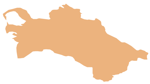
"Turkmenistan, formerly also known as Turkmenia, is one of the Turkic states in Central Asia. Turkmenistan is bordered by Afghanistan to the southeast, Iran to the south and southwest, Uzbekistan to the east and northeast, Kazakhstan to the northwest and the Caspian Sea to the west."
[Turkmenistan. Wikipedia]
The vector stencils library Turkmenistan contains contours for ConceptDraw DIAGRAM diagramming and vector drawing software. This library is contained in the Continent Maps solution from Maps area of ConceptDraw Solution Park.
Use the Turkmenistan library to draw thematic maps, geospatial infographics and vector illustrations for your business documents, presentations and websites.
Geo Map - Asia - Turkmenistan
Geo Map - Asia - Turkmenistan Contour

Geo Map - Asia

Geo Map - Asia Contour

Geo Map - contours of Asia countries

See also Geo Maps of Asia Countries :
EIGHT RELATED HOW TO's:
You need design a continent map, world continents map, continents and oceans map, or any other type of continent maps? Now, it's very easy thanks to the ConceptDraw DIAGRAM diagramming and vector drawing software supplied with Continent Maps Solution from the Maps Area of ConceptDraw Solution Park.
Picture: Continents and Oceans Map
Related Solution:
Nepal, officially the Federal Democratic Republic of Nepal, is a landlocked sovereign state located in South Asia.
The vector stencils library Nepal contains contours for ConceptDraw DIAGRAM diagramming and vector drawing software. This library is contained in the Continent Maps solution from Maps area of ConceptDraw Solution Park.
Picture: Geo Map - Asia - Nepal
Related Solution:
Papua New Guinea, officially named the Independent State of Papua New Guinea, is a country in Oceania that occupies the eastern half of the island of New Guinea (the western portion of the island is a part of the Indonesian provinces of Papua and West Papua) and numerous offshore islands.
The vector stencils library Papua New Guinea contains contours for ConceptDraw DIAGRAM diagramming and vector drawing software. This library is contained in the Continent Maps solution from Maps area of ConceptDraw Solution Park.
Picture: Geo Map - Asia - Papua New Guinea
Related Solution:
Create maps, flags, and more with ConceptDraw
Picture: Map Software
Related Solution:
An Example world map, showing a simple outline of world map. The world map is vector and can be edited or export to svg format.
Picture: Geo Mapping Software Examples - World Map Outline
Related Solution:
The vector stencils library Serbia contains contours for ConceptDraw DIAGRAM diagramming and vector drawing software. This library is contained in the Continent Maps solution from Maps area of ConceptDraw Solution Park.
Picture: Geo Map - Europe - Serbia
Related Solution:
Pakistan, officially the Islamic Republic of Pakistan, is a sovereign country in South Asia.
The vector stencils library Pakistan contains contours for ConceptDraw DIAGRAM diagramming and vector drawing software. This library is contained in the Continent Maps solution from Maps area of ConceptDraw Solution Park.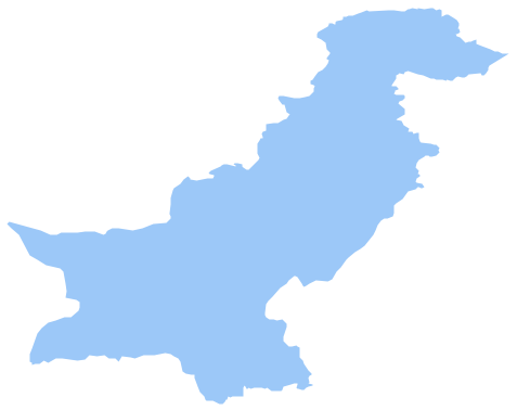
Picture: Geo Map - Asia - Pakistan
Related Solution:
Oman, officially called the Sultanate of Oman, is an Arab state in southwest Asia on the southeast coast of the Arabian Peninsula.
The vector stencils library Oman contains contours for ConceptDraw DIAGRAM diagramming and vector drawing software. This library is contained in the Continent Maps solution from Maps area of ConceptDraw Solution Park.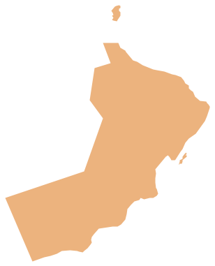
Picture: Geo Map - Asia - Oman
Related Solution:


