Geo Map - Asia - Kazakhstan
Maps of Asia - Republic of Kazakhstan
"Kazakhstan, officially the Republic of Kazakhstan, is a contiguous transcontinental country in Central Asia, with its smaller part west of the Ural River in Eastern Europe. Kazakhstan is the world's largest landlocked country by land area and the ninth largest country in the world; its territory of 2,727,300 square kilometres (1,053,000 sq mi) is larger than Western Europe. It has borders with (clockwise from the north) Russia, China, Kyrgyzstan, Uzbekistan, and Turkmenistan, and also adjoins a large part of the Caspian Sea. The terrain of Kazakhstan includes flatlands, steppe, taiga, rock canyons, hills, deltas, snow-capped mountains, and deserts. With 17 million people (2013 estimate) Kazakhstan has the 62nd largest population in the world, though its population density is less than 6 people per square kilometre (15 per sq. mi.). The capital is Astana, where it was moved from Almaty in 1997." [Kazakhstan. Wikipedia]
The vector stencils library Kazakhstan contains contours for ConceptDraw DIAGRAM diagramming and vector drawing software. This library is contained in the Continent Maps solution from Maps area of ConceptDraw Solution Park.

Pic. 1. Geo Map solution
Use the Kazakhstan library to draw thematic maps, geospatial infographics and vector illustrations for your business documents, presentations and websites.
Geo Map - Asia - Republic of Kazakhstan
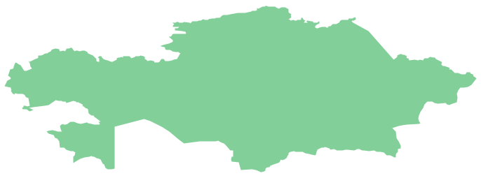
Pic. 2. Geo Map - Asia - Republic of Kazakhstan
Geo Map - Asia - Kazakhstan Contour

Pic. 3. Geo Map - Asia - Kazakhstan Contour
Geo Map - Asia

Pic. 4. Geo Map - Asia
Geo Map - Asia Contour

Pic. 5. Geo Map - Asia Contour
Geo Map - contours of Asia countries

Pic. 6. Geo Map - contours of Asia countries
All ConceptDraw DIAGRAM documents are vector graphic files and are available for reviewing, modifying, and converting to a variety of formats: image, HTML, PDF file, MS PowerPoint Presentation, Adobe Flash, MS Visio.
See also Geo Maps of Asia Countries :
TEN RELATED HOW TO's:
Tajikistan, officially the Republic of Tajikistan, is a mountainous landlocked country in Central Asia.
The vector stencils library Tajikistan contains contours for ConceptDraw DIAGRAM diagramming and vector drawing software. This library is contained in the Continent Maps solution from Maps area of ConceptDraw Solution Park.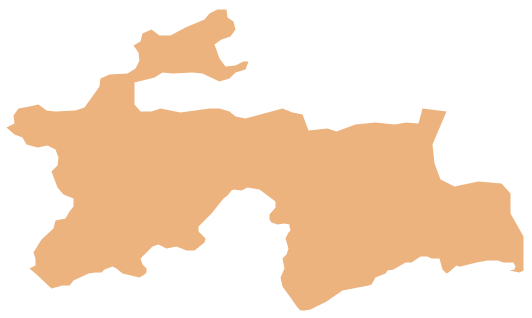
Picture: Geo Map - Asia - Tajikistan
Related Solution:
No one can imagine a geography class without such educational stuff as a geo map or a globe. As for one of the biggest countries in North America, the United States of America Map is present in every American school or college. It’s easier to remember all the states if you look on the map more often.
The following sample represents the map of USA. This precise map has names of all states of America. The different colors which are used to indicate each state add the visuality and brightness to the whole map. The ConceptDraw USA Maps solution - one of a family of ConceptDraw Maps solutions. Any country invokes a big piece of data: geographical, political, statistical, etc. A simple way of representing this data is to design maps that will show a certain item in relation to a particular area of Earth.
Picture:
How to Draw the US Map?
ConceptDraw Diagram Software for Easy USA Map Drawing
Related Solution:
China, officially the People's Republic of China, is a sovereign state located in East Asia.
The vector stencils library China contains contours for ConceptDraw DIAGRAM diagramming and vector drawing software. This library is contained in the Continent Maps solution from Maps area of ConceptDraw Solution Park.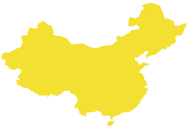
Picture: Geo Map - Asia - China
Related Solution:
Georgia is a country in the Caucasus region of Eurasia.
The vector stencils library Georgia contains contours for ConceptDraw DIAGRAM diagramming and vector drawing software. This library is contained in the Continent Maps solution from Maps area of ConceptDraw Solution Park.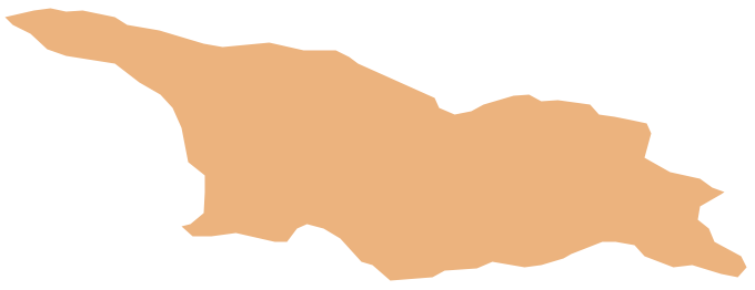
Picture: Geo Map - Asia - Georgia
Related Solution:
The vector stencils library Serbia contains contours for ConceptDraw DIAGRAM diagramming and vector drawing software. This library is contained in the Continent Maps solution from Maps area of ConceptDraw Solution Park.
Picture: Geo Map - Europe - Serbia
Related Solution:
Turkey, officially the Republic of Turkey, is a contiguous transcontinental country, located mostly on Anatolia in Western Asia, and on East Thrace in Southeastern Europe.
The vector stencils library Turkey contains contours for ConceptDraw DIAGRAM diagramming and vector drawing software. This library is contained in the Continent Maps solution from Maps area of ConceptDraw Solution Park.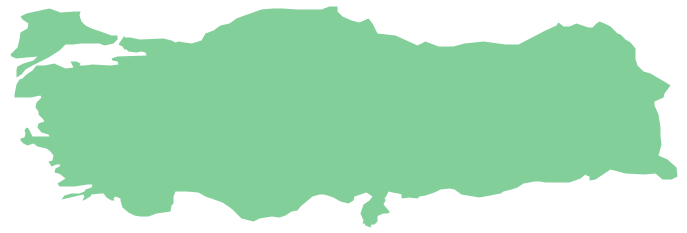
Picture: Geo Map - Asia - Turkey
Related Solution:
The United Arab Emirates, sometimes simply called the Emirates or the UAE, is a country located in the southeast end of the Arabian Peninsula on the Persian Gulf, bordering Oman to the east and Saudi Arabia to the south, as well as sharing sea borders with Qatar, Iran and Pakistan.
The vector stencils library United Arab Emirates contains contours for ConceptDraw DIAGRAM diagramming and vector drawing software. This library is contained in the Continent Maps solution from Maps area of ConceptDraw Solution Park.
Picture: Geo Map - Asia - United Arab Emirates
Related Solution:
Sri Lanka, officially the Democratic Socialist Republic of Sri Lanka, is an island country in the northern Indian Ocean off the southern coast of the Indian subcontinent in South Asia; known until 1972 as Ceylon, Sri Lanka has maritime borders with India to the northwest and the Maldives to the southwest.
The vector stencils library Sri Lanka contains contours for ConceptDraw DIAGRAM diagramming and vector drawing software. This library is contained in the Continent Maps solution from Maps area of ConceptDraw Solution Park.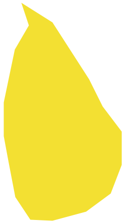
Picture: Geo Map - Asia - Sri Lanka
Related Solution:
Papua New Guinea, officially named the Independent State of Papua New Guinea, is a country in Oceania that occupies the eastern half of the island of New Guinea (the western portion of the island is a part of the Indonesian provinces of Papua and West Papua) and numerous offshore islands.
The vector stencils library Papua New Guinea contains contours for ConceptDraw DIAGRAM diagramming and vector drawing software. This library is contained in the Continent Maps solution from Maps area of ConceptDraw Solution Park.
Picture: Geo Map - Asia - Papua New Guinea
Related Solution:
Illustrate the Asia continent and explore its parts, geographical features, resources, and economic development through designing various kinds of colorful Asia maps and using them in presentations, reports, educational materials, websites, business documents
Picture: Geo Map — Asia
Related Solution:


