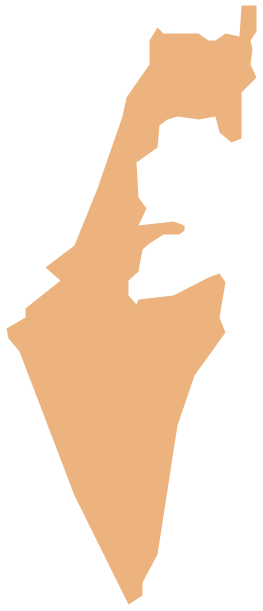
Geo Map - Asia - Brunei
Maps of Asia - Nation of Brunei, the Abode of Peace
"Brunei, officially the Nation of Brunei, the Abode of Peace (Malay: Negara Brunei Darussalam, Jawi), is a sovereign state located on the north coast of the island of Borneo, in Southeast Asia. Apart from its coastline with the South China Sea, it is completely surrounded by the state of Sarawak, Malaysia; and it is separated into two parts by the Sarawak district of Limbang. It is the only sovereign state completely on the island of Borneo. The remainder of the island's territory is divided between the nations of Malaysia and Indonesia. Brunei's population was 408,786 in July 2012."
The vector stencils library Brunei contains contours for ConceptDraw DIAGRAM diagramming and vector drawing software. This library is contained in the Continent Maps solution from Maps area of ConceptDraw Solution Park.
Use the Brunei library to draw thematic maps, geospatial infographics and vector illustrations for your business documents, presentations and websites.
Geo Map - Asia - Nation of Brunei, the Abode of Peace

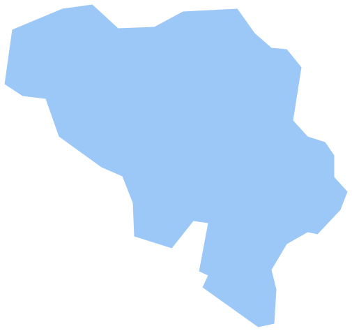
Geo Map - Asia - Brunei Contour

Geo Map - Asia

Geo Map - Asia Contour

Geo Map - contours of Asia countries

See also Geo Maps of Asia Countries :
- Afghanistan
- Armenia
- Azerbaijan
- Bahrain
- Bangladesh
- Bhutan
- Brunei
- Cambodia
- China
- Cyprus
- Georgia
- India
- Indonesia
- Iran
- Iraq
- Israel
- Japan
- Jordan
- Kazakhstan
- Kuwait
- Kyrgyzstan
- Laos
- Lebanon
- Malaysia
- Mongolia
- Myanmar
- Nepal
- North Korea
- Oman
- Pakistan
- Papua New Guinea
- Philippines
- Qatar
- Saudi Arabia
- Singapore
- South Korea
- Sri Lanka
- Syria
- Tajikistan
- Thailand
- Turkey
- Turkmenistan
- United Arab Emirates
- Uzbekistan
- Vietnam
- Yemen