Geo Map - Asia - Israel
Maps of Asia - State of Israel
"Israel, officially the State of Israel, is a country in Western Asia, on the south-eastern shore of the Mediterranean Sea. It shares land borders with Lebanon in the north, Syria in the northeast, Jordan on the east, the Palestinian territories (or State of Palestine) comprising the West Bank and Gaza Strip on the east and southwest respectively, Egypt and the Gulf of Aqaba in the Red Sea to the south, and it contains geographically diverse features within its relatively small area. In its Basic Laws Israel defines itself as a Jewish and Democratic State; it is the world's only Jewish-majority state." [Israel. Wikipedia]
The vector stencils library Israel contains contours for ConceptDraw DIAGRAM diagramming and vector drawing software. This library is contained in the Continent Maps solution from Maps area of ConceptDraw Solution Park.

Use the Israel library to draw thematic maps, geospatial infographics and vector illustrations for your business documents, presentations and websites.
Geo Map - Asia - State of Israel
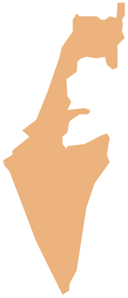
Geo Map - Asia - Israel Contour

Geo Map - Asia

Geo Map - Asia Contour

Geo Map - contours of Asia countries

See also Geo Maps of Asia Countries :
SIX RELATED HOW TO's:
ConceptDraw DIAGRAM diagramming and vector drawing software offers the Australia Map Solution from the Maps Area of ConceptDraw Solution Park - the best tool for fast and easy drawing various types of Australia maps, maps of Australia states and islands, Map Australia with cities, thematic Australia maps and cartograms of any degree of detailing.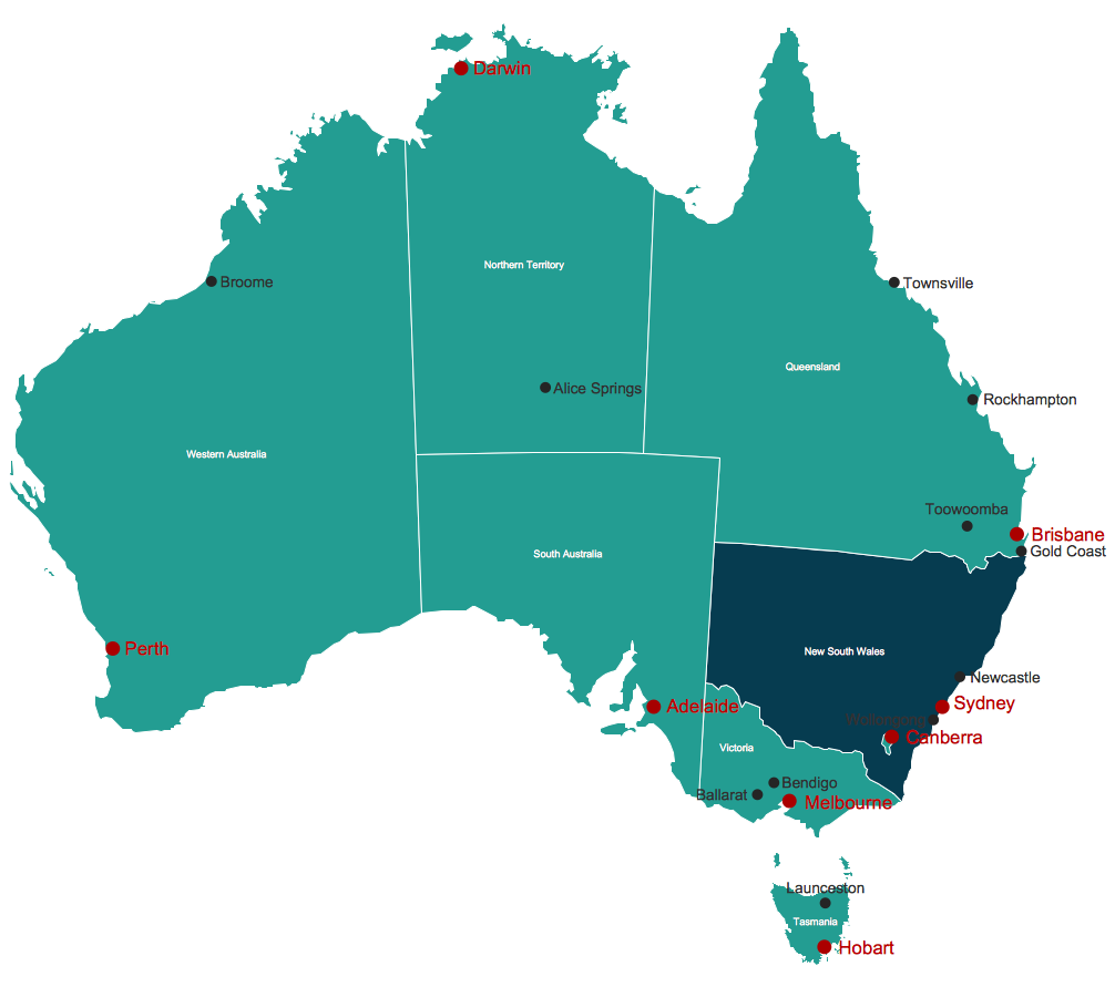
Picture: Map Australia
Related Solution:
Sudan, officially the Republic of the Sudan is an Arab state in the Nile Valley of North Africa, bordered by Egypt to the north, the Red Sea, Eritrea and Ethiopia to the east, South Sudan to the south, the Central African Republic to the southwest, Chad to the west and Libya to the northwest.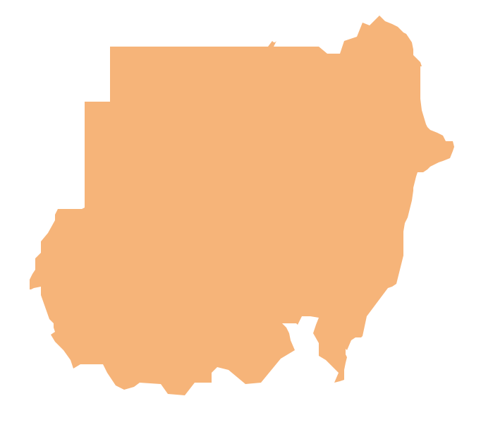
Picture: Geo Map — Africa — Sudan
Related Solution:
Turkey, officially the Republic of Turkey, is a contiguous transcontinental country, located mostly on Anatolia in Western Asia, and on East Thrace in Southeastern Europe.
The vector stencils library Turkey contains contours for ConceptDraw DIAGRAM diagramming and vector drawing software. This library is contained in the Continent Maps solution from Maps area of ConceptDraw Solution Park.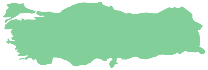
Picture: Geo Map - Asia - Turkey
Related Solution:
outh Sudan, officially the Republic of South Sudan, is a landlocked country in northeastern Africa.
The vector stencils library South Sudan contains contours for ConceptDraw DIAGRAM diagramming and vector drawing software. This library is contained in the Continent Maps solution from Maps area of ConceptDraw Solution Park.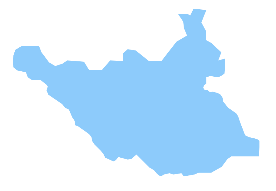
Picture: Geo Map - Africa - South Sudan
Related Solution:
India, officially the Republic of India (Bharat Ganrajya), is a country in South Asia.
The vector stencils library India contains contours for ConceptDraw DIAGRAM diagramming and vector drawing software. This library is contained in the Continent Maps solution from Maps area of ConceptDraw Solution Park.
Picture: Geo Map - Asia - India
Related Solution:
Thailand, officially the Kingdom of Thailand, is a country located at the centre of the Indochina peninsula in Southeast Asia.
The vector stencils library Thailand contains contours for ConceptDraw DIAGRAM diagramming and vector drawing software. This library is contained in the Continent Maps solution from Maps area of ConceptDraw Solution Park.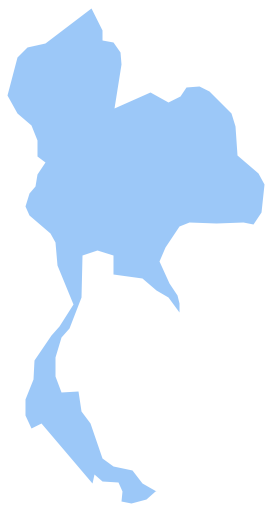
Picture: Geo Map - Asia - Thailand
Related Solution:


