Geo Mapping Software Examples - World Map Outline

This example was created on the base of thematic map "Germany: Sugarbeets. Percent of total area by state" from the website of the U.S. Department of Agriculture. [usda.gov/ oce/ weather/ pubs/ Other/ MWCACP/ Graphs/ eur/ grmsugb.gif]
"Sugar beet, cultivated Beta vulgaris, is a plant whose root contains a high concentration of sucrose. It is grown commercially for sugar production.
In 2011, France, the United States, Germany, Russia, and Ukraine were the world's five largest sugar beet producers by mass, whilst by value Turkey takes the place of Ukraine. However, in 2010–2011, North America, Western Europe, and Eastern Europe did not produce enough sugar from sugar beets to meet overall demand for sugar, and were all net importers of sugar. ... In 2009, sugar beets accounted for 20% of the world's sugar production." [Sugar beet. Wikipedia]
The thematic map example "Germany crop areas map - Sugar beets" was designed using the ConceptDraw PRO software extended with the Map of Germany solution from the Maps area of ConceptDraw Solution Park.
Germany thematic map example

Germany Map
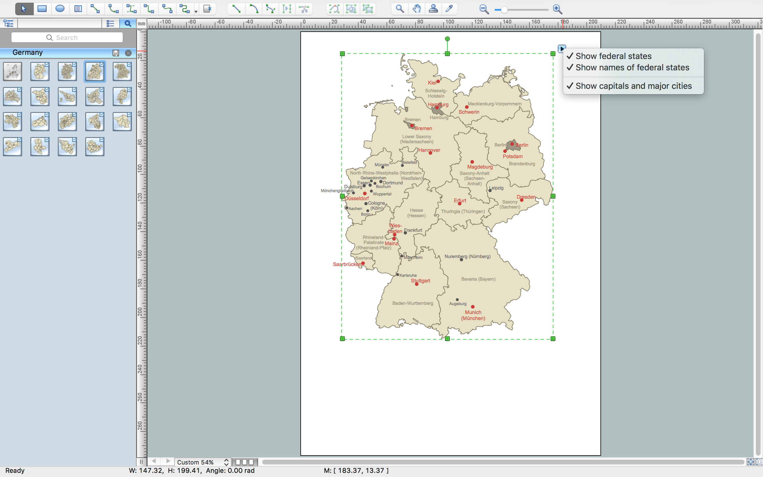
ConceptDraw DIAGRAM diagramming and vector drawing software enhanced with Germany Map Solution from the Maps Area of ConceptDraw Solution Park is the best for drawing geographic Germany map, topography, political, and various thematic maps of Germany.
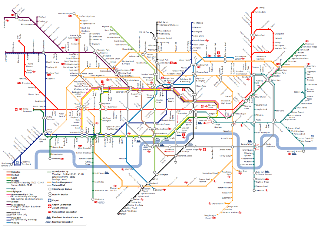
How to draw Metro Map style infographics? (London)
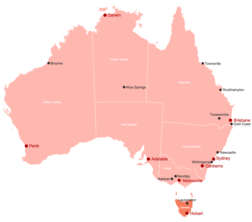
Australia Map
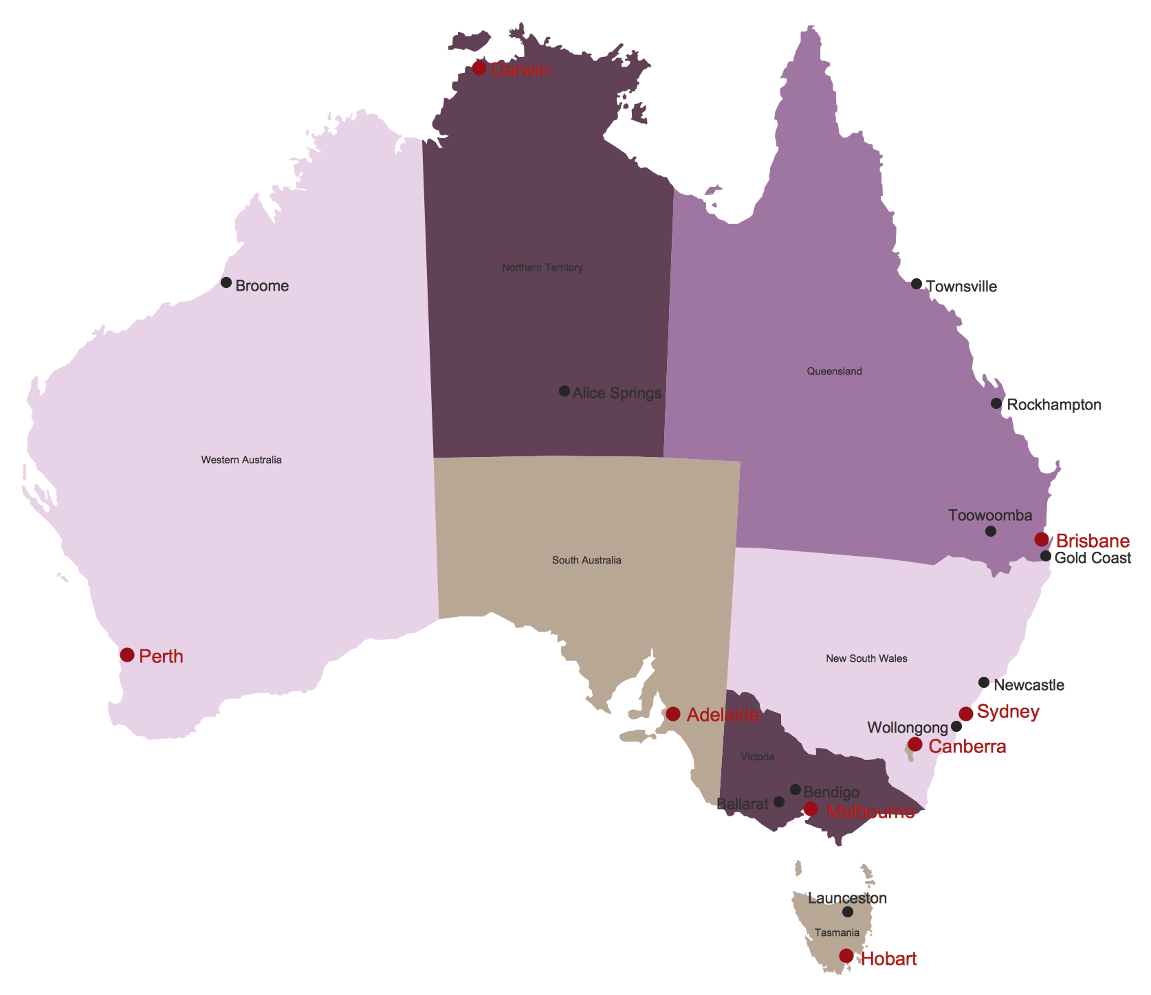
Map of Australia
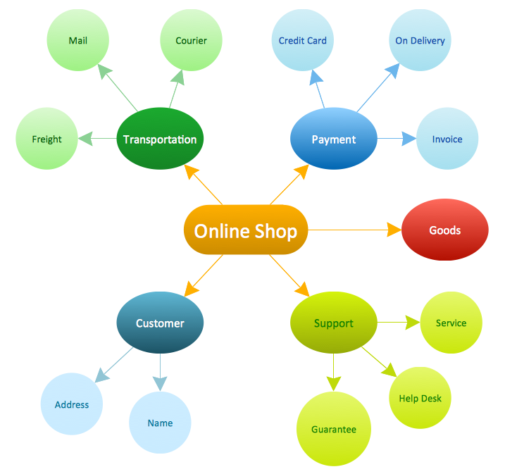
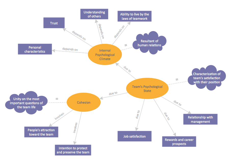
What Is a Concept Map
Superb Examples of Infographic Maps
Vector Map of Germany

Personal area (PAN) networks. Computer and Network Examples
 networks")
This example was created in ConceptDraw DIAGRAM using the Computer and Networks Area of ConceptDraw Solution Park and shows the Personal area network.

Geo Map Software

World Continents Map

Concept Map
How to draw a Concept Map quick, easy and effective? ConceptDraw DIAGRAM offers the unique Concept Maps Solution from the "Diagrams" Area that will help you!
Concept Maps
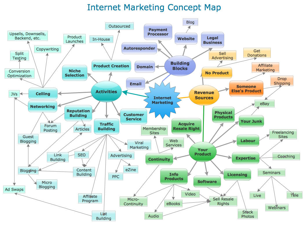
ConceptDraw DIAGRAM diagramming and vector drawing software extended with Concept Maps Solution from the "Diagrams" Area is effective tool for creating professional looking Concept Maps.
Map Directions
- Examples Of Area Map
- Local area network (LAN). Computer and Network Examples | How ...
- The Best Choice for Creating Diagram | Concept Maps | How to ...
- Metropolitan area networks (MAN). Computer and Network Examples
- Metropolitan area networks (MAN). Computer and Network Examples
- Brilliant Examples of Infographics Map , Transport, Road | Network ...
- Examples of Flowcharts, Org Charts and More | Project Management ...
- Campus Area Networks (CAN). Computer and Network Examples ...
- Mind Map Diagram For Basic Of Computer Network
- Example Of Map Drawing
- Geo Mapping Software Examples - World Map Outline | Campus ...
- Broadcast Area for Movie Central - Thematic map | Geo Map ...
- Metropolitan area networks (MAN). Computer and Network Examples
- Geo Mapping Software Examples - World Map Outline | Process ...
- Geo Mapping Software Examples - World Map Outline | Geo Map ...
- Sport Study Mind Map Examples
- Personal area (PAN) networks. Computer and Network Examples ...
- Example Of Directional Map
- Geo Mapping Software Examples - World Map Outline | Geo Map ...
- Local area network (LAN). Computer and Network Examples ...
- ERD | Entity Relationship Diagrams, ERD Software for Mac and Win
- Flowchart | Basic Flowchart Symbols and Meaning
- Flowchart | Flowchart Design - Symbols, Shapes, Stencils and Icons
- Flowchart | Flow Chart Symbols
- Electrical | Electrical Drawing - Wiring and Circuits Schematics
- Flowchart | Common Flowchart Symbols
- Flowchart | Common Flowchart Symbols