Geo Map - South America - Paraguay
Maps of South America - Republic of Paraguay
"Paraguay, officially the Republic of Paraguay, is a landlocked country in South America, bordered by Argentina to the south and southwest, Brazil to the east and northeast, and Bolivia to the northwest. Paraguay lies on both banks of the Paraguay River, which runs through the center of the country from north to south. Due to its central location in South America, it is sometimes referred to as Corazón de América ("Heart of America")."
[Paraguay. Wikipedia]
The vector stencils library Paraguay contains contours for ConceptDraw DIAGRAM diagramming and vector drawing software. This library is contained in the Continent Maps solution from Maps area of ConceptDraw Solution Park.

Pic. 1. Continent Maps Solution
Use the Paraguay library to draw thematic maps, geospatial infographics and vector illustrations for your business documents, presentations and websites.
Geo Map — South America — Republic of Paraguay
Paraguay has a population of over 6,7 million and an area 406,752 sq km (157,048 sq mi).

Pic. 2. Paraguay
Geo Map — South America — Paraguay Contour
Capital - Asuncion.

Pic. 3. Paraguay Contour
Geo Map — South America
South America is a continent located in the Western Hemisphere, mostly in the Southern Hemisphere, with a relatively small portion in the Northern Hemisphere. It is also considered as a subcontinent of the Americas, which is the model used in Spanish-speaking nations and most of South America.
List of South American countries:
- Argentina
- Belize
- Bolivia
- Brazil
- Chile
- Colombia
- Costa Rica
- Cuba
- Dominican Republic
- Ecuador
- El Salvador
- French Guiana
- Guatemala
- Guyana
- Haiti
- Honduras
- Jamaica
- Mexico
- Nicaragua
- Panama
- Paraguay
- Peru
- Puerto Rico
- Suriname
- Trinidad and Tobago
- Uruguay
- Venezuela

Pic. 4. South America Map
Geo Map — South America Contour
A contour map is a map illustrated with contour lines.

Pic. 5. South America Contour
Geo Map — Contours of South America Countries
Use the map contours library "South America" to design thematic maps of South American countries using the ConceptDraw DIAGRAM diagramming and vector drawing software.
The vector stencils library "South America" contains 29 map contours: South America political map, Central America political map, state map contours of South American countries.

Pic. 6. Contours of South America countries
All ConceptDraw DIAGRAM documents are vector graphic files and are available for reviewing, modifying, and converting to a variety of formats: image, HTML, PDF file, MS PowerPoint Presentation, Adobe Flash, MS Visio (.VDX, .VSDX).
See also Geo Maps of South America Countries :
NINE RELATED HOW TO's:
Cuba, officially the Republic of Cuba, is an island country in the Caribbean.
The vector stencils library Cuba contains contours for ConceptDraw DIAGRAM diagramming and vector drawing software. This library is contained in the Continent Maps solution from Maps area of ConceptDraw Solution Park.
Picture: Geo Map - South America - Cuba
Related Solution:
Washington is a state in the Pacific Northwest region of the United States located north of Oregon, west of Idaho, and south of the Canadian province of British Columbia on the coast of the Pacific Ocean.
The vector stencils library Washington contains contours for ConceptDraw DIAGRAM diagramming and vector drawing software. This library is contained in the Continent Maps solution from Maps area of ConceptDraw Solution Park.
Picture: Geo Map — USA — Washington
Related Solution:
California is a state located on the West Coast of the United States.
The vector stencils library California contains contours for ConceptDraw DIAGRAM diagramming and vector drawing software. This library is contained in the Continent Maps solution from Maps area of ConceptDraw Solution Park.
Picture: Geo Map - USA - California
Related Solution:
Uruguay, officially the Oriental Republic of Uruguay or the Eastern Republic of Uruguay or the Republic East of the Uruguay (River), is a country in the southeastern region of South America.
The vector stencils library Uruguay contains contours for ConceptDraw DIAGRAM diagramming and vector drawing software. This library is contained in the Continent Maps solution from Maps area of ConceptDraw Solution Park.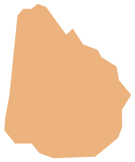
Picture: Geo Map - South America - Uruguay
Related Solution:
It is impossible to imagine modern life and science without maps, they surround us anywhere, they are used in geography, history, politics, economics, and many other fields of science. ConceptDraw DIAGRAM diagramming and vector drawing software offers the USA Maps Solution from the Maps Area of ConceptDraw Solution Park with its collection of samples and libraries for easy drawing the Map of USA.
Picture: Map of USA
Related Solution:
Ohio is a state in the Midwestern United States.
The vector stencils library Ohio contains contours for ConceptDraw DIAGRAM diagramming and vector drawing software. This library is contained in the Continent Maps solution from Maps area of ConceptDraw Solution Park.
Picture: Geo Map - USA - Ohio
Related Solution:
Indonesia, officially the Republic of Indonesia, is a sovereign state in Southeast Asia and Oceania.
The vector stencils library Indonesia contains contours for ConceptDraw DIAGRAM diagramming and vector drawing software. This library is contained in the Continent Maps solution from Maps area of ConceptDraw Solution Park.
Picture: Geo Map — Asia — Indonesia
Related Solution:
Value Stream Mapping solution extends ConceptDraw DIAGRAM software with templates, samples and vector shapes for drawing the current state value stream maps.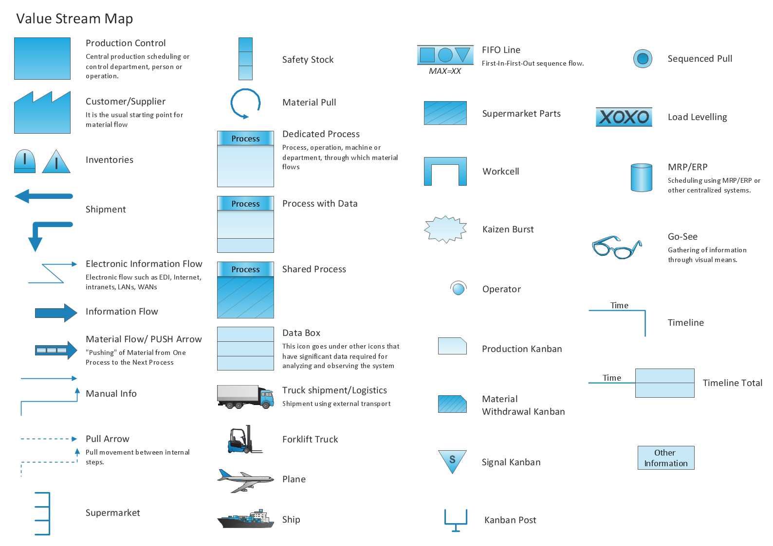
Picture: Learn how to create a current state value stream map
Related Solution:
Haiti, officially the Republic of Haiti, is a Caribbean country.
The vector stencils library Haiti contains contours for ConceptDraw DIAGRAM diagramming and vector drawing software. This library is contained in the Continent Maps solution from Maps area of ConceptDraw Solution Park.
Picture: Geo Map - South America - Haiti
Related Solution:


