
Pic. 2. Republic of Suriname
Geo Map - South America - Suriname Contour
Capital - Paramaribo

Pic. 3. Suriname Contour
Geo Map - South America
South America includes 27 states.

Pic. 4. South America Map
Geo Map - South America Contour
A contour map is a map illustrated with contour lines.

Pic. 5. South America Contour
Geo Map - contours of South America countries
Use the map contours library "South America" to design thematic maps of South American countries using the ConceptDraw DIAGRAM diagramming and vector drawing software.
The vector stencils library "South America" contains 29 map contours: South America political map, Central America political map, state map contours of South American countries.

Pic. 6. South America Contour
All ConceptDraw DIAGRAM documents are vector graphic files and are available for reviewing, modifying, and converting to a variety of formats: image, HTML, PDF file, MS PowerPoint Presentation, Adobe Flash, MS Visio (.VDX, .VSDX).
See also Geo Maps of South America Countries :
EIGHT RELATED HOW TO's:
Victoria (abbreviated as Vic.) is a state in the south-east of Australia. Victoria is Australia's most densely populated state and its second-most populous state overall.
Picture: Geo Map - Australia - Victoria
Related Solution:
No one can imagine a geography class without such educational stuff as a geo map or a globe. As for one of the biggest countries in North America, the United States of America Map is present in every American school or college. It’s easier to remember all the states if you look on the map more often.
The following sample represents the map of USA. This precise map has names of all states of America. The different colors which are used to indicate each state add the visuality and brightness to the whole map. The ConceptDraw USA Maps solution - one of a family of ConceptDraw Maps solutions. Any country invokes a big piece of data: geographical, political, statistical, etc. A simple way of representing this data is to design maps that will show a certain item in relation to a particular area of Earth.
Picture: How to Draw the US Map? ConceptDraw Diagram Software for Easy USA Map Drawing
Related Solution:
Mexico, officially the United Mexican States, is a federal republic in North America.
The vector stencils library Mexico contains contours for ConceptDraw DIAGRAM diagramming and vector drawing software. This library is contained in the Continent Maps solution from Maps area of ConceptDraw Solution Park.
Picture: Geo Map - South America - Mexico
Related Solution:
Jamaica is an island country situated in the Caribbean Sea, comprising the third-largest island of the Greater Antilles.
The vector stencils library Jamaica contains contours for ConceptDraw DIAGRAM diagramming and vector drawing software. This library is contained in the Continent Maps solution from Maps area of ConceptDraw Solution Park.
Picture: Geo Map - South America - Jamaica
Related Solution:
Namibia, officially the Republic of Namibia, is a country in southern Africa whose western border is the Atlantic Ocean.
The vector stencils library Namibia contains contours for ConceptDraw DIAGRAM diagramming and vector drawing software. This library is contained in the Continent Maps solution from Maps area of ConceptDraw Solution Park.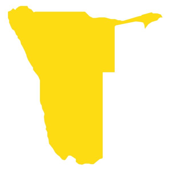
Picture: Geo Map - Africa - Namibia
Related Solution:
Brazi, officially the Federative Republic of Brazil, is the largest country in both South America and the Latin American region.
The vector stencils library Brazil contains contours for ConceptDraw DIAGRAM diagramming and vector drawing software. This library is contained in the Continent Maps solution from Maps area of ConceptDraw Solution Park.
Picture: Geo Map - South America - Brazil
Related Solution:
Panama, officially Republic of Panama, is the southernmost country of Central America and the whole of North America.
The vector stencils library Panama contains contours for ConceptDraw DIAGRAM diagramming and vector drawing software. This library is contained in the Continent Maps solution from Maps area of ConceptDraw Solution Park.
Picture: Geo Map - South America - Panama
Related Solution:
Haiti, officially the Republic of Haiti, is a Caribbean country.
The vector stencils library Haiti contains contours for ConceptDraw DIAGRAM diagramming and vector drawing software. This library is contained in the Continent Maps solution from Maps area of ConceptDraw Solution Park.
Picture: Geo Map - South America - Haiti
Related Solution:


