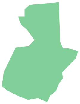
Geo Map - South America - Guatemala
Maps of South America - Republic of Guatemala
"Guatemala, officially the Republic of Guatemala, is a country in Central America bordered by Mexico to the north and west, the Pacific Ocean to the southwest, Belize to the northeast, the Caribbean to the east, Honduras to the east and El Salvador to the southeast. Its area is 108,890 km2 (42,043 sqmi) with an estimated population of 15,438,384. A representative democracy, its capital is Nueva Guatemala de la Asunción, also known as Guatemala City." [Guatemala. Wikipedia]
The vector stencils library Guatemala contains contours for ConceptDraw DIAGRAM diagramming and vector drawing software. This library is contained in the Continent Maps solution from Maps area of ConceptDraw Solution Park.

Use the Guatemala library to draw thematic maps, geospatial infographics and vector illustrations for your business documents, presentations and websites.
Geo Map - South America - Republic of Guatemala
Geo Map - South America - Guatemala Contour

Geo Map - South America

Geo Map - South America Contour

Geo Map - contours of South America countries

See also Geo Maps of South America Countries :
FOUR RELATED HOW TO's:
Chile, officially the Republic of Chile, is a South American country occupying a long, narrow strip of land between the Andes mountains to the east and the Pacific Ocean to the west.
The vector stencils library Chile contains contours for ConceptDraw DIAGRAM diagramming and vector drawing software. This library is contained in the Continent Maps solution from Maps area of ConceptDraw Solution Park.
Picture: Geo Map - South America - Chile
Related Solution:
Panama, officially Republic of Panama, is the southernmost country of Central America and the whole of North America.
The vector stencils library Panama contains contours for ConceptDraw DIAGRAM diagramming and vector drawing software. This library is contained in the Continent Maps solution from Maps area of ConceptDraw Solution Park.
Picture: Geo Map - South America - Panama
Related Solution:
Nicaragua, officially the Republic of Nicaragua, is the largest country in the Central American isthmus, bordering Honduras to the north and Costa Rica to the south.
The vector stencils library Nicaragua contains contours for ConceptDraw DIAGRAM diagramming and vector drawing software. This library is contained in the Continent Maps solution from Maps area of ConceptDraw Solution Park.
Picture: Geo Map - South America - Nicaragua
Related Solution:
Honduras, officially the Republic of Honduras, is a republic in Central America.
The vector stencils library Honduras contains contours for ConceptDraw DIAGRAM diagramming and vector drawing software. This library is contained in the Continent Maps solution from Maps area of ConceptDraw Solution Park.
Picture: Geo Map - South America - Honduras
Related Solution:


