Geo Map - South America - Belize
Maps of South America - Belize
"Belize is a country on the northeastern coast of Central America. It is the only country in the area that has English as its official language; an English creole (Kriol) and Spanish are also commonly spoken. Belize is bordered on the north by Mexico, to the south and west by Guatemala, and to the east by the Caribbean Sea. Its mainland is about 290 km (180 mi) long and 110 km (68 mi) wide." [Belize. Wikipedia]
The vector stencils library Belize contains contours for ConceptDraw DIAGRAM diagramming and vector drawing software. This library is contained in the Continent Maps solution from Maps area of ConceptDraw Solution Park.
Use the Belize library to draw thematic maps, geospatial infographics and vector illustrations for your business documents, presentations and websites.
Geo Map - South America - Belize

Geo Map - South America - Belize Contour

Geo Map - South America

Geo Map - South America Contour

Geo Map - contours of South America countries

See also Geo Maps of South America Countries :
SEVEN RELATED HOW TO's:
Mexico, officially the United Mexican States, is a federal republic in North America.
The vector stencils library Mexico contains contours for ConceptDraw DIAGRAM diagramming and vector drawing software. This library is contained in the Continent Maps solution from Maps area of ConceptDraw Solution Park.
Picture: Geo Map — USA — Mexico
Related Solution:
Design illustrative maps and explore the geographic diversity of American continents. Create detailed maps of North America, South America, Central America, USA, and thematic maps based on them for presentations, websites, social media, reports, marketing materials, educational materials, business documents
Picture: Geo Map of Americas
Related Solution:
Cuba, officially the Republic of Cuba, is an island country in the Caribbean.
The vector stencils library Cuba contains contours for ConceptDraw DIAGRAM diagramming and vector drawing software. This library is contained in the Continent Maps solution from Maps area of ConceptDraw Solution Park.
Picture: Geo Map - South America - Cuba
Related Solution:
New Brunswick is one of Canada's three Maritime provinces and is the only province in the Canadian federation that is constitutionally bilingual (English–French).
The vector stencils library New Brunswick contains contours for ConceptDraw DIAGRAM diagramming and vector drawing software. This library is contained in the Continent Maps solution from Maps area of ConceptDraw Solution Park.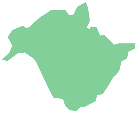
Picture: Geo Map - Canada - New Brunswick
Related Solution:
Nevada is a state in the western, mountain west, and southwestern regions of the United States.
The vector stencils library Nevada contains contours for ConceptDraw DIAGRAM diagramming and vector drawing software. This library is contained in the Continent Maps solution from Maps area of ConceptDraw Solution Park.
Picture: Geo Map — USA — Nevada
Related Solution:
Create maps, flags, and more with ConceptDraw
Picture: Map Software
Related Solution:
Costa Rica, officially the Republic of Costa Rica, is a country in Central America, bordered by Nicaragua to the north, Panama to the southeast, the Pacific Ocean to the west, and the Caribbean Sea to the east.
The vector stencils library Costa Rica contains contours for ConceptDraw DIAGRAM diagramming and vector drawing software. This library is contained in the Continent Maps solution from Maps area of ConceptDraw Solution Park.
Picture: Geo Map - South America - Costa Rica
Related Solution:


