Geo Map — USA — Louisiana
Maps of USA — State of Louisiana
The US state Louisiana is located in the southern part of the United States of America. It is on the 31st place in a list of most expensive states in America and on the 25th one among the most populous ones. The capital of Louisiana is Baton Rouge, but it is not the largest city as the largest one is New Orleans. This state is the only one in the U.S.A. with the political subdivisions termed “parishes”. These “parishes” are the local government's synonym to “countries”. The largest of them in terms of population is the East Baton Rouge one, but the largest in terms of its total area is another — Plaquemines.
Louisiana’s neighbours are Mississippi in the east, Arkansas in the north, the Gulf of Mexico in the south and Texas in the west. The lands of the state were formed from the sediment, which was washed down the river — the Mississippi River – and contain a rich southern “biota”. There are also many species of so-called “tree frogs” as well as fish, such as “paddlefish” and “sturgeon”. In more elevated areas, the fire is a natural process in the landscape. It has produced the extensive areas of the pine forest as well as the wet savannas, which are simply the mixed woodland ecosystems, characterised by the trees being sufficiently widely spaced so that the canopy does not close.
There are more Native American tribes in Louisiana than in any other southern state. They encompass those four, that are federally recognized, ten that are state recognized and another four that have not yet received recognition. Some of the Louisiana urban environments have a heritage, which can be named as a “multilingual” as well as “multicultural” one, as this state’s culture was influenced by a mixture of other different cultures, such as Spanish, Asian, French and Native American ones in the18th century. There were also many people coming there from West Africa at that time, but there was never one official language in this state, so people speak English, Spanish, French and other languages they prefer.
There is the so-called “Pleistocene Terraces” in between the Tertiary rocks on the north, which is a vast belt, having nowadays many deep channels, while the newer terraces tend to be much flatter. There are also “salt domes” in this state, which are simply the structural domes, formed when a thick bed of the minerals, such as salt, found at depth intrudes vertically into surrounding rock strata, so they form as “diaper”. The surface of the state can be divided into two parts: the uplands of the north and the rest along the coast. The region along the coast includes low swamp lands, beaches, barrier islands for over 50000 square kilometres and coastal marshlands. This is the area along the Mississippi River and Gulf of Mexico from north to south for a distance of about 1000 kilometres.
The Mississippi River flows along a ridge, which was formed by its own natural deposits. The contiguous hill lands and those higher in the north and north-west from the state extend on the area of over 65000 square kilometres. These lands consist of the woodlands and prairie. The elevations, which are above the sea level range from 3 metres at the coast and swamp lands to about 16 metres at the prairie and those lands along the coast.
Besides the mentioned above waterways, there are the Pearl one which is in the eastern part of the state, the Sabine in the west, the Calcasieu, the Vermilion, the Mermentau, Bayou Teche, the Boeuf, the Atchafalaya, the Bayou Lafourche, the Courtableau River, the Macon River, the Bayou D'Arbonne, the Tensas, the Amite River, the Tickfaw, the Tchefuncte, the Natalbany River and so many other smaller streams, all together over 6000 kilometres long.
The state Louisiana has a political jurisdiction over the 4,8 kilometres-wide portion of subsea land in the Gulf of Mexico. The coast on the south of Louisiana in the United States of America is among the fastest-disappearing areas in the world, which has largely resulted from the human mismanagement of the coast. Some time ago this land was added to when spring floods from the Mississippi River added the sediment and so stimulated the marsh growth. Nowadays the land is shrinking for a number of reasons.
There are about 63% of White Americans living in the state and over 32% of the “Black” or African ones. There are also Asian people (about 1,8%) and Native Americans (less than 1%) live there. About 5% of Latino people live in Louisiana, but the major ancestry groups of this state consists of the French, American, including the African Americans, German people, Irish people, English and Italia. Although there are also Scottish people living there. In New Orleans there are about 378715 inhabitants, in Baton Rouge — about 230000, Shreveport — 200000 or so, Kenner — 67000, Alexandria — 48000 and Houma — 33000 people all together.
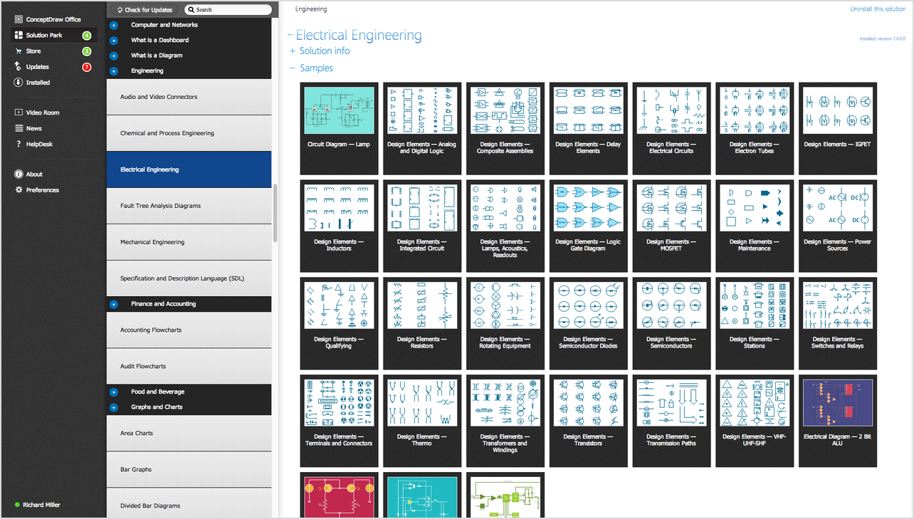
Mentioning the population of this state or the cities in a way of the map made by yourself is the best way as while creating this map you can mention all of the needed features of Louisiana as well as to highlight the needed sections and regions. In order to create such map of this state or some other, you can always use the great, unique, professional and very convenient application — ConceptDraw DIAGRAM This software enables its users to draw any needed map of any complexity and having also ConceptDraw STORE can simplify your work even more as there you can find and download the “Continent Maps solution” (although you can also find it in the “Maps area” of ConceptDraw Solution Park on this site). Having the vector stencils library “Louisiana” that contains all of the needed contours of this state is a great thing to have as it enables you to use the pre-made maps and design symbols while you are working in the ConceptDraw DIAGRAM diagramming and vector drawing software.
Get the ConceptDraw DIAGRAM software today as well as the needed solution in order to make your own great looking and smart looking maps of the needed states and the countries.
The vector stencils library Louisiana contains contours for ConceptDraw DIAGRAM diagramming and vector drawing software. This library is contained in the Continent Maps solution from Maps area of ConceptDraw Solution Park.

Use the Louisiana library to draw thematic maps, geospatial infographics and vector illustrations for your business documents, presentations and websites.
Geo Map — USA — State of Louisiana

Geo Map — USA — Louisiana Contour

Geo Map — USA

Geo Map — USA Contour

Geo Map — Contours of Territories of the United States

See Also Territories of the United States Geo Maps :
- Alabama
- Alaska
- Arizona
- Arkansas
- California
- Colorado
- Connecticut
- Delaware
- Florida
- Georgia
- Hawaii
- Idaho
- Illinois
- Indiana
- Iowa
- Kansas
- Kentucky
- Louisiana
- Maine
- Maryland
- Massachusetts
- Mexico
- Michigan
- Minnesota
- Mississippi
- Missouri
- Montana
- Nebraska
- Nevada
- New Hampshire
- New Jersey
- New Mexico
- New York
- North Carolina
- North Dakota
- Ohio
- Oklahoma
- Oregon
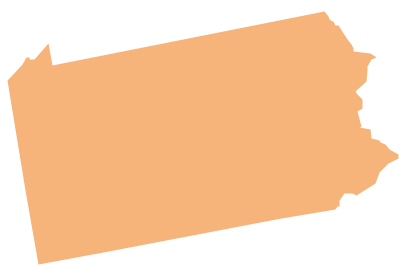
- Pennsylvania
- Tennesse
- Utah
- Vermont
- Virginia
- Washington
- West Virginia
- Wisconsin
- Wyoming
- United States