Geo Map — USA — Vermont
Maps of USA — State of Vermont
"Vermont is a state in the New England region of the northeastern United States. Vermont is the 6th least extensive and the 2nd least populous of the 50 United States. It is the only New England state not bordering the Atlantic Ocean. Lake Champlain forms half of Vermont's western border, which it shares with the state of New York. The Green Mountains are within the state. Vermont is bordered by Massachusetts to the south, New Hampshire to the east, New York to the west, and the province of Quebec to the north." [Vermont. Wikipedia]
The vector stencils library Vermont contains contours for ConceptDraw DIAGRAM diagramming and vector drawing software. This library is contained in the Continent Maps solution from Maps area of ConceptDraw Solution Park.

Use the Vermont library to draw thematic maps, geospatial infographics and vector illustrations for your business documents, presentations and websites.
Geo Map — USA — State of Vermont
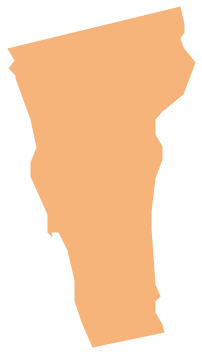
Geo Map — USA — Vermont Contour

Geo Map — USA

Geo Map — USA Contour

Geo Map - contours of Territories of the United States

See Also Territories of the United States Geo Maps :
- Alabama
- Alaska
- Arizona
- Arkansas
- California
- Colorado
- Connecticut
- Delaware
- Florida
- Georgia
- Hawaii
- Idaho
- Illinois
- Indiana
- Iowa
- Kansas
- Kentucky
- Louisiana
- Maine
- Maryland
- Massachusetts
- Mexico
- Michigan
- Minnesota
- Mississippi
- Missouri
- Montana
- Nebraska
- Nevada
- New Hampshire
- New Jersey
- New Mexico
- New York
- North Carolina
- North Dakota
- Ohio
- Oklahoma
- Oregon
- Pennsylvania
- Tennesse
- Utah
- Vermont
- Virginia
- Washington
- West Virginia
- Wisconsin
- Wyoming
- United States