Metro Maps

How to draw Metro Map style infographics? (New York)

 Metro Map
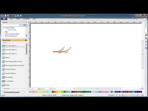
Metro Map solution extends ConceptDraw PRO software with templates, samples and library of vector stencils for drawing the metro maps, route maps, bus and other transport schemes, or design tube-style infographics.
How to draw Metro Map style infographics? Moscow, New York, Los Angeles, London

Metro Map

How to draw Metro Map style infographics? (Los Angeles)

HelpDesk
How to Make a Web Page from Your Metro Map

How to draw Metro Map style infographics? (London)

Metro Train Map

Metro Path Map

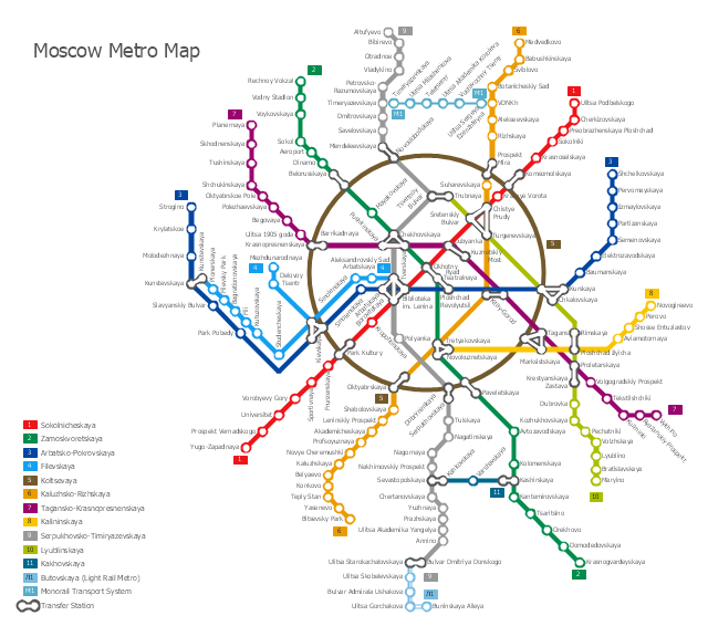
How to draw Metro Map style infographics? (Moscow)

Infographic design elements, software tools Subway and Metro style

Subway infographic design elements - software tools

Infographic software: the sample of New York City Subway map

"The Moscow Metro is a rapid transit system serving Moscow, Russia and the neighbouring Moscow Oblast towns of Krasnogorsk and Reutov. Opened in 1935 with one 11-kilometre (6.8 mi) line and 13 stations, it was the first underground railway system in the Soviet Union. As of 2013, the Moscow Metro has 190 stations and its route length is 317.5 km (197.3 mi). The system is mostly underground, with the deepest section 74 metres (243 ft) at the Park Pobedy station. The Moscow Metro was the world's second most heavily used rapid transit system in 2012 after Seoul Metropolitan Subway." [Moscow Metro. Wikipedia]
The transit map example "Moscow metro map" was created using the ConceptDraw PRO diagramming and vector drawing software extended with the Metro Map solution from the Maps area of ConceptDraw Solution Park.
The transit map example "Moscow metro map" was created using the ConceptDraw PRO diagramming and vector drawing software extended with the Metro Map solution from the Maps area of ConceptDraw Solution Park.
- How to draw Metro Map style infographics? (Los Angeles) | How to ...
- Process Flowchart | How to draw Metro Map style infographics ...
- Los Angeles county Metro Rail map | How to draw Metro Map style ...
- Metro Maps | Subway Map | Metro Map | Subway Map Powerpoint ...
- Metro Maps | Metro Path Map | How to draw Metro Map style ...
- Metro Train Map
- Infographic design elements, software tools Subway and Metro style ...
- How to draw Metro Map style infographics? Moscow, New York, Los ...
- Metro Map | Subway Train Map | Rail transport - Design elements ...
- How to draw Metro Map style infographics? Moscow, New York, Los ...
- How to draw Metro Map style infographics? (London) | Infographic ...
- Metro Area Network Visio Stencil
- How to draw Metro Map style infographics? (New York) | Road ...
- Metro Map | Fire Exit Plan. Building Plan Examples | Metro Maps ...
- How to draw Metro Map style infographics? Moscow, New York, Los ...
- How to draw Metro Map style infographics? Moscow, New York, Los ...
- Metro Map | How to draw Metro Map style infographics? (New York ...
- Metro Maps | Metro Map | How to draw Metro Map style infographics ...
- Design elements - Transport map | Subway Train Map | Metro Maps ...