The vector clipart library Geography contains 14 images of geographical features: ocean, forest, river, lake, waterfall, mountains, ravine, volcano, desert, hills, iceberg, trees.
Use the design elements library Geography to draw illustrations with landform images using the ConceptDraw PRO diagramming and vector drawing software.
"A landform in the earth sciences comprises a geomorphological unit, and is largely defined by its surface form and location in the landscape. As part of the terrain a landform is an element of topography. Landform elements also include land such as hills, mountains, plateaus,canyons,valleys, seascape and oceanic waterbody interface features such as bays, peninsulas, seas and so forth, including sub-aqueous terrain features such as mid-ocean ridges, volcanoes,and the great ocean basins." [Landform. Wikipedia]
This landscape illustration example is included in the Nature solution from the Illustration area of ConceptDraw Solution Park.
Vector illustration

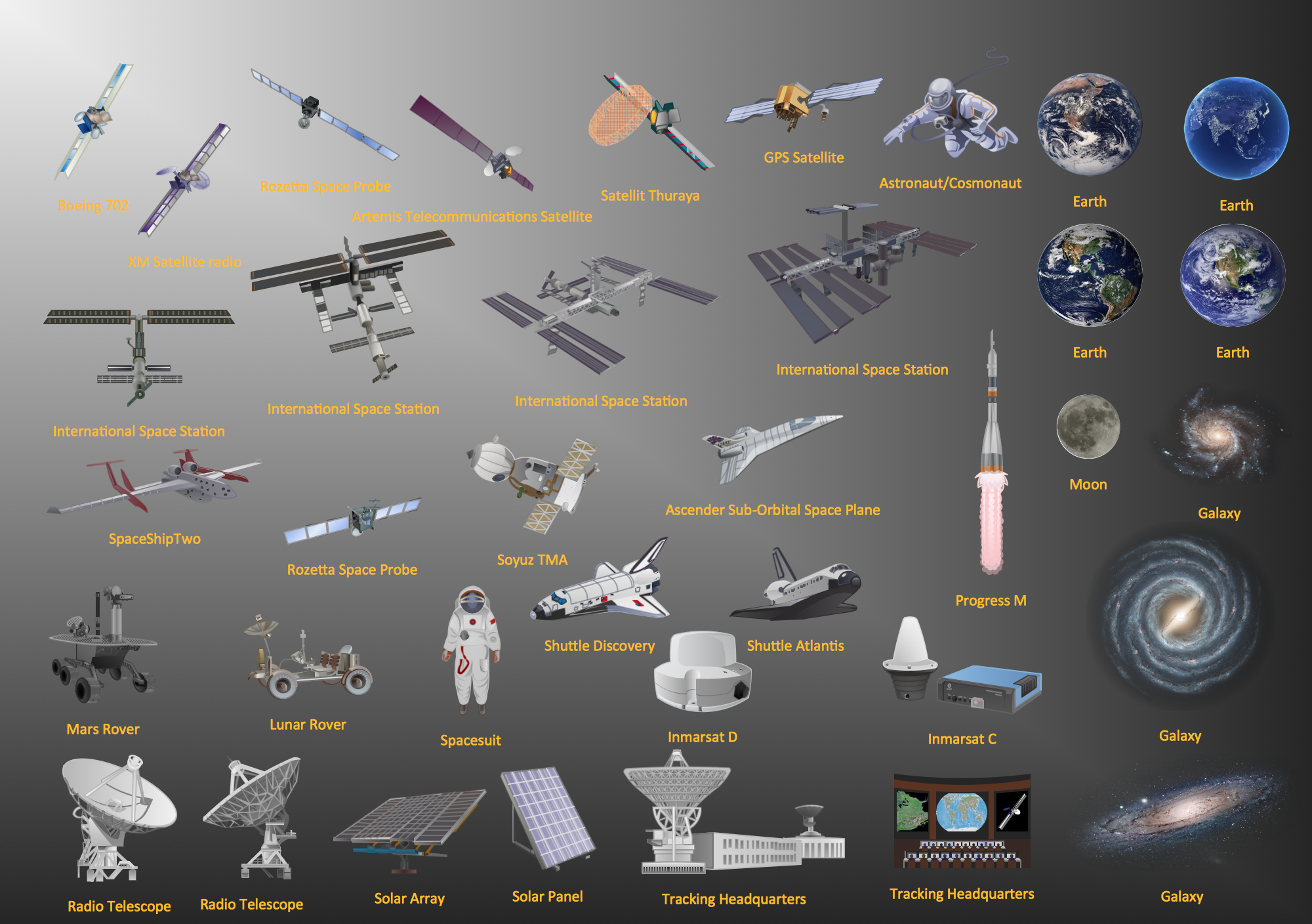
Aerospace - Design Elements
Use the map contours library "Asia" to design thematic maps of Asian countries using the ConceptDraw PRO diagramming and vector drawing software.
"Asia ... is the world's largest and most populous continent, located primarily in the eastern and northern hemispheres. ...
The boundaries of Asia are culturally determined, as there is no clear geographical separation between it and Europe, which together form one continuous landmass called Eurasia. The most commonly accepted boundaries place Asia to the east of the Suez Canal, the Ural River, and the Ural Mountains, and south of the Caucasus Mountains (or the Kuma–Manych Depression) and the Caspian and Black Seas. It is bounded on the east by the Pacific Ocean, on the south by the Indian Ocean and on the north by the Arctic Ocean." [Asia. Wikipedia]
The vector stencils library "Asia" contains 57 map contours: Asia state map contours, Asia political map, sea contours, lake contours.
The map contours example "Design elements - Asia" is included in the Continent Maps solution from the Maps area of ConceptDraw Solution Park.
Asia map contours

Geo Map — Europe

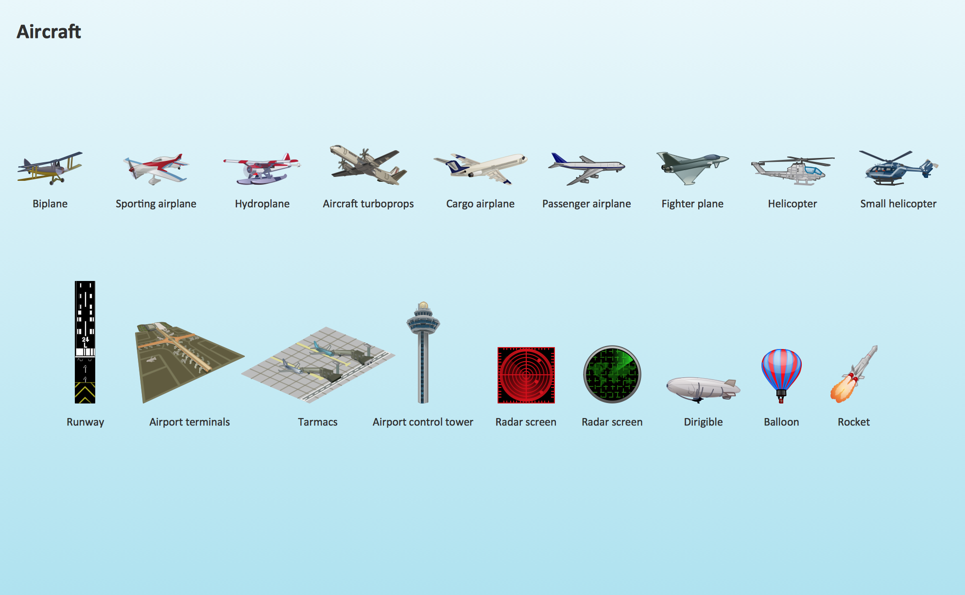
Aircraft - Design Elements
Rail transport - Design elements
Spatial infographics Design Elements: Continental Map

Geo Map - Asia - Papua New Guinea

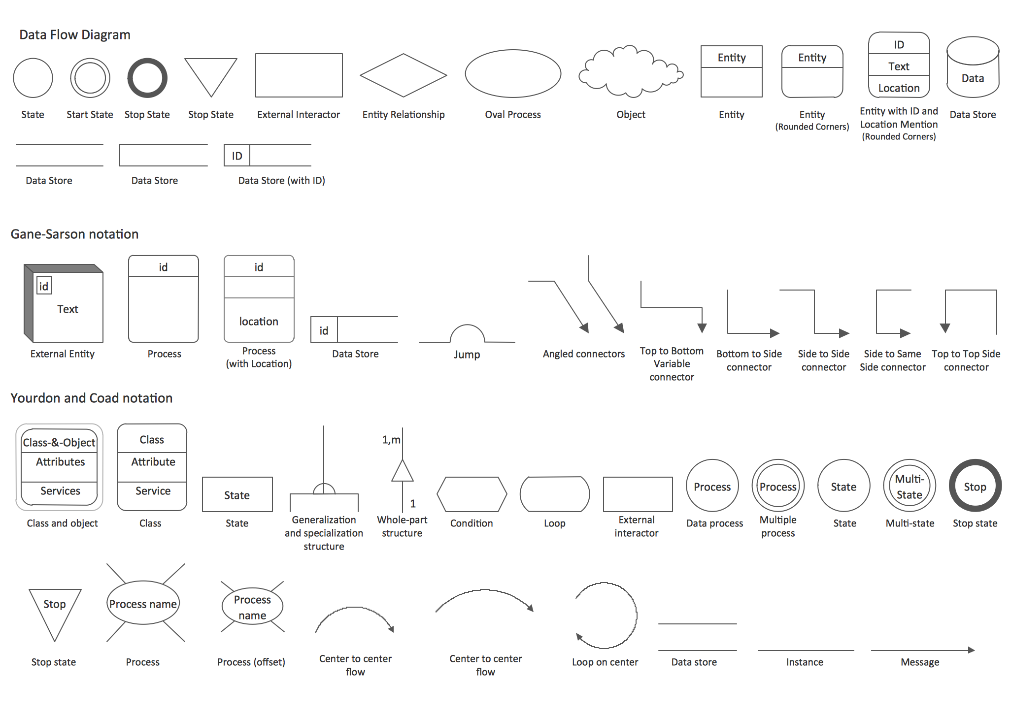
DFD Library — Design elements
Continents and Oceans Map

Geo Map - Africa

Interior Design. Shipping and Receiving — Design Elements

Geo Map — South America Continent

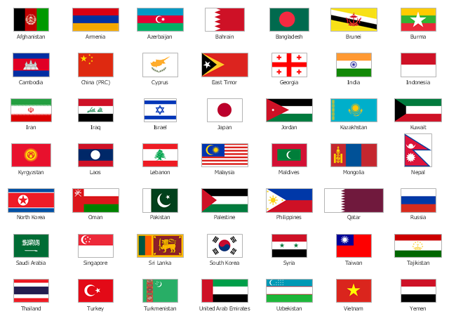
The vector stencils library "Asia flags" contains 49 clipart images of Asian countries state flags.
National flags of Central Asia countries: Kazakhstan, Kyrgyzstan, Tajikistan, Turkmenistan, Uzbekistan.
National flags of Eastern Asia countries: People's Republic of China, Hong Kong (China), Japan, North Korea, South Korea, Macau (China), Mongolia, Republic of China (Taiwan).
National flags of Southeast Asia countries: Brunei, Burma, Cambodia, Christmas Island (Australia), Cocos (Keeling) Islands (Australia), East Timor, Indonesia, Laos, Malaysia, Philippines, Singapore, Thailand, Vietnam.
National flags of Southern Asia countries: Bangladesh, Bhutan, British Indian Ocean Territory (United Kingdom), India, Maldives, Nepal, Pakistan, Sri Lanka.
National flags of Western Asia countries: Abkhazia, Afghanistan, Akrotiri and Dhekelia (United Kingdom), Armenia, Azerbaijan, Bahrain, Cyprus, Egypt, Georgia, Iran, Iraq, Israel, Jordan, Kuwait, Lebanon, Nagorno-Karabakh, Northern Cyprus, Oman, Palestine, Qatar, Saudi Arabia, South Ossetia, Syria, Turkey, United Arab Emirates, Yemen.
National flags of Northern Asia countries: Russia.
The clip art example "Design elements - Asia flags" was created using the ConceptDraw PRO diagramming and vector drawing software extended with the Continent Maps solution from the Maps area of ConceptDraw Solution Park.
Asia state flags
Geo Map - Asia - India

- Design elements - Geography | Desert Terrain Clipart Png
- Design elements - Geography | Geography - Vector stencils library ...
- Design elements - Geography | Geography - Vector stencils library ...
- Design elements - Ponds and Fountains | Design elements ...
- Png Mountain River
- Ocean Png Images
- Hill Nataurl Cartoon Png
- Geography - Vector stencils library | Design elements - Geography ...
- Iceberg Png
- Ocean Icon Png Visio
- Design elements - Geography | Watercraft - Design Elements ...
- USA Maps | Design elements - Geography | Geo Map - Europe ...
- Vector stencils library | River Lakes Mountains Oceans Clipart Png
- Png River Image
- Geography - Vector stencils library | Design elements - Geography ...
- Vector Ocean Png
- Png Images Of Mountains Vector
- Waterfall Bar Chart | Design elements - Geography | SSADM ...
- Geography - Vector stencils library | Design elements - Geography ...
- Geo Map - Europe | Design elements - Geography | Rail transport ...