 USA Maps
Use the USA Maps solution to create a map of USA, a US interstate map, printable US maps, US maps with cities and US maps with capitals. Create a complete USA states map.
The vector clipart library Geography contains 14 images of geographical features: ocean, forest, river, lake, waterfall, mountains, ravine, volcano, desert, hills, iceberg, trees.
Use the design elements library Geography to draw illustrations with landform images using the ConceptDraw PRO diagramming and vector drawing software.
"A landform in the earth sciences comprises a geomorphological unit, and is largely defined by its surface form and location in the landscape. As part of the terrain a landform is an element of topography. Landform elements also include land such as hills, mountains, plateaus,canyons,valleys, seascape and oceanic waterbody interface features such as bays, peninsulas, seas and so forth, including sub-aqueous terrain features such as mid-ocean ridges, volcanoes,and the great ocean basins." [Landform. Wikipedia]
This landscape illustration example is included in the Nature solution from the Illustration area of ConceptDraw Solution Park.
Vector illustration

 Windows 10 User Interface
Windows 10 User Interface solution extends significantly ConceptDraw PRO v11 functionality with look-and-feel functions of GUI software and makes it a great assistant for Win10 designers, developers, and software engineers. This solution provides a wide s
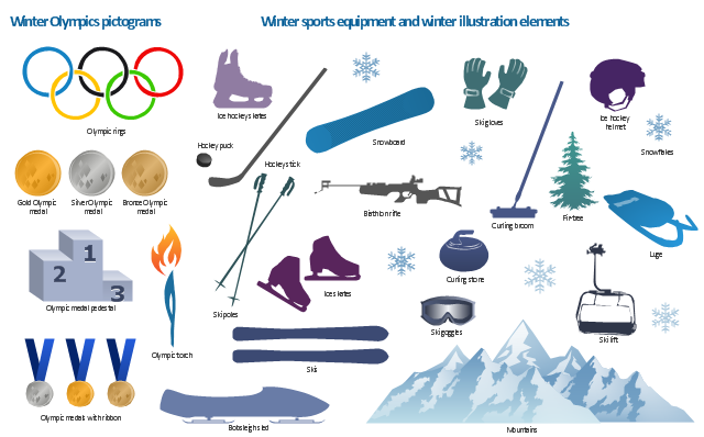
The vector stencils library "Winter Olympics pictograms" contains 29 pictograms and silhouettes: Olympic rings, Olympic torch, medal pedestal, gold medal, silver medal, bronze medal, medals with ribbon, skis, ski poles, biathlon rifle, snowboard, ski goggles, ski gloves, ice hockey helmet, hockey stick, hockey puck, ice hockey skates, ice skates, luge, bobsleigh sled, curling stone, mountains, snowflake, fir-tree, ski lift.
Use it to create your own winter sports diagrams, infographics and illustrations.
The example "Design elements - Winter Olympics pictograms" is included in the Winter Sports solution from the Sport area of ConceptDraw Solution Park.
Use it to create your own winter sports diagrams, infographics and illustrations.
The example "Design elements - Winter Olympics pictograms" is included in the Winter Sports solution from the Sport area of ConceptDraw Solution Park.
Winter Olympics pictograms
Use the map contours library "Asia" to design thematic maps of Asian countries using the ConceptDraw PRO diagramming and vector drawing software.
"Asia ... is the world's largest and most populous continent, located primarily in the eastern and northern hemispheres. ...
The boundaries of Asia are culturally determined, as there is no clear geographical separation between it and Europe, which together form one continuous landmass called Eurasia. The most commonly accepted boundaries place Asia to the east of the Suez Canal, the Ural River, and the Ural Mountains, and south of the Caucasus Mountains (or the Kuma–Manych Depression) and the Caspian and Black Seas. It is bounded on the east by the Pacific Ocean, on the south by the Indian Ocean and on the north by the Arctic Ocean." [Asia. Wikipedia]
The vector stencils library "Asia" contains 57 map contours: Asia state map contours, Asia political map, sea contours, lake contours.
The map contours example "Design elements - Asia" is included in the Continent Maps solution from the Maps area of ConceptDraw Solution Park.
Asia map contours

HelpDesk
How To Create a MS Visio Rack Diagram Using ConceptDraw PRO

"The Andean States are a group of nations in South America that are defined by sharing a common geography (Andes mountain range) or culture such as the Quechua language and Andean cuisine which was primarily spread during the times of the Inca Empire, but also before and after it. ...
The Andes occupy the western part of South America, stretching through the following countries: Colombia, Venezuela, Ecuador, Peru, Bolivia, Argentina (not considered to be -geopolitically- an Andean State), Chile (not considered to be -geopolitically- an Andean State)." [Andean states. Wikipedia]
This Andean states map was redesigned from Wikipedia file Andean States1.PNG.
[en.wikipedia.org/ wiki/ File:Andean_ States1.PNG]
This file is licensed under the Creative Commons Attribution-Share Alike 3.0 Unported license. [creativecommons.org/ licenses/ by-sa/ 3.0/ deed.en]
This Andean states political map example was drawn using the ConceptDraw PRO diagramming and vector drawing software extended with the design elements library South America. This example is included in the Continent Maps solution from the Maps area of ConceptDraw Solution Park.
Political map - Andean states

 Education Package
Education Package is a comprehensive set of multifarious graphical solutions from ConceptDraw Solution Park, collected together in help to ConceptDraw PRO users working in a field of science, education and training, which is aimed at improving the quality of education and helping to design with ease variety of interesting and colorful educational materials, diagrams, charts and maps. Use it to present the information and knowledge in an interesting, clear, structured and simple form to achieve a success in education and pedagogy, to maintain the interest of students and pupils throughout the whole learning process, at the lectures, lessons and even during independent work with additional materials, to contribute to better perception of scientific information by listeners during the conferences and reports.
How To Plan and Implement Projects Faster

The vector stencils library "Bushes and trees" contains 57 clipart images of bushes and trees. Use it to create your landscape design and garden plan.
"A shrub is a small to medium sized woody plant. It is distinguished from a tree by its multiple stems and shorter height, usually under 6 m (20 ft) tall. Plants of many species may grow either into shrubs or trees, depending on their growing conditions. Small, low shrubs, generally less than 2 m (6.6 ft) tall, such as lavender, periwinkle and most small garden varieties of roses, are often termed subshrubs or bushes.
An area of cultivated shrubs in a park or a garden is known as a shrubbery. When clipped as topiary, suitable species or varieties of shrubs develop dense foliage and many small leafy branches growing close together. Many shrubs respond well to renewal pruning, in which hard cutting back to a 'stool' results in long new stems known as "canes". Other shrubs respond better to selective pruning to reveal their structure and character.
Shrubs in common garden practice are generally considered broad-leaved plants, though some smaller conifers such as Mountain Pine and Common Juniper are also shrubby in structure. Species that grow into a shrubby habit may be either deciduous or evergreen." [Shrub. Wikipedia]
The bushes clipart example "Design elements - Bushes and trees (bushes)" was created using the ConceptDraw PRO diagramming and vector drawing software extended with the Landscape & Garden solution from the Building Plans area of ConceptDraw Solution Park.
Bushes clipart
.png--diagram-flowchart-example.png)
- Iceberg Png
- Png Images Of Mountains Vector
- Stone Mountain Vector Png
- Mountains Cartoon Png
- Design elements - Geography | Geography - Vector stencils library ...
- Design elements - Map of US Mountain | Telecommunication ...
- Mountain Range Vector Png
- Geo Map - Europe | Design elements - Geography | Rail transport ...
- River Water Png
- Geography - Vector stencils library | Design elements - Geography ...
- Desert Png Vector
- Design elements - IVR mobile | Telecommunication networks ...
- Design elements - Geography | Geography - Vector stencils library ...
- Rock Cartoon Png
- Mountain Vectors Png
- Airplane seat plan | Aircraft - Vector stencils library | Aircraft - Design ...
- How to Draw a Landscape Design Plan | Design elements - Bushes ...
- Design elements - Geography | Geo Map - Europe - Russia ...
- Ski lift in the snow capped mountains | Geography - Vector stencils ...
- Flowchart design . Flowchart symbols, shapes, stencils and icons ...