Geo Map - USA - New York
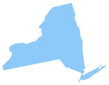
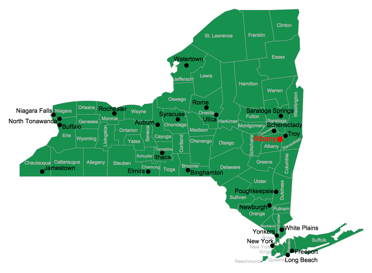
New York is a state in the Northeastern and Mid-Atlantic regions of the United States. The vector stencils library New York contains contours for ConceptDraw PRO diagramming and vector drawing software. This library is contained in the Continent Maps solution from Maps area of ConceptDraw Solution Park.Infographic design elements, software tools Subway and Metro style
Subway infographic design elements for ConceptDraw PRO (mac and pc).How to draw Metro Map style infographics? Moscow, New York, Los Angeles, London
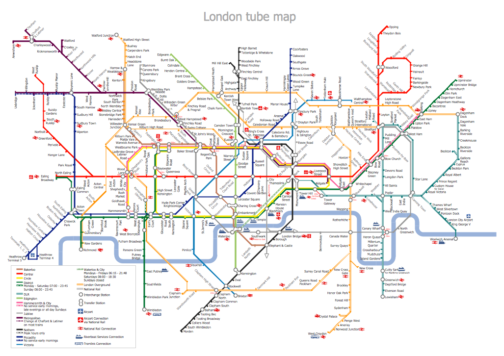
The solution handles designs of any complexity, and the comprehensive library covers all key aspects of a transportation system. To further enhance your map design, there is the option to embed links, that can display station images or other relevant, important information. We have also included a set of samples in the solution, that show the possible real-world application — complex tube systems including the London Tube and New York City Subway show the level of detail possible when using the Metro Map Solution.How to draw Metro Map style infographics? (New York)
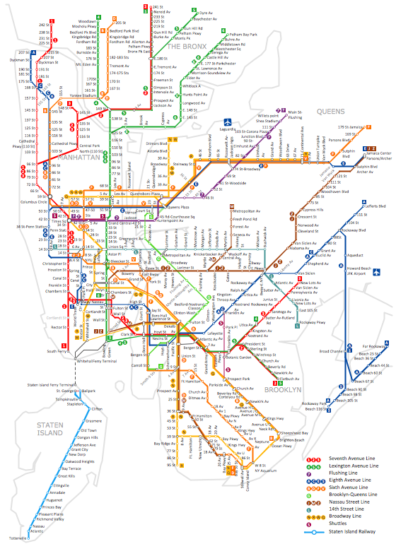
How to draw Metro Map style infographics of New York subway. New York Subway has a long history starting on October 27, 1904. Since the opening many agencies have provided schemes of the subway system. At present time are 34 lines in use. This page present New York City subway map construct with Metro Map Solution in Conceptdraw PRO software. This is a one-click tool to add stations to the map. It lets you control the direction in which you create new stations, change lengths, and add text labels and icons. It contains Lines, Stations, and Landmarks objectsGeo Map - USA - New Jersey
New Jersey is a state in the Northeastern and Middle Atlantic regions of the United States. The vector stencils library New Jersey contains contours for ConceptDraw PRO diagramming and vector drawing software. This library is contained in the Continent Maps solution from Maps area of ConceptDraw Solution Park.Infographic software: the sample of New York City Subway map
Tool to draw Metro Map styled inforgraphics. New York City Subway map sample.Geo Map - USA - Pennsylvania
Pennsylvania, officially the Commonwealth of Pennsylvania, is a U.S. state that is located in the Northeastern and Mid-Atlantic regions of the United States, and the Great Lakes region. The vector stencils library Pennsylvania contains contours for ConceptDraw PRO diagramming and vector drawing software. This library is contained in the Continent Maps solution from Maps area of ConceptDraw Solution Park.Geo Map - USA - New Hampshire
New Hampshire is a state in the New England region of the northeastern United States of America. The state was named after the southern English county of Hampshire. The vector stencils library New Hampshire contains contours for ConceptDraw PRO diagramming and vector drawing software. This library is contained in the Continent Maps solution from Maps area of ConceptDraw Solution Park.Winter Sports Vector Clipart. Medal Map. Spatial Infographics
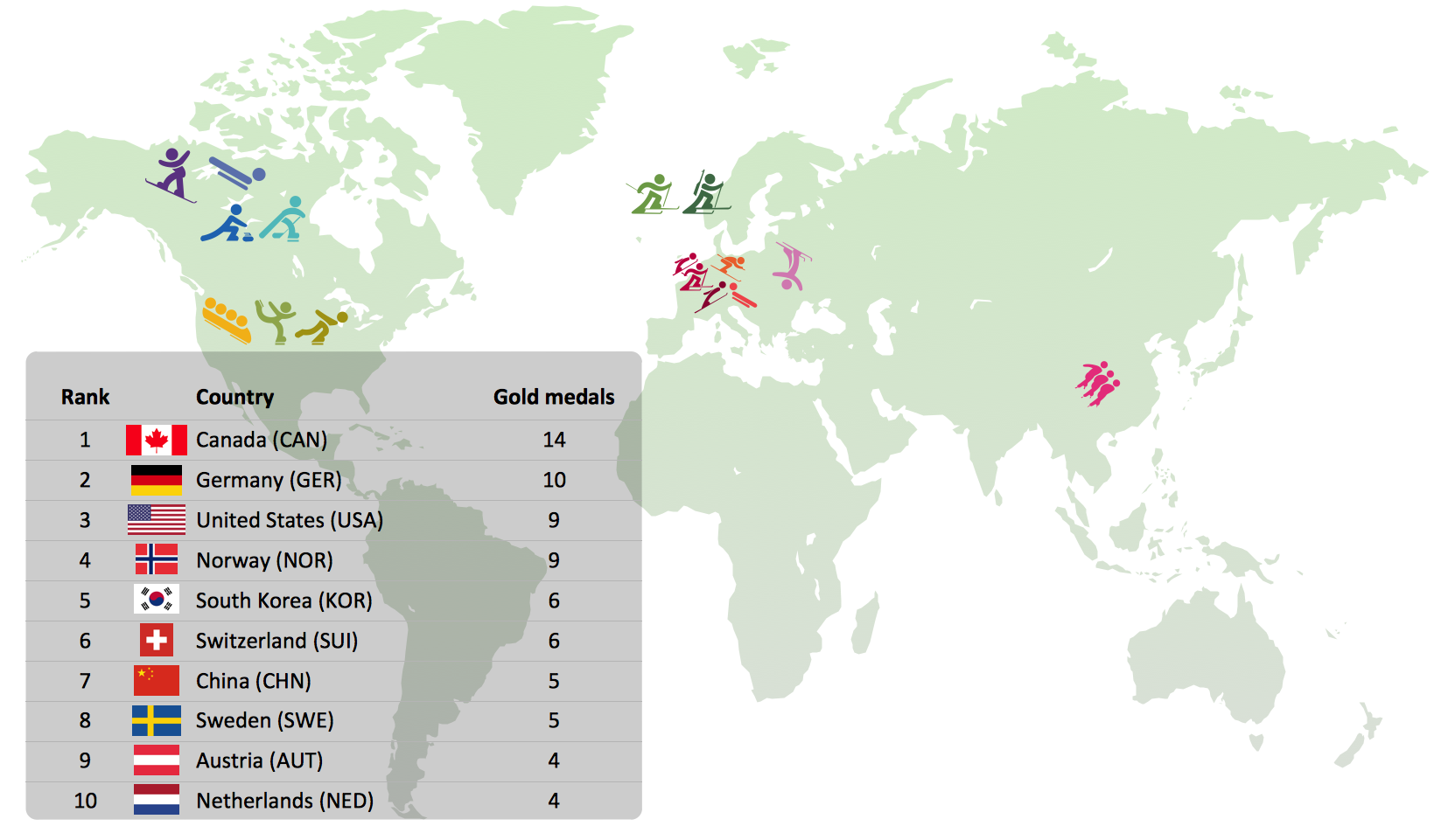
Tracking Olympic results in visual format is the most modern way to deliver statistics to a broad audience. This is a good example of an illustrated table you may easily modify, print, or publish on web from ConceptDraw Winter Sports solution .Geo Map - USA - Connecticut
Connecticut is the southernmost state in the northeastern region of the United States known as New England. The vector stencils library Connecticut contains contours for ConceptDraw PRO diagramming and vector drawing software. This library is contained in the Continent Maps solution from Maps area of ConceptDraw Solution Park.Geo Map - USA - Kentucky
Kentucky, officially the Commonwealth of Kentucky, is a state located in the east south-central region of the United States. The vector stencils library Kentucky contains contours for ConceptDraw PRO diagramming and vector drawing software. This library is contained in the Continent Maps solution from Maps area of ConceptDraw Solution Park.USA Map
Usually designing of maps, including the USA Map is a quite complex, long and labour-intensive process. But now we have an excellent possibility to make it easier with ConceptDraw PRO diagramming and vector drawing software extended with powerful USA Maps Solution from the Maps Area of ConceptDraw Solution Park.Geo Map - USA - Massachusetts
Massachusetts, officially the Commonwealth of Massachusetts, is a state in the New England region of the northeastern United States. The vector stencils library Massachusetts contains contours for ConceptDraw PRO diagramming and vector drawing software. This library is contained in the Continent Maps solution from Maps area of ConceptDraw Solution Park.Maps of Germany With Cities
Despite the fact that the maps surround us everywhere in our life, usually the process of their drawing is sufficienly complex and labor-intensive. But now, thanks to the ConceptDraw PRO diagramming and vector drawing software extended with Germany Map Solution from the Maps Area of ConceptDraw Solution Park, we have the possibility to make easier this process. Design fast and easy your own pictorial maps of Germany, map of Germany with cities, and thematic Germany maps in ConceptDraw PRO!Metro Path Map
You need a powerful software for drawing a Metro Path Map? Use the ConceptDraw PRO diagramming and vector drawing software extended with Metro Map Solution from the Maps Area. Make sure that it is what you need.- Nyc Subway Map Vector Art Color
- Nyc Map Vector
- Metro Map Vector Free
- London Tube Map Vector
- How to draw Metro Map style infographics? ( New York ) | Transport ...
- Geo Map - USA - New York
- How to draw Metro Map style infographics? Moscow, New York , Los ...
- How to draw Metro Map style infographics? ( New York ) | How to ...
- Vector Simple Drawing Of Long Island Ny
- the sample of New York City Subway map
- Vector Map Of Nyc And Nj
- Metro Map | How to draw Metro Map style infographics? Moscow ...
- How to draw Metro Map style infographics? ( New York ) | Landmarks ...
- Metro Maps | How to draw Metro Map style infographics? Moscow ...
- New York State In Map To Draw
- Transit map template | Transport map - Template | Maps | Public ...
- Metro Maps | How to draw Metro Map style infographics? Moscow ...
- Metro Design Vector
- How to draw Metro Map style infographics? Moscow, New York , Los ...
- How to draw Metro Map style infographics? ( New York ...
