Bubble Map Maker

 USA Maps
The USA Maps solution can be used as an additional tool to the ConceptDraw DIAGRAM diagramming and drawing software. Each of the pre-made maps that are available to be taken from this solution is scaled. The USA Maps solution allows using the option of adding further details such as country’s borders, states’ names, their capitals and major cities that can be either shown or hidden by using the action menu for each of the state maps. The solution is incredibly useful for all who have an international business working with people, providing other countries products from the USA, or making purchases to supply those who live in the US with.
 UK Map
Making a map of the UK can be as simple as to create any other needed drawing by using the pre-made examples and templates from the Map of UK solution. The last-mentioned application may increase the opportunities for all users of the ConceptDraw DIAGRAM charting and drawing software by providing the collection of the professionally designed samples and vector stencil graphics of the maps which represent the United Kingdom counties, cities, and regions. The Map of UK solution can be used while working in the ConceptDraw DIAGRAM application enabling its users to have the pre-made templates as the base for some other, unique-looking UK maps of many different levels of detail. It is useful for visualizing business and other UK-related thematic information mentioning the UK geographic areas for either reference guides, presentations or other purposes.
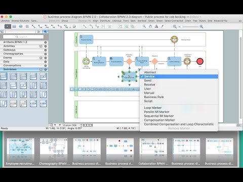
Geo Map Software

 Continent Maps
Continent Maps solution extends ConceptDraw DIAGRAM software with templates, samples and libraries of vector stencils for drawing the thematic maps of continents, state maps of USA and Australia.
 Germany Map
The Germany Map solution contains collection of samples, templates and scalable vector stencil graphic maps, representing map of Germany and all 16 states of Germany. Use the ConceptDraw DIAGRAM diagramming and drawing software makes it possible to create any needed map of Germany from a scratch but using the Germany Map solution may enable any ConceptDraw DIAGRAM user to design it quicker by providing the collection of the pre-made examples, templates of the maps and the vector stencil graphic maps of Germany, including all its 16 states. The Germany Map solution can be used as the base for making various thematic maps that can reflect any needed information concerning Germany by all the ConceptDraw DIAGRAM users.
Map of Germany

Map of Germany — Hamburg

 Directional Maps
Directional Maps solution extends ConceptDraw DIAGRAM software with templates, samples and libraries of vector stencils for drawing the directional, location, site, transit, road and route maps, plans and schemes.
How to draw Metro Map style infographics? (Moscow)
</i> *")
How to exchange data files of major mind mapping software?

Germany Map

Map of Germany — Bremen

Map of Germany — Brandenburg State

Business Diagram Software

 Australia Map
To simplify the work of drawing the maps of Australia in the ConceptDraw DIAGRAM application, the Australia Map solution can be used, including its collection of scalable graphics that is known to be representing the political geography of Australia, splitting into distinct state maps. Each of the available maps offers many details that can be added to the maps so it becomes possible to show this country’s sub-divisions and its local government areas. Being focused on the main cities and the capital, the maps of Australia can be created by edited the pre-made templates.
Geo Map — USA — Ohio

Maps and Directions

Geo Mapping Software Examples - World Map Outline

Map of USA

- How to draw Metro Map style infographics? (New York) | How to ...
- Geo Map - Europe - Czech Republic | Software European Cities Map
- Metro Maps | Metro Map | Infographic design elements, software ...
- Map Infographic Creator | What Is The Best Free Software For ...
- Directional Maps | Free Draw Directional Map Software
- Brilliant Examples of Infographics Map , Transport, Road | Map ...
- Cross-Functional Process Map Template | Free Town Map Template
- Maps | Directional Map Drawing Software Free - Conceptdraw.com
- How to draw Metro Map style infographics? Moscow, New York, Los ...