Geo Map — USA — Utah
Maps of USA — State of Utah
"Utah is a state in the United States. It became the 45th state admitted to the Union on January 4, 1896. Utah is the 13th-largest, the 33rd-most populous, and the 10th-least-densely populated of the 50 United States. Utah has a population of about 2.9 million, approximately 80% of whom live along the Wasatch Front, centering on Salt Lake City, leaving vast expanses of the state nearly uninhabited. Utah is bordered by Colorado to the east, Wyoming to the northeast, Idaho to the north, Arizona to the south, and Nevada to the west. It also touches a corner of New Mexico in the southeast." [Utah. Wikipedia]
The vector stencils library Utah contains contours for ConceptDraw DIAGRAM diagramming and vector drawing software. This library is contained in the Continent Maps solution from Maps area of ConceptDraw Solution Park.
Use the Utah library to draw thematic maps, geospatial infographics and vector illustrations for your business documents, presentations and websites.
Geo Map — USA — State of Utah

Geo Map — USA — Utah Contour

Geo Map — USA

Geo Map — USA Contour

Geo Map — Contours of Territories of the United States

See Also Territories of the United States Geo Maps :
- Alabama
- Alaska
- Arizona
- Arkansas
- California
- Colorado
- Connecticut
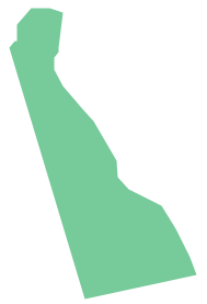
- Delaware
- Florida
- Georgia
- Hawaii
- Idaho
- Illinois
- Indiana
- Iowa
- Kansas
- Kentucky
- Louisiana
- Maine
- Maryland
- Massachusetts
- Mexico
- Michigan
- Minnesota
- Mississippi
- Missouri
- Montana
- Nebraska
- Nevada
- New Hampshire
- New Jersey
- New Mexico
- New York
- North Carolina
- North Dakota
- Ohio
- Oklahoma
- Oregon
- Pennsylvania
- Tennesse
- Utah
- Vermont
- Virginia
- Washington
- West Virginia
- Wisconsin
- Wyoming
- United States