Geo Map — USA — Colorado
Maps of USA — State of Colorado
The Colorado state in the United States of America encompasses most of the mountains there named “the Southern Rocky” and the north-eastern part of the so-called “Colorado Plateau”. The western edge of the Great Plains is also on the territory of this state, which is part of the so-called “Western United States” as well as the “Southwestern United States” and the “Mountain States”. This state is the 8th most extensive and the 21st most populous of the 50 United States. The population of Colorado is over 5540000 nowadays increasing day by day as this state is quite popular among people moving to as it is quite a quiet and prosperous place to live.
The name of the state was chosen because of the Colorado River when one of the Spanish travellers was getting by the mountains on the river. The territory of this state was organized in 1861 on the 28th of February and on the 1st of August 1876 the President of the United States of America signed the “Proclamation 230”, where it was mentioned that Colorado was admitted as a state to the United States as this country’s 38th state. Colorado is also known as the so-called "Centennial State” for a reason of it becoming a state in the same year as the centennial of the Declaration of Independence of America.
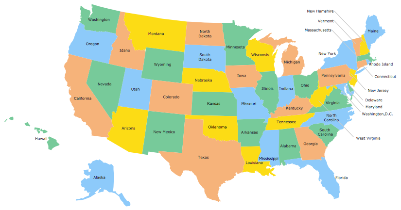
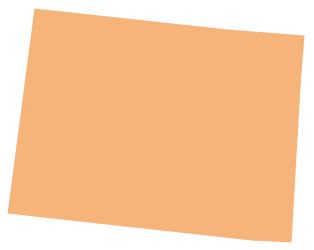
Colorado state is bordered by another state — Nebraska — in the north-east, by the one called “Wyoming” in the north, “Kansas” in the east, “New Mexico” in the south, “Oklahoma” in the southeast, “Utah” in the west and the one called “Arizona” in the south-west. There is a beautiful landscape of mountains, high plains, forests, mesas, woods, canyons, rivers, plateaus as well as the desert lands in Colorado. Its capital is Denver, which is the most populous place in the whole state. The residents of this state are called “Coloradans” or “Coloradoans”.
The geography of Colorado ranges from the arid plains, alpine mountains as well as deserts with deep canyons, huge sand dunes, granite rocks and sandstone formations, lakes, rivers and lush forests. The borders of the state of Colorado were originally defined as the lines of longitude and latitude, making the shape of the state a latitude-longitude quadrangle. Colorado stretches from the 35N to 41N latitude. Same as Wyoming, Utah and Colorado are the only states with the boundaries, which are defined solely by the lines of longitude and latitude.
Colorado is the only state in the USA that lies above 1000 meters elevation and the point, where the river called “Arikaree river” is, is the lowest point in Colorado. The climate in Colorado is quite complex, but generally the southern Colorado state is not always warmer than its northern part. Most of the Colorado state territory is made up of foothills, high plains, mountains as well as the desert lands. These mountains and valleys affect the local climate in Colorado so it always makes a difference in the area where they are situated.
With an increase in elevation there is a decrease in temperature as well as in precipitation comes. North-east, east and south-east of Colorado are mostly the high plains. Northern part of the state of Colorado is a mix of foothills, mountains and high plains. Western and north-western parts of Colorado are mainly mountainous with some desert lands, but south-western and southern parts of Colorado are a mixture of mountain and desert areas. Extreme weather changes are very common in this state. But nevertheless the majority of extreme weather occurs in the least populated its areas. Thunderstorms are common for the eastern part of the Continental Divide both in the summer and spring. The Eastern Plains have had one of the biggest hail storms in North America since a long time ago. There were also some damaging tornadoes in the Eastern Plains, including the one in 1990 and the one in 2008.
Much of the area of the Colorado state is a very dry one averaging only 430 mm of precipitation per year. Although the lack of precipitation contributes to the severity of the wildfires in this state. Some of the mountainous regions of Colorado get a huge amount of moisture from the winter snowfalls. The melting snow in spring often causes the great waterflows in the two rivers — Colorado and Yampa ones — as well as in the Rio Grande, the Arkansas one, the North Platte River and the South Platte one. There also can be a serious water flowing out of the Colorado Rocky Mountains, which is a very significant source of water for the towns, farms and cities of Arizona, New Mexico, Utah, Nevada and the Midwest (Nebraska and Kansas), as well as for the southern states (Oklahoma and Texas). There are also lots of water for use in California or even northern Mexico.
The state of Colorado, despite its mountainous terrain, is relatively seismically quiet. There was an earthquake of a 5,3 magnitude on August 22 in 2011 in the city of Trinidad, but not much damage was reported. This mentioned earthquake in Colorado was the second largest. As another earthquake was recorded in 1973 of magnitude 5,7 which was the first one on the list as it was quite serious.
But, in general, the state is safe and it can be visited by anyone who wants to see both the wild nature and the cities full of comforts, such as restaurants and shops. Colorado is quite popular among tourists to come and see this interesting place and if you plan to visit it or you need, for some other reasons, to create the map of it, then we can recommend you to create a map of Colorado or any other needed state of the United States of America or other country with help of ConceptDraw DIAGRAM software as well as with the “Continent Maps solution” from “Maps” area of ConceptDraw Solution Park on this site. This solution consists of the vector stencils library “Colorado” that contains the needed contours of the state for using them while working in the ConceptDraw DIAGRAM diagramming and vector drawing software. Using it, you can create the needed thematic maps, geospatial infographics and vector illustrations for your business documents, presentations and websites within only a very short period of time.
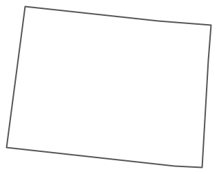
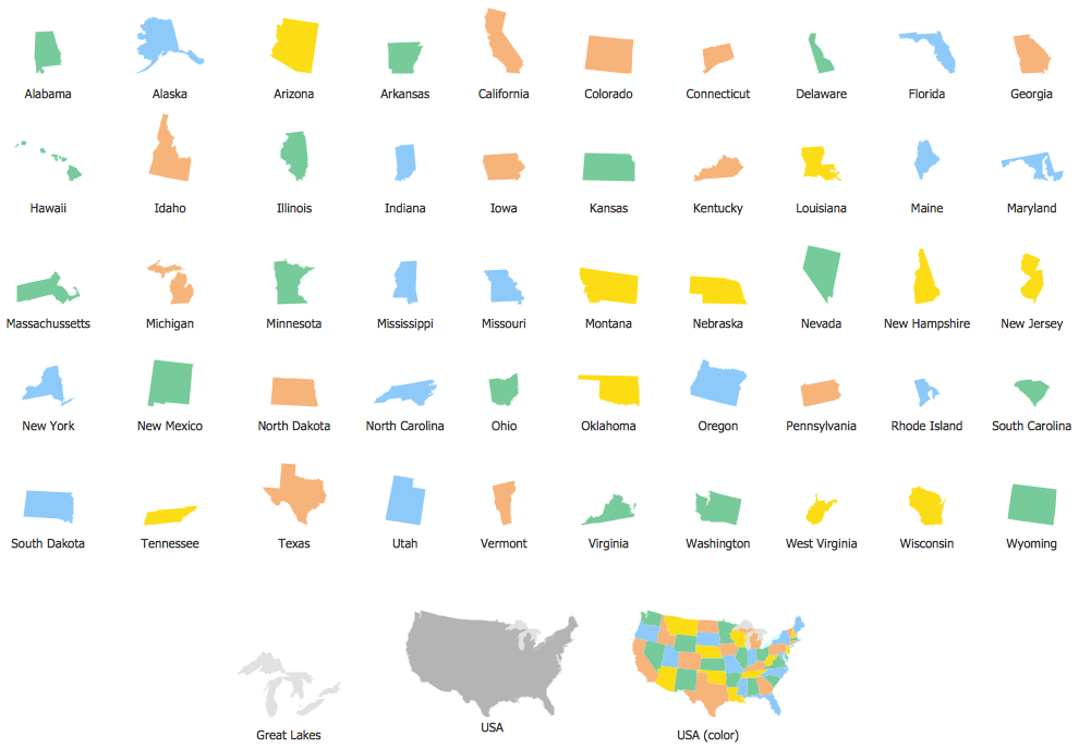
The vector stencils library Colorado contains contours for ConceptDraw DIAGRAM diagramming and vector drawing software. This library is contained in the Continent Maps solution from Maps area of ConceptDraw Solution Park.
Use the Colorado library to draw thematic maps, geospatial infographics and vector illustrations for your business documents, presentations and websites.
Geo Map — USA — State of Colorado
Geo Map — USA — Colorado Contour
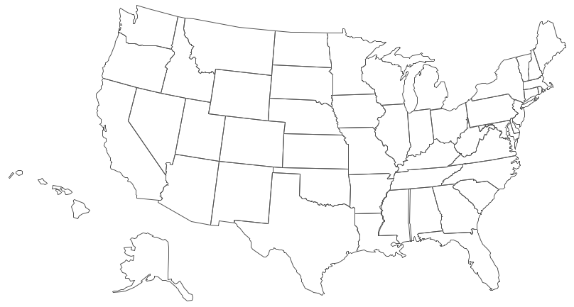
Geo Map — USA
Geo Map — USA Contour
Geo Map — Contours of Territories of the United States
See Also Territories of the United States Geo Maps :
- Alabama
- Alaska
- Arizona
- Arkansas
- California
- Colorado
- Connecticut
- Delaware
- Florida
- Georgia
- Hawaii
- Idaho
- Illinois
- Indiana
- Iowa
- Kansas
- Kentucky
- Louisiana
- Maine
- Maryland
- Massachusetts
- Mexico
- Michigan
- Minnesota
- Mississippi
- Missouri
- Montana
- Nebraska
- Nevada
- New Hampshire
- New Jersey
- New Mexico
- New York
- North Carolina
- North Dakota
- Ohio
- Oklahoma
- Oregon
- Pennsylvania
- Tennesse
- Utah
- Vermont
- Virginia
- Washington
- West Virginia
- Wisconsin
- Wyoming
- United States
