Made with
ConceptDraw
DIAGRAM 17

USA Map States

ConceptDraw DIAGRAM diagramming and vector drawing software offers the unique USA Maps Solution from the Maps Area of ConceptDraw Solution Park which is indispensable for easy drawing professional looking:

  • map of USA,
  • USA map states,
  • US interstate map,
  • US map with cities,
  • thematic USA maps.
USA Map States *

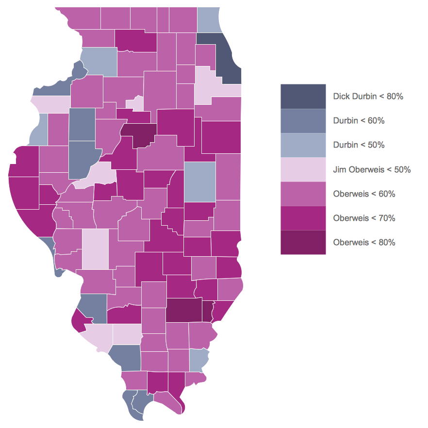
Example 1. USA Map States - Illinois Senatorial Election Results by County 2014

Thanks to the professional set of drawing tools which provide the ConceptDraw DIAGRAM software and USA Maps Solution, visual design and representation of USA Map States will take literally few minutes of your time.

ConceptDraw STORE deserves special attention. It is incredibly useful tool which gives you the access to all ConceptDraw Solution Park, to the libraries, templates and samples of all solutions. As for the USA Maps solution, collection of predesigned samples, template and 9 libraries are also available from ConceptDraw STORE.

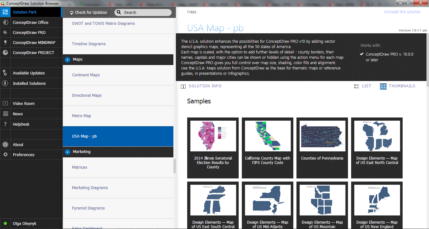
USA Maps Solution in ConceptDraw STORE

Example 2. USA Maps Solution in ConceptDraw STORE

9 libraries of USA Maps solution contain 52 ready-to-use vector objects which were designed to facilitate drawing process of USA Maps with any level of detail - from large USA map to the detailed maps of specific states, counties, cities.

The list of libraries of USA Maps solution includes:

  • East North Central States
  • East South Central States
  • Mid-West North States
  • Mid-West South States
  • Mid-Atlantic States
  • South Atlantic States
  • Mountain States
  • New England States
  • Pacific States

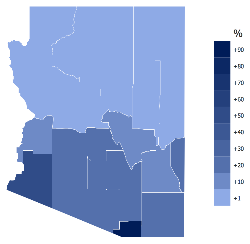
USA Map States - Spanish Speakers in Arizona

Example 3. USA Map States - Spanish Speakers in Arizona

The USA Map States you see on this page were created in ConceptDraw DIAGRAM software using the tools of USA Maps solution. These samples successfully demonstrate solution's capabilities and professional results you can achieve. An experienced user spent 15 minutes creating each of these thematic maps.

Use the USA Maps solution for ConceptDraw DIAGRAM software to create your own maps of various USA states fast, easy and effective.

All source documents are vector graphic documents. They are available for reviewing, modifying, or converting to a variety of formats (PDF file, MS PowerPoint, MS Visio, and many other graphic formats) from the ConceptDraw STORE. The USA Maps Solution is available for all ConceptDraw DIAGRAM or later users.


FIVE RELATED HOW TO's:
New York is a state in the Northeastern and Mid-Atlantic regions of the United States. The vector stencils library New York contains contours for ConceptDraw DIAGRAM diagramming and vector drawing software. This library is contained in the Continent Maps solution from Maps area of ConceptDraw Solution Park.Geo Map - USA - New York *
Picture: Geo Map - USA - New York
Related Solution:
Colorado is a U.S. state encompassing most of the Southern Rocky Mountains as well as the northeastern portion of the Colorado Plateau and the western edge of the Great Plains. The vector stencils library Colorado contains contours for ConceptDraw DIAGRAM diagramming and vector drawing software. This library is contained in the Continent Maps solution from Maps area of ConceptDraw Solution Park.Geo Map — USA — Colorado *
Picture: Geo Map — USA — Colorado
Related Solution:
Mississippi is a U.S. state located in the Southern United States. The vector stencils library Mississippi contains contours for ConceptDraw DIAGRAM diagramming and vector drawing software. This library is contained in the Continent Maps solution from Maps area of ConceptDraw Solution Park.Geo Map — USA — Mississippi *
Picture: Geo Map — USA — Mississippi
Related Solution:
South America includes 12 sovereign states. ConceptDraw DIAGRAM is idea to draw the geological maps of South America continent from the pre-designed vector geo map shapes. Use Continent Maps solution from the Maps area of ConceptDraw Solution Park to draw thematic maps, geospatial infographics and vector illustrations for your business documents, presentations and websites.Geo Map — South America Continent *
Picture: Geo Map — South America Continent
Related Solution:
Germany, officially the Federal Republic of Germany, is a federal parliamentary republic in West-Central Europe. You need design the map of Germany or detailed map of Germany with cities fast and easy? We reccomend you to use the indispensable ConceptDraw DIAGRAM diagramming and vector drawing software extended with unique Germany Map Solution from the Maps Area of ConceptDraw Solution Park.Map of Germany *
Picture: Map of Germany
Related Solution:
ConceptDraw
DIAGRAM 17