Geo Mapping Software Examples - World Map Outline *

Geo Mapping Software Examples - World Map Outline
An Example world map , showing a simple outline of world map . The world map is vector and can be edited or export to svg format.World Continents Map *

World Continents Map
World Continents Map
.png--diagram-flowchart-example.png)
The vector stencils library "Marketing maps " contains 44 map contours: the Group
of Twenty (G20) state maps , EU state maps and world map . Use it to visualize
Types of Map - Overview *

Types of Map - Overview
ConceptDraw defines some map types, divided into three categories. Continent Maps to design the geographical maps of the world , of any countries and
Continents and Oceans Map *

Continents and Oceans Map
Continents and Oceans Map

Geo Map - Asia - Myanmar *

Geo Map - Asia - Myanmar
Geo Map - Asia - MyanmarGeo Map - Europe - Czech Republic *

Geo Map - Europe - Czech Republic
Geo Map - Europe - Czech RepublicMap Software *

Map Software. Create Great-Looking Maps , Flags, Charts and More!
Map Software for Mac and Windows

Geo Map - Africa - Ethiopia *

Geo Map - Africa - Ethiopia
Geo Map - Africa - Ethiopia
The vector stencils library "Management maps " contains 44 map contours: G-20
state maps , EU state maps and world map . Use it to create your management
The vector stencils library "CRM maps " contains 8 thematic maps : World maps ,
continent maps (Africa map , Asia map , Europe map , North America map , South
 Continent Maps Solution. ConceptDraw.com
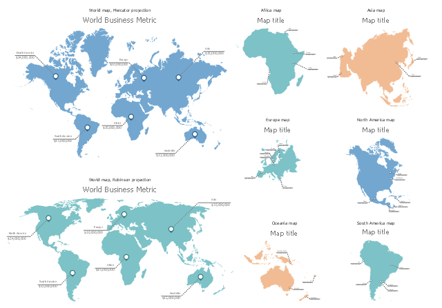
Continent Maps solution extends ConceptDraw DIAGRAM software with maps
with any level of detail – from world continents map to maps of specific cities.

- World Maps
- ConceptDraw News | Navigate the World with Metro Maps
- 7 Continents Map | World Continents Map | Continents Map ...
- Continent Maps | Map of Continents | World Continents Map ...
- Geo Mapping Software Examples - World Map Outline | Superb ...
- Design elements - Marketing maps ( World map ) | Design elements ...
- Geo Mapping Software Examples - World Map Outline | Geo Map ...
- Continent Maps | Continents Map | World Continents Map | Continent
- Design elements - Marketing maps ( World map )
- World Continents Map | Political map of Europe | European ...
- Geo Map - World | Geo Map of Americas | Geo Map — United States ...
- Design elements - Education maps ( World map )
- Geo Mapping Software Examples - World Map Outline | Geo Map ...
- Map of Continents | Geo Map - World | 7 Continents Map | Antarctica ...
- Continent Maps
- 7 Continents Map | World Continents Map | Continent Maps | Draw ...
- Continent Maps | Geo Mapping Software Examples - World Map ...
- Geo Mapping Software Examples - World Map Outline | World ...
- Geo Map - World | Geo Mapping Software Examples - World Map ...
- Continent Maps | World Continents Map | Geo Map Software | Maps ...