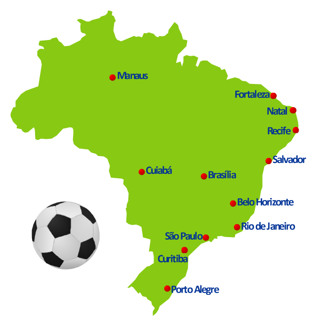
This spatial infographics example was created on the base of Brazil location map from the Wikipedia article "2014 FIFA World Cup". [en.wikipedia.org/ wiki/ 2014_ FIFA_ World_ Cup]
"The 2014 FIFA World Cup will be the 20th FIFA World Cup, an international men's football tournament that is scheduled to take place in Brazil from 12 June to 13 July 2014. ...
Eighteen locations were presented as potential World Cup host cities: Belém, Belo Horizonte, Brasília, Campo Grande, Cuiabá, Curitiba, Florianópolis, Fortaleza, Goiânia, Maceió, Manaus, Natal, Porto Alegre, Recife, Rio Branco, Rio de Janeiro, Salvador and São Paulo." [2014 FIFA World Cup. Wikipedia]
The geospatial infographics example "2014 FIFA World Cup - Brazil location map" was created using the ConceptDraw PRO diagramming and vector drawing software extended with the Soccer solution from the Sport area of ConceptDraw Solution Park.
Geospatial infographics
Geo Map - Asia - Philippines

Types of Map - Overview

Spatial infographics Design Elements: Location Map

2014 FIFA World Cup

 Soccer
The Soccer (Football) Solution extends ConceptDraw PRO v9.5 (or later) software with samples, templates, and libraries of vector objects for drawing soccer (football) diagrams, plays schemas, and illustrations. It can be used to make professional looking
Geo Map - Europe - Iceland

Geo Map Software

Map of Germany

Vector Map of Germany

Geo Map - Asia

Geo Map - Europe - Russia

Geo Map - Europe - Macedonia

Geo Map - South America - Paraguay

Geo Map - Africa

- Spatial infographics Design Elements: Location Map | Conference ...
- Geo Map Software | Geo Map - World | Types of Map - Overview ...
- Geo Mapping Software Examples - World Map Outline | Geo Map ...
- World Map Infographic
- Geo Map - Asia - Myanmar | Geo Mapping Software Examples ...
- Spatial infographics Design Elements: Location Map | Conference ...
- World Map With Countries And Continents
- 2014 FIFA World Cup | Brazil Stadium Location Map
- Geo Mapping Software Examples - World Map Outline | Fire Exit ...
- Continent Maps | World Continents Map | Geo Map - South America ...
- Spatial infographics Design Elements: Location Map | Value Stream ...
- World Continents Map | Geo Mapping Software Examples - World ...
- World Continents Map | Emergency Plan | Geo Map - South America ...
- Map Of The World Infographic
- Process Flowchart | Geo Mapping Software Examples - World Map ...
- Continent Maps
- Continent Maps | Continent Map | Spatial infographics Design ...
- World Map Infographic Creator
- Geo Map - South America - Brazil | Brazil in South America - Political ...