Continent Maps
Continent Maps solution extends ConceptDraw DIAGRAM software with templates, samples and libraries of vector stencils for drawing the thematic maps of continents, state maps of USA and Australia.
Continent Map
Every day many of people confront in their work with necessity of drawing various continent maps. Specially for these people was developed the Continent Maps Solution and included to the Maps Area of ConceptDraw Solution Park. Thanks to it you can design any Continent Map quick and easy.Spatial infographics Design Elements: Location Map
Infographic Design Elements for visually present various geographically distributed information.Geospatial Data
Effective spatial infographics design, easy geospatial data presenting, now it is reality thanks to the extensive drawing tools of the Spatial Infographics Solution included in “Infographics” Area of ConceptDraw Solution Park.Emergency Plan
Fire emergency plan need to be in every building on each floor. The evacuation plan preliminary designed in ConceptDraw DIAGRAM software will help employees or family members when natural disasters, fires, hazardous leaks and other disaster events happen. Start drawing emergency blueprint from floor bounds, then put the inner walls and doors, and finally use arrows to show evacuation directions to fire exits.Geo Map Software
Geo Map Software - Full Geographic Reach of Your Business with Geo Map Shapes.Geo Map — United States of America Map
United States is a federal republic consisting of 50 states and a federal district.ConceptDraw is idea to draw the geological map of the United States of America from the pre-designed vector geo map shapes.
Each map is scaled, with the option to add further levels of detail - county borders, their names, capitals and major cities can be shown or hidden using the action menu for each state map. ConceptDraw DIAGRAM gives you full control over map size, shading, color fills and alignment.
Use the Continent Maps solution for easy drawing professional looking geological maps, thematic maps, geospatial infographics and vector illustrations for your business documents, presentations and websites.
HelpDesk
How to Draw a Map of North America
Geographic maps, cardiograms, and thematic maps are often used for geographical visualization of business information. Any country can inspire a wealth of geopolitical statistical data. A common way of assimilating this data is to create maps that convey a particular theme or subject matter in relation to a specific geographical area. Known as thematic maps, they cover themes such as population density, average rainfall, or political allegiance, differentiating the data by using graphical elements and annotation. Thematic maps contrast general reference maps, which tend to display information on a variety of subjects — vegetation, topology, roads, and highways, for example. A thematic map will always focus on one particular subject matter. ConceptDraw DIAGRAM can be helpful as a tool for creating maps of countries and regions of the world. It allows you to draw continental maps quickly and easily using the special templates and vector stencils libraries.Types of Map - Overview
ConceptDraw defines some map types, divided into three categories. Every map type has specific shapes and examples.Informative and Well-Designed Infographics
Informative and well-designed Infographics allows visually present various map containing information.Spatial Infographics
Spatial infographics solution extends ConceptDraw DIAGRAM software with infographic samples, map templates and vector stencils libraries with design elements for drawing spatial information graphics.
UK Map
The Map of UK solution contains collection of professionally designed samples and scalable vector stencil graphics maps, representing the United Kingdom counties, regions and cities. Use the Map of UK solution from ConceptDraw Solution Park as the base fo
Subway infographic design elements - software tools
Subway infographic design elements of MetroMap and ConceptDraw software tools.Soccer
The Soccer (Football) Solution extends ConceptDraw DIAGRAM.5 (or later) software with samples, templates, and libraries of vector objects for drawing soccer (football) diagrams, plays schemas, and illustrations. It can be used to make professional looking
Mind Map Exchange
This solution extends ConceptDraw MINDMAP software with the ability to easily exchange mind maps with a large variety of other mind mapping applications.
- Continent Maps | Sample Of Political Map Of Europe
- Continent Maps | Spatial infographics Design Elements: Continental ...
- Example Of Voting System Flowchart
- Continent Maps | Entity Relationship Diagram For Online Voting ...
- South Asia Map Example
- Us Thematic Map Example
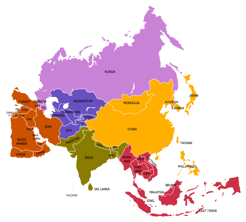
- Middle East - Political map | Geo Map - Asia | Continent Maps ...
- Biology | Concept Maps | Value Stream Mapping | Sample Concept ...
- Spatial infographics Design Elements: Continental Map | Map ...
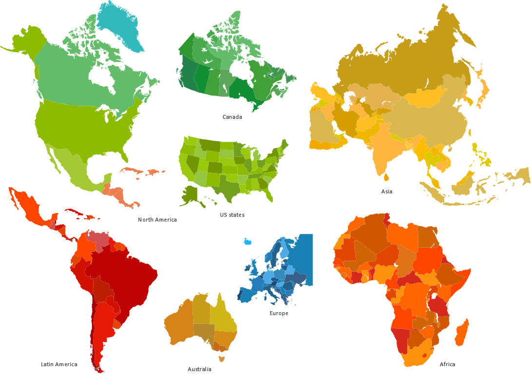
- Continents Map
- Benefit Corporation legislation - Thematic map | Continent Maps ...
- Continent Maps | Central Asia - Political map | Political map of Asia ...
- Subway infographic design elements - software tools | Map ...
- Languages of South America - Thematic map | Continent Maps ...
- Spatial infographics Design Elements: Continental Map
- Southern Cone - Political map | South America regions - Political ...
- Continents and Oceans Map | Continent Maps | Geo Map - South ...
- Continent Maps | Geo Map - Asia | Central Asia - Political map ...
- Directional Maps | How to Create a Directional Map Using ...
- World Population Infographics | Sample Pictorial Chart Sample ...
- ERD | Entity Relationship Diagrams, ERD Software for Mac and Win
- Flowchart | Basic Flowchart Symbols and Meaning
- Flowchart | Flowchart Design - Symbols, Shapes, Stencils and Icons
- Flowchart | Flow Chart Symbols
- Electrical | Electrical Drawing - Wiring and Circuits Schematics
- Flowchart | Common Flowchart Symbols