 Continent Maps
Continent Maps solution extends ConceptDraw DIAGRAM software with templates, samples and libraries of vector stencils for drawing the thematic maps of continents, state maps of USA and Australia.
World Continents Map

Geo Map — South America Continent

Geo Map Software

Geo Mapping Software Examples - World Map Outline

Geo Map - World

HelpDesk
How to Draw a Map of North America

Types of Map - Overview

Geo Map - Africa

Continents Map

Geo Map of Americas

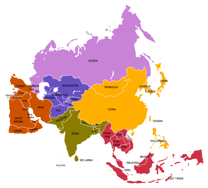
Geo Map — Asia

7 Continents Map

Continent Map
Map of Continents

Geo Map — United States of America Map

Geo Map - Canada

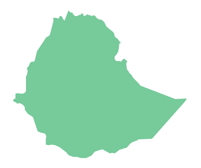
Geo Map - Africa - Ethiopia
Spatial infographics Design Elements: Location Map

Geo Map - South America - Brazil

- Continent Maps | Maps | Geo Map - World | The Seven Continents ...
- Continent Maps | Design elements - Continental map | Geo Map ...
- How to Draw a Geographical Map Quickly | Geo Map - World ...
- Continent Maps | Geo Map Software | Types of Map - Overview ...
- Geo Map - World | Geo Map Software | Types of Map - Overview ...
- Maps | Who in the world eats chocolate? | Design elements ...
- Continent Maps | Spatial infographics Design Elements: Location ...
- Geo Mapping Software Examples - World Map Outline | Geo Map ...
- Geo Map Software | Continent Maps | Geo Map - South America ...
- Geo Map - World | Geo Mapping Software Examples - World Map ...
- ConceptDraw Solution Park | Geo Map Software | Continent Maps ...
- Geo Map Software | Geo Mapping Software Examples - World Map ...
- Continent Maps | Design elements - Continental map | How to Draw ...
- Types of Map - Overview | Geo Map Software | Geo Map - Africa ...
- Continent Maps | Political map of Central America | Political map of ...
- How to Draw a Geographical Map Quickly | Continent Maps | Maps ...
- Continent Maps | How to Draw a Map of North America Using ...
- Geo Map - World
- Maps | Spatial infographics Design Elements: Location Map | Geo ...
- Continent Maps | Picture graph - Population growth by continent ...