 Maps
Maps
This solution extends ConceptDraw DIAGRAM.4 with the specific tools necessary to help you draw continental, directional, road, or transit maps, to represent international, business, or professional information visually.
 Maps Area
Solutions from the Maps Area of ConceptDraw Solution Park collect templates, samples and libraries of vector stencils for drawing geographical, directional and transport maps.
 Directional Maps
Directional Maps solution extends ConceptDraw DIAGRAM software with templates, samples and libraries of vector stencils for drawing the directional, location, site, transit, road and route maps, plans and schemes.
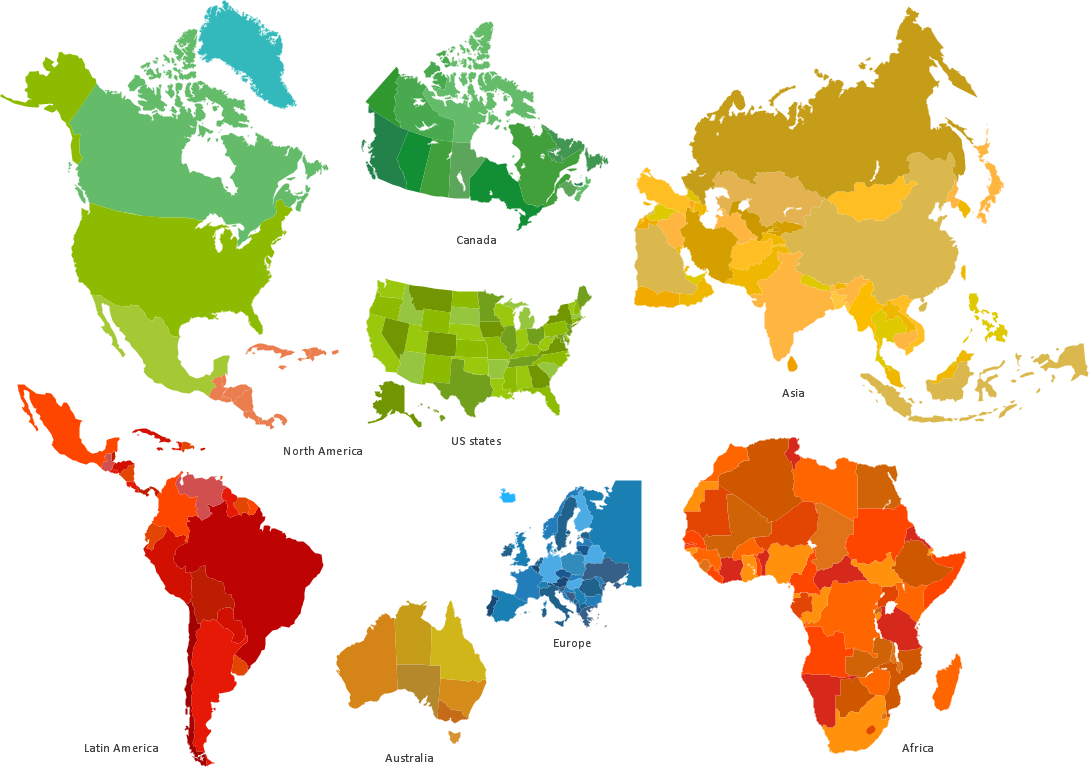
 Continent Maps
Continent Maps solution extends ConceptDraw DIAGRAM software with templates, samples and libraries of vector stencils for drawing the thematic maps of continents, state maps of USA and Australia.
Concept Maps
Enhancing maps using ConceptDraw MINDMAP ′s Theme Gallery
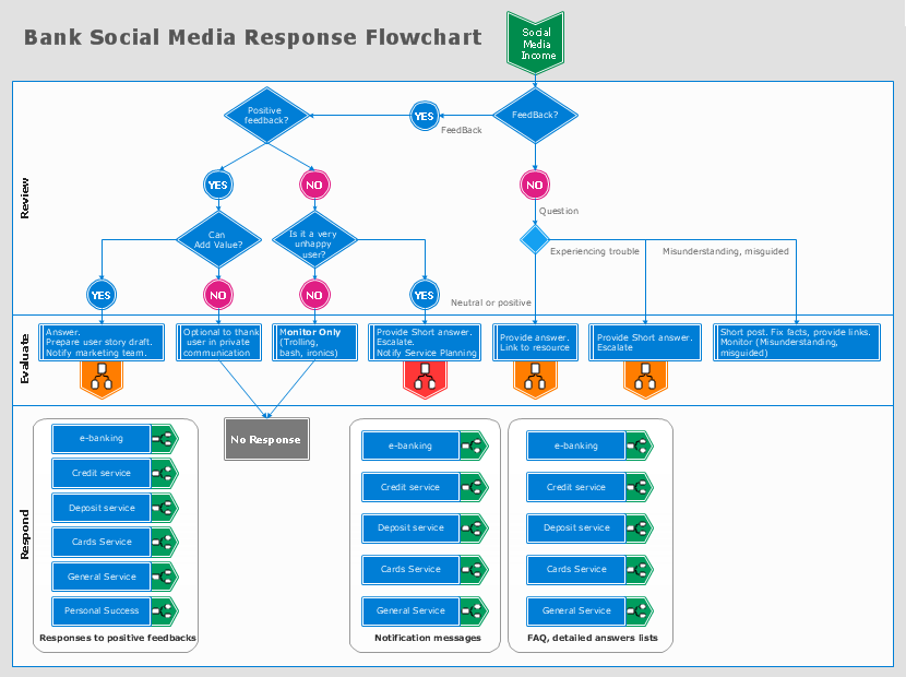
How to Connect Social Media DFD Flowchart with Action Maps
 Concept Maps
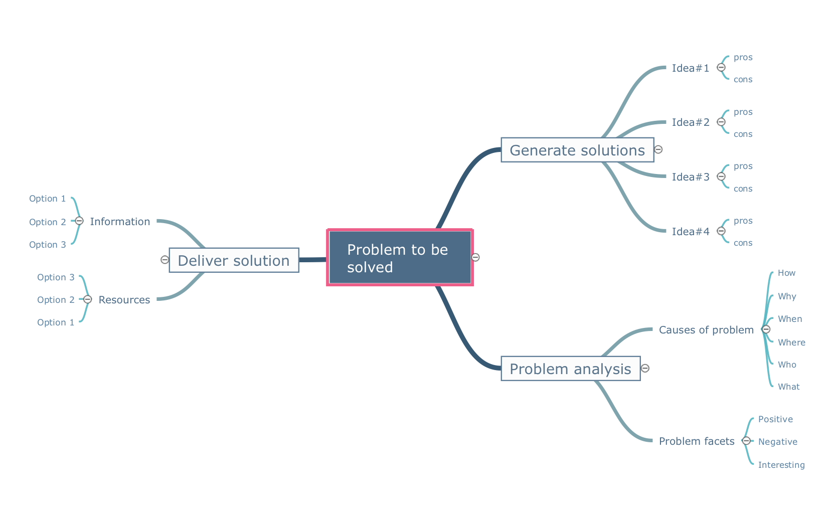
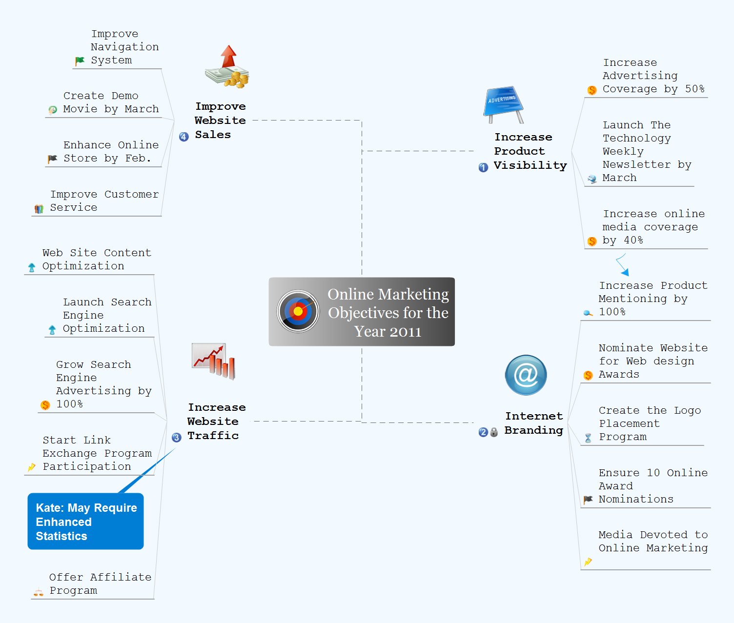
The technique of concept mapping was developed as a constructive way of representing knowledge in science and increasing the meaningfulness of learning. Now, the creation of a concept map is extremely helpful when used in education as learning and teaching techniques that assist memorization. Concept maps are also used for idea generation in brainstorming sessions, and for detailing the structure of complex ideas.
Quality Mind Maps
Excellent Examples of Infographic Maps
Infographics and Maps
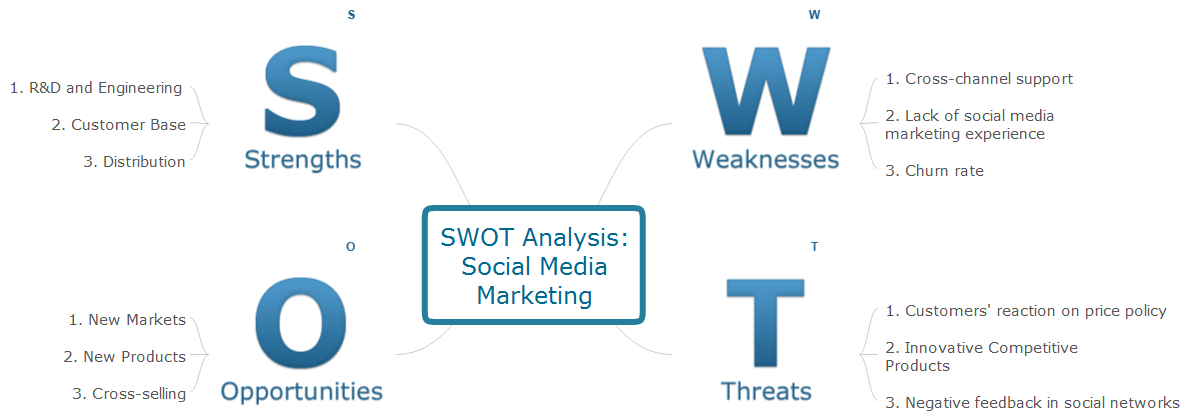
Mind Maps for Business - SWOT Analysis
How to Import Mind Maps from FreeMind

The vector stencils library "3D directional maps" contains 40 symbols for creating pictorial maps, street maps, locator maps, transit maps, tourist maps with points of interest (POI), road maps and route maps using the ConceptDraw PRO diagramming and vector drawing software.
"Pictorial maps are a category of maps that are also loosely called illustrated maps, panoramic maps, perspective maps, bird’s-eye view maps and Geopictorial maps amongst others. In contrast to the regular road map, Atlas or topographic cartography, pictorial maps depict a given territory with a more artistic rather than technical style. The cartography can be a sophisticated 3-D perspective landscape or a simple map graphic enlivened with illustrations of buildings, people and animals. They can feature all sorts of varied topics like historical events, legendary figures or local agricultural products and cover anything from an entire continent to a college campus. ...
Pictorial maps usually show an area as if viewed from above at an oblique angle. They are not generally drawn to scale in order to show street patterns, individual buildings, and major landscape features in perspective. While regular maps focus on the accurate rendition of distances, pictorial maps enhance landmarks and often incorporate a complex interplay of different scales into one image in order to give the viewer a more familiar sense of recognition." [Pictorial maps. Wikipedia]
The design elements library "3D directional maps" is included in the Directional Maps solution from the Maps area of ConceptDraw Solution Park.
3D pictorial map symbols

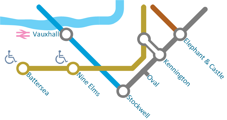
 Metro Map
Metro Map solution extends ConceptDraw DIAGRAM software with templates, samples and library of vector stencils for drawing the metro maps, route maps, bus and other transport schemes, or design tube-style infographics.
HelpDesk
How to Use Mind Map Exchange Solution
Quality Project Management with Mind Maps
HelpDesk
How to Manage a Multiple Project Participants Responsibilities With To-Do Mind Maps

Develop Scripts Exchanging Mind Maps with Evernote
- Maps | Enhancing maps using ConceptDraw MINDMAP′s Theme ...
- 3D directional maps
- Concept Maps | Basic Diagramming | The Best Mac Software for ...
- Value Stream Mapping | Maps | Metro Map |
- Quality Mind Maps | Mind Maps for Business - SWOT Analysis | How ...
- 3D Network Diagram Software | Maps | Design elements - 3D ...
- What is SWOT Analysis in Marketing | Concept maps with ...
- Maps | Spatial infographics Design Elements: Transport Map | Metro ...
- Visualization Spatial Data Using Thematic Maps Combined with ...
- Marketing Mind Maps | Mind Maps for Business - SWOT Analysis ...
- Continent Maps | Spatial infographics Design Elements: Location ...
- Concept maps with ConceptDraw PRO
- Concept maps with ConceptDraw PRO | Concept Maps | Concept ...
- Positioning map (Perceptual map) | Swot Analysis Examples for Mac ...
- Concept maps with ConceptDraw PRO | Concept Maps | Concept ...
- Concept Maps | Concept maps with ConceptDraw PRO | Simple ...
- Metro Map | Maps | How to draw Metro Map style infographics ...
- Directional Maps | 3D directional map example | Neighborhood 3D ...
- Basic Diagramming | 3D Network Diagram Software | Maps |
- Maps