"A thematic map is a type of map or chart especially designed to show a particular theme connected with a specific geographic area. ...
A thematic map is a map that focuses on a specific theme or subject area, whereas in a general map the variety of phenomena - geological, geographical, political - regularly appear together. ...
Thematic maps emphasize spatial variation of one or a small number of geographic distributions. These distributions may be physical phenomena such as climate or human characteristics such as population density and health issues. ...
Thematic map are sometimes referred to as graphic essays that portray spatial variations and interrelationships of geographical distributions. Location, of course, is important to provide a reference base of where selected phenomena are occurring. ...
Thematic maps serve three primary purposes.
First, they provide specific information about particular locations.
Second, they provide general information about spatial patterns.
Third, they can be used to compare patterns on two or more maps." [Thematic map. Wikipedia]
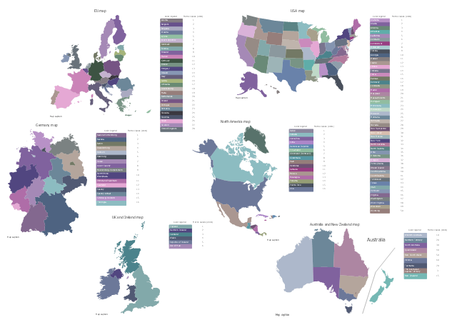
The vector stencils library "Thematic maps" contains 7 continent map contours for creating the thematic maps of geographic regions displaying the metric values by countries, states and territories marked by different colors.
Use the design elements library "Thematic maps" to create spatial dashboards using the ConceptDraw PRO diagramming and vector drawing software for your Spatial Intelligence and Location Intelligence business practice.
The example "Design elements - Thematic maps" is included in the Spatial Dashboard solution from the area "What is a Dashboard" of ConceptDraw Solution Park.
A thematic map is a map that focuses on a specific theme or subject area, whereas in a general map the variety of phenomena - geological, geographical, political - regularly appear together. ...
Thematic maps emphasize spatial variation of one or a small number of geographic distributions. These distributions may be physical phenomena such as climate or human characteristics such as population density and health issues. ...
Thematic map are sometimes referred to as graphic essays that portray spatial variations and interrelationships of geographical distributions. Location, of course, is important to provide a reference base of where selected phenomena are occurring. ...
Thematic maps serve three primary purposes.
First, they provide specific information about particular locations.
Second, they provide general information about spatial patterns.
Third, they can be used to compare patterns on two or more maps." [Thematic map. Wikipedia]
The vector stencils library "Thematic maps" contains 7 continent map contours for creating the thematic maps of geographic regions displaying the metric values by countries, states and territories marked by different colors.
Use the design elements library "Thematic maps" to create spatial dashboards using the ConceptDraw PRO diagramming and vector drawing software for your Spatial Intelligence and Location Intelligence business practice.
The example "Design elements - Thematic maps" is included in the Spatial Dashboard solution from the area "What is a Dashboard" of ConceptDraw Solution Park.
Thematic map templates

Visualization Spatial Data Using Thematic Maps Combined with Infographics

The vector stencils library "BI maps" contains 6 thematic map templates.
Use it to visualize geospatial data on your business intelligence dashboards in ConceptDraw PRO software.
"A thematic map is a map that focuses on a specific theme or subject area. ...
Thematic maps emphasize spatial variation of one or a small number of geographic distributions." [Thematic map. Wikipedia]
The thematic map templates example "Design elements - BI maps" is included in the Business Intelligence Dashboards solution from the Business Processes area of ConceptDraw Solution Park.
Thematic maps
Spatial infographics Design Elements: Continental Map

Geo Map - Africa

Map of UK

Geo Map - Europe

Map of UK — Wales Subdivisions and Towns

Map Infographic Creator

Map of UK — Channel Islands

United Kingdom Cities

Geo Map - Asia

Geo Map - Asia - India

Use the map contours library "Asia" to design thematic maps of Asian countries using the ConceptDraw PRO diagramming and vector drawing software.
"Asia ... is the world's largest and most populous continent, located primarily in the eastern and northern hemispheres. ...
The boundaries of Asia are culturally determined, as there is no clear geographical separation between it and Europe, which together form one continuous landmass called Eurasia. The most commonly accepted boundaries place Asia to the east of the Suez Canal, the Ural River, and the Ural Mountains, and south of the Caucasus Mountains (or the Kuma–Manych Depression) and the Caspian and Black Seas. It is bounded on the east by the Pacific Ocean, on the south by the Indian Ocean and on the north by the Arctic Ocean." [Asia. Wikipedia]
The vector stencils library "Asia" contains 57 map contours: Asia state map contours, Asia political map, sea contours, lake contours.
The map contours example "Design elements - Asia" is included in the Continent Maps solution from the Maps area of ConceptDraw Solution Park.
Asia map contours

Australia Map

- Design elements - Thematic maps | Design elements - Continental ...
- Design elements - Thematic maps | Asia Map Practice
- Design elements - Thematic maps | Geo Map - Asia - Singapore ...
- Design elements - Thematic maps | Visualization Spatial Data Using ...
- North America Thematic Map
- Australia states time zones - Thematic map | Design elements ...
- Design elements - Thematic maps | Spatial Dashboard | Spatial ...
- Visualization Spatial Data Using Thematic Maps Combined with ...
- Map Design Elements Vector
- Spatial infographics Design Elements : Location Map | Visualization ...
- Spatial Dashboard | Spatial Infographics | Design elements ...
- Languages of South America - Thematic map | Design elements ...
- Geo Map - South America Continent | Design elements - Thematic ...
- Design elements - Asia | Depression Thematic Map
- Americas Map Design
- Subway infographic design elements - software tools | Spatial ...
- Geo Map - Europe | Design elements - Asia | Design elements ...
- Examples Of Projects Of Designing Thematic Maps
- Design elements - USA | Thematic Map Of West Virginia
- How to Support Your Mind Map with Visual Elements | Subway ...