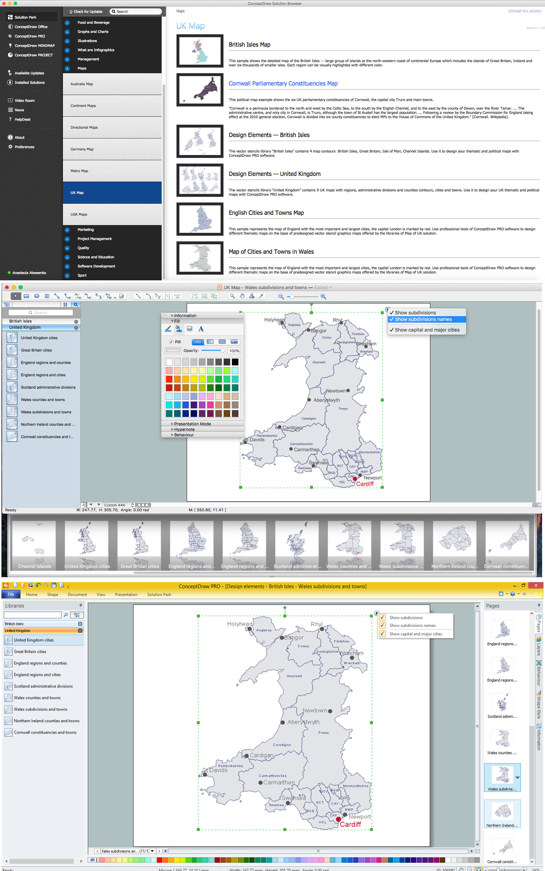
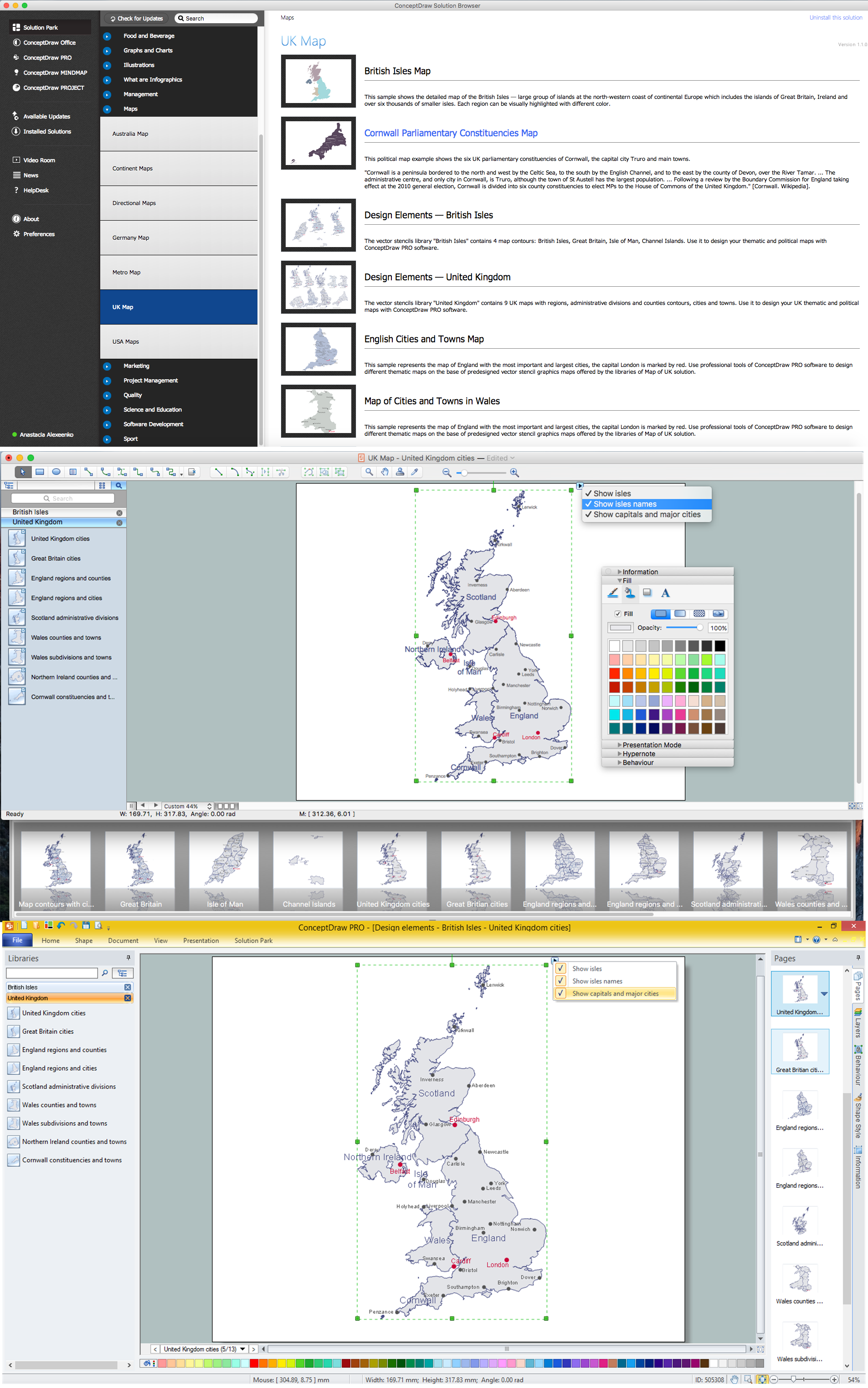
Map of UK — Channel Islands
“TheChannel Islands are an archipelago in the English Channel, off the French coast of Normandy. They include two Crown dependencies, both of which are bailiwicks: the Bailiwick of Jersey and the Bailiwick of Guernsey. They are considered the remnants of the Duchy of Normandy, and although they are not part of the United Kingdom, it is responsible for the defence and international relations of the islands. They have a total population of about 168,000 and their respective capitals, Saint Helier and Saint Peter Port, have populations of 33,500 and 16,488, respectively. The total area of the islands is 198 km2.”
The Channel Islands
- Alderney
- Brecqhou
- Burhou
- Guernsey
- Herm
- Jersey
- Jethou
- L'Etac
- Sark
How to design the Map of UK fast and easy? It is incredibly convenient to use special software. ConceptDraw DIAGRAM diagramming and vector drawing software offers the Map of UK Solution from the Maps Area of ConceptDraw Solution Park specially developed to make easier drawing the maps of UK counties, various UK related thematic maps and cartograms on their base.
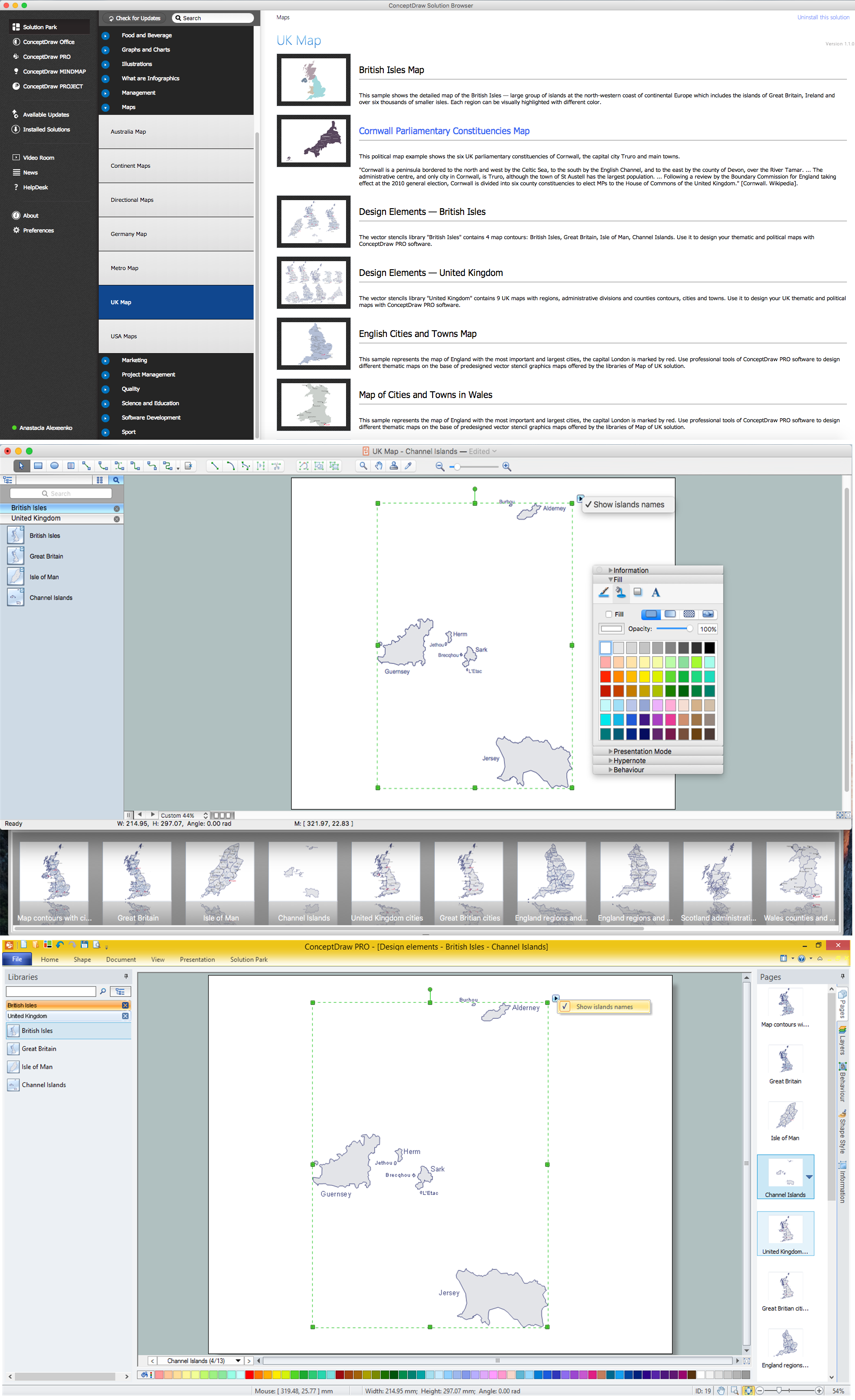
Example 1. UK Map Solution — Channel Islands
Map of UK Solution provides wide collection of predesigned maps of UK countries, islands and counties, and 2 libraries with 12 ready-to-use vector maps objects which lie at the base of included samples.

Example 2. British Isles Library Design Elements

Example 3. United Kingdom Library Design Elements
Thanks to all these tools, now design of UK Map and thematic maps for the countries included to UK is very simple process. All that you need is follow the next steps:
- create new ConceptDraw document,
- drag the needed objects from the libraries of Map of UK Solution,
- make changes in color style and apply the commands from the object's action menu to make your map colorful and successful.

Example 4. Map of UK — British Isles Counties
The maps, geospatial infographics and especially thematic maps which are the popular visual way of studying different points of interest and geographical data, all they are incredibly useful in various scientific fields. Design them easy in ConceptDraw DIAGRAM
Use the Map of UK solution for ConceptDraw DIAGRAM software to design your own Map of UK quick, easy and effective, and then successfully use it in your life or work activity.
All source documents are vector graphic documents. They are available for reviewing, modifying, or converting to a variety of formats (PDF file, MS PowerPoint, MS Visio, and many other graphic formats) from the ConceptDraw STORE. The Map of UK Solution is available for all ConceptDraw DIAGRAM users.