"A thematic map is a type of map or chart especially designed to show a particular theme connected with a specific geographic area. ...
A thematic map is a map that focuses on a specific theme or subject area, whereas in a general map the variety of phenomena - geological, geographical, political - regularly appear together. ...
Thematic maps emphasize spatial variation of one or a small number of geographic distributions. These distributions may be physical phenomena such as climate or human characteristics such as population density and health issues. ...
Thematic map are sometimes referred to as graphic essays that portray spatial variations and interrelationships of geographical distributions. Location, of course, is important to provide a reference base of where selected phenomena are occurring. ...
Thematic maps serve three primary purposes.
First, they provide specific information about particular locations.
Second, they provide general information about spatial patterns.
Third, they can be used to compare patterns on two or more maps." [Thematic map. Wikipedia]
The vector stencils library "Thematic maps" contains 7 continent map contours for creating the thematic maps of geographic regions displaying the metric values by countries, states and territories marked by different colors.
Use the design elements library "Thematic maps" to create spatial dashboards using the ConceptDraw PRO diagramming and vector drawing software for your Spatial Intelligence and Location Intelligence business practice.
The example "Design elements - Thematic maps" is included in the Spatial Dashboard solution from the area "What is a Dashboard" of ConceptDraw Solution Park.
Thematic map templates

Visualization Spatial Data Using Thematic Maps Combined with Infographics

"A thematic map is a map that focuses on a specific theme or subject area, whereas in a general map the variety of phenomena - geological, geographical, political - regularly appear together. The contrast between them lies in the fact that thematic maps use the base data, such as coastlines, boundaries and places, only as points of reference for the phenomenon being mapped. General maps portray the base data, such as landforms, lines of transportation, settlements, and political boundaries, for their own sake." [Thematic map. Wikipedia]
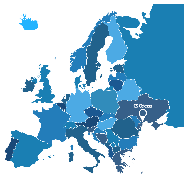
The template "Europe thematic map" for the ConceptDraw PRO diagramming and vector drawing software is included in the Spatial Infographics solution from the area "What is Infographics" of ConceptDraw Solution Park.
The template "Europe thematic map" for the ConceptDraw PRO diagramming and vector drawing software is included in the Spatial Infographics solution from the area "What is Infographics" of ConceptDraw Solution Park.
Europe contour map
A color-coded map showing US state-by-state status of Benefit Corporation legislation.
"A thematic map is a type of map or chart especially designed to show a particular theme connected with a specific geographic area. These maps "can portray physical, social, political, cultural, economic, sociological, agricultural, or any other aspects of a city, state, region, nation, or continent"." [Thematic map. Wikipedia]
This U.S.A. thematic map was redesigned from Wikipedia file: Benefit Corporation Map 2012 05 16.svg. [commons.wikimedia.org/ wiki/ File:Benefit_ Corporation_ Map_ 2012_ 05_ 16.svg]
This file is licensed under the Creative Commons Attribution-Share Alike 3.0 Unported license.
[creativecommons.org/ licenses/ by-sa/ 3.0/ deed.en]
This U.S. thematic map example was created using the ConceptDraw PRO diagramming and vector drawing software extended with the Continent Maps solution from the Maps area of ConceptDraw Solution Park.
Thematic map of U.S.

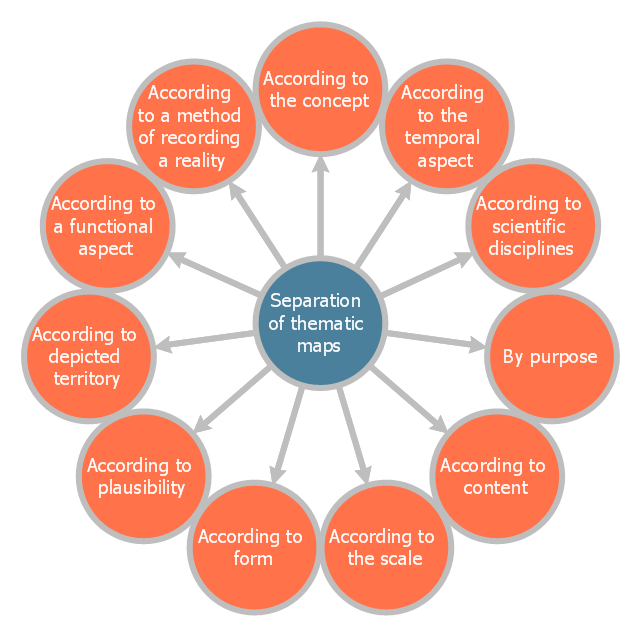
This circle-spoke diagram sample shows the basic division of thematic maps. It was designed on the base of the Wikimedia Commons file: Dělení tematických map.png.
[commons.wikimedia.org/ wiki/ File:D%C4%9Blen%C3%AD_ tematick%C3%BDch_ map.png]
This file is licensed under the Creative Commons Attribution-Share Alike 4.0 International license. [creativecommons.org/ licenses/ by-sa/ 4.0/ deed.en]
"A thematic map is a map that focuses on a specific theme or subject area. This is in contrast to general reference maps, which regularly show the variety of phenomena — geological, geographical, political — together. The contrast between them lies in the fact that thematic maps use the base data, such as coastlines, boundaries and places, only as points of reference for the phenomenon being mapped. General maps portray the base data, such as landforms, lines of transportation, settlements, and political boundaries, for their own sake.
Thematic maps emphasize spatial variation of one or a small number of geographic distributions. These distributions may be physical phenomena such as climate or human characteristics such as population density and health issues." [Thematic map. Wikipedia]
The hub-and-spoke diagram example "Division of thematic maps" was created using the ConceptDraw PRO diagramming and vector drawing software extended with the Circle-Spoke Diagrams solution from the area "What is a Diagram" of ConceptDraw Solution Park.
Circle-spoke diagram
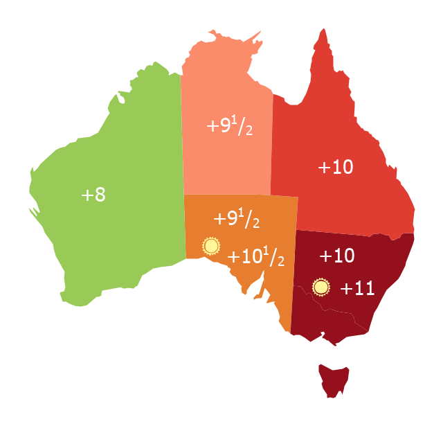
Map of Australia depicting time zones offsets from UTC by state (including daylight saving).
"Time in Australia uses more than three time zones, including Australian Western Standard Time (AWST; UTC+08:00), Australian Central Standard Time (ACST; UTC+09:30), and Australian Eastern Standard Time (AEST; UTC+10:00). Time is regulated by the individual state governments, some of which observe daylight saving time (DST). Australia's external territories observe different time zones." [Time in Australia. Wikipedia]
This thematic map was redesigned from Wikipedia file: Australia states timezones.png. [commons.wikimedia.org/ wiki/ File:Australia-states-timezones.png]
This file is licensed under the Creative Commons Attribution-Share Alike 3.0 Unported license.
[creativecommons.org/ licenses/ by-sa/ 3.0/ deed.en]
The thematic map example "Australia states time zones" was created using the ConceptDraw PRO diagramming and vector drawing software extended with the Continent Maps solution from the Maps area of ConceptDraw Solution Park.
Thematic map - Australia states time zones
"Spanish and Portuguese are the most spoken languages in South America, with approximately 200 million speakers each. Spanish is the official language of most countries, along with other native languages in some countries. Portuguese is the official language of Brazil. Dutch is the official language of Suriname; English is the official language of Guyana, although there are at least twelve other languages spoken in the country, including Hindi and Arabic. English is also spoken in the Falkland Islands. French is the official language of French Guiana and the second language in Amapá, Brazil.
Indigenous languages of South America include Quechua in Ecuador, Peru, Chile, Argentina, Colombia, and Bolivia; Wayuunaiki in northern Colombia (La Guajira); Guaraní in Paraguay and, to a much lesser extent, in Bolivia; Aymara in Bolivia, Peru, and less often in Chile; and Mapudungun is spoken in certain pockets of southern Chile and, more rarely, Argentina. At least three South American indigenous languages (Quechua, Aymara, and Guarani) are recognized along with Spanish as national languages." [South America. Wikipedia]
The Languages of South America map example was redesigned from Wikimedia Commons file: Languages of South America (en).svg.
[commons.wikimedia.org/ wiki/ File:Languages_ of_ South_ America_ (en).svg]
This file is licensed under the Creative Commons Attribution-Share Alike 3.0 Unported license. [creativecommons.org/ licenses/ by-sa/ 3.0/ deed.en]
The Languages of South America map example was drawn using ConceptDraw PRO diagramming and vector drawing software extended with design elements library South America.
The Languages of South America map example is included in the Continent Maps solution from the Maps area of ConceptDraw Solution Park.
Thematic map - South America

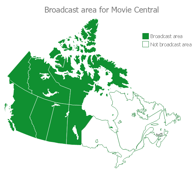
This example of Canada thematic map shows Broadcast area (in green) for Movie Central.
"Movie Central is a Canadian English language Category A premium cable and satellite television channel that is owned by Corus Entertainment. Movie Central is designated to operate west of the Ontario-Manitoba border, including the territories." [Movie Central. Wikipedia]
This thematic map was redesigned from the Wikimedia Commons file: Movie Central Broadcast Area.svg. [commons.wikimedia.org/ wiki/ File:Movie_ Central_ Broadcast_ Area.svg]
The thematic map example "Broadcast Area for Movie Central" was created using ConceptDraw PRO diagramming and vector drawing software extended with Continent Maps solution from Maps area of ConceptDraw Solution Park.
Canada thematic map
The vector stencils library "Thematic maps" contains 7 continent map contours.
Use it for drawing thematic maps of geographic regions displaying the metric values by countries, states and territories marked by different colors in the ConceptDraw PRO diagramming and vector drawing software extended with the Spatial Dashboard solution from the area "What is a Dashboard" of ConceptDraw Solution Park.
Use it for drawing thematic maps of geographic regions displaying the metric values by countries, states and territories marked by different colors in the ConceptDraw PRO diagramming and vector drawing software extended with the Spatial Dashboard solution from the area "What is a Dashboard" of ConceptDraw Solution Park.
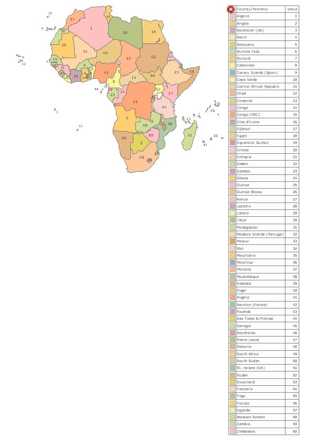
Africa
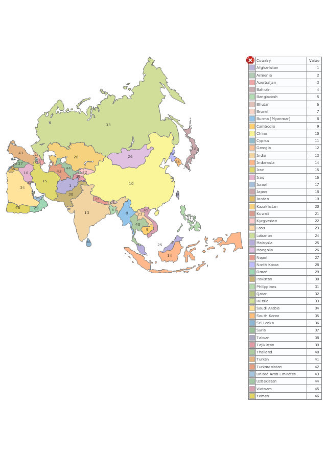
Asia
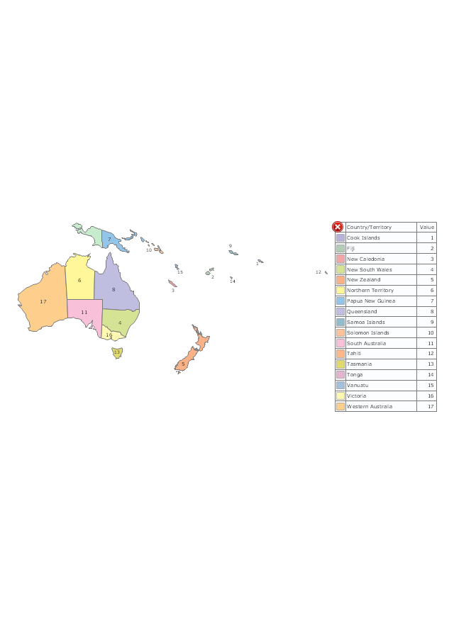
Australia and Oceania
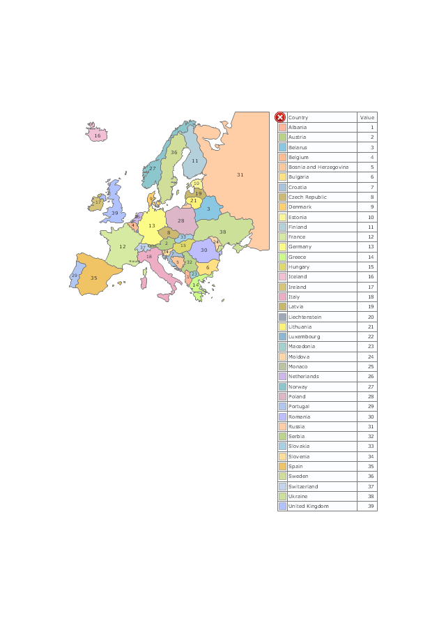
Europe
Latin America
North America
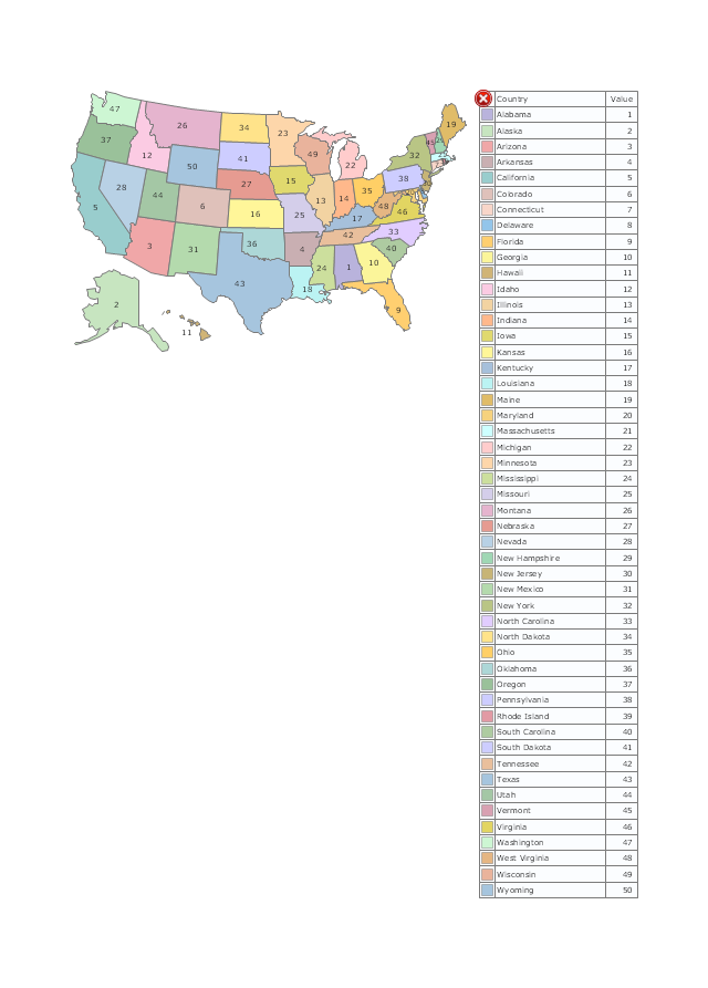
USA
Map of UK — Northern Ireland

Geo Map - Europe - Romania

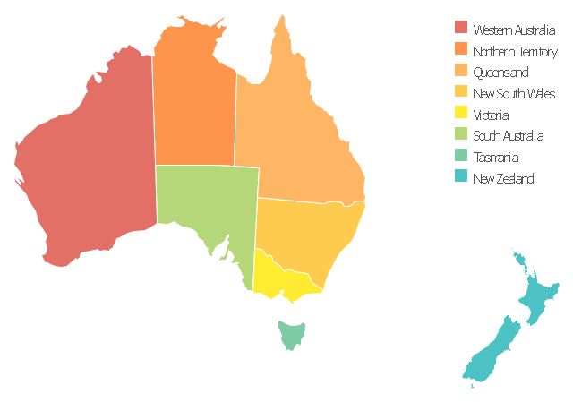
Use this template to design your Australia political map, cartogram or thematic map, to visualize your spatial business information connected with geographic areas, locations or ways.
This Australia map template for the ConceptDraw PRO diagramming and vector drawing software is included in the Continent Maps solution from the Maps area of ConceptDraw Solution Park.
This Australia map template for the ConceptDraw PRO diagramming and vector drawing software is included in the Continent Maps solution from the Maps area of ConceptDraw Solution Park.
Australia thematic map template
USA Map

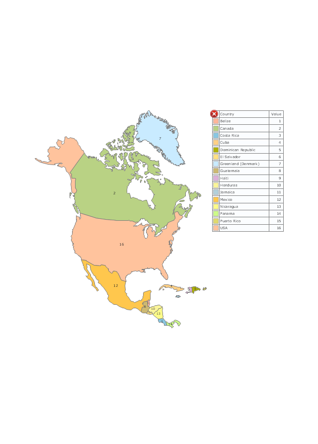
Use this template to design your North America political map, cartogram or thematic map, to visualize your spatial business information connected with geographic areas, locations or ways.
This North America map template for the ConceptDraw PRO diagramming and vector drawing software is included in the Continent Maps solution from the Maps area of ConceptDraw Solution Park.
This North America map template for the ConceptDraw PRO diagramming and vector drawing software is included in the Continent Maps solution from the Maps area of ConceptDraw Solution Park.
North America thematic map template

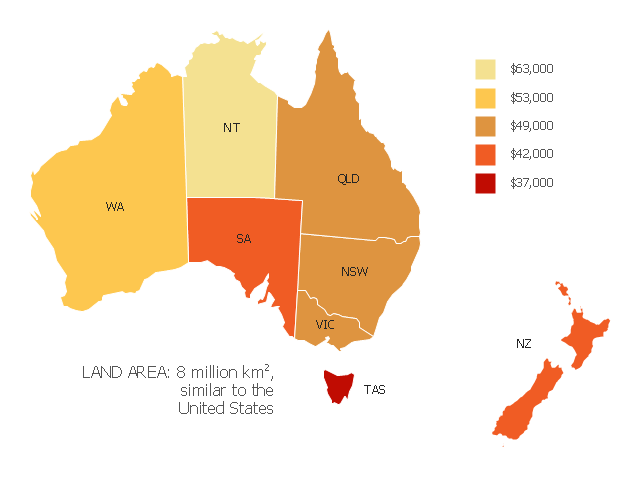
"Household income is a measure of the combined incomes of all people sharing a particular household or place of residence. It includes every form of income, e.g., salaries and wages, retirement income, near cash government transfers like food stamps, and investment gains.
Average household income can be used as an indicator for the monetary well-being of a country's citizens. Mean or median net household income, after taxes and mandatory contributions, are good indicators of standard of living, because they include only disposable income and acknowledge people sharing accommodation benefit from pooling at least some of their living costs.
Average household incomes need not map directly to measures of an individual's earnings such as per capita income as numbers of people sharing households and numbers of income earners per household can vary significantly between regions and over time." [Household income. Wikipedia]
This map example shows 2007 median household incomes in the states and mainland territories of the Commonwealth of Australia.
The thematic map example "Map of median household income in Australia" was redesigned from the Wikimedia Commons file: Map of median household income in Australia.PNG.
[commons.wikimedia.org/ wiki/ File:Map_ of_ median_ household_ income_ in_ Australia.PNG]
The example "Map of median household income in Australia" was created using the ConceptDraw PRO diagramming and vector drawing software extended with the Continent Map solution from the Maps area of ConceptDraw Solution Park.
Thematic map - Australia
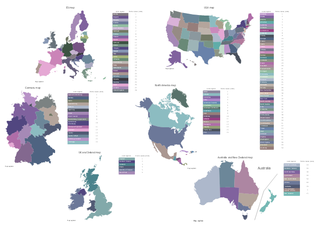
The vector stencils library "BI maps" contains 6 thematic map templates.
Use it to visualize geospatial data on your business intelligence dashboards in ConceptDraw PRO software.
"A thematic map is a map that focuses on a specific theme or subject area. ...
Thematic maps emphasize spatial variation of one or a small number of geographic distributions." [Thematic map. Wikipedia]
The thematic map templates example "Design elements - BI maps" is included in the Business Intelligence Dashboards solution from the Business Processes area of ConceptDraw Solution Park.
Thematic maps
 UK Map
The Map of UK solution contains collection of professionally designed samples and scalable vector stencil graphics maps, representing the United Kingdom counties, regions and cities. Use the Map of UK solution from ConceptDraw Solution Park as the base fo
World Continents Map

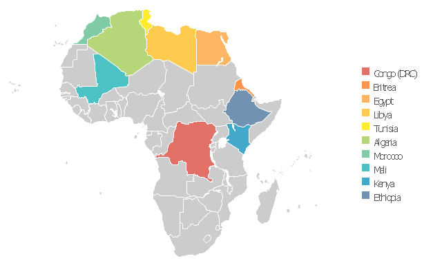
Use this template to design your Africa political map, cartogram or thematic map, to visualize your spatial business information connected with geographic areas, locations or ways.
This Africa map template for the ConceptDraw PRO diagramming and vector drawing software is included in the Continent Maps solution from the Maps area of ConceptDraw Solution Park.
This Africa map template for the ConceptDraw PRO diagramming and vector drawing software is included in the Continent Maps solution from the Maps area of ConceptDraw Solution Park.
Africa thematic map template
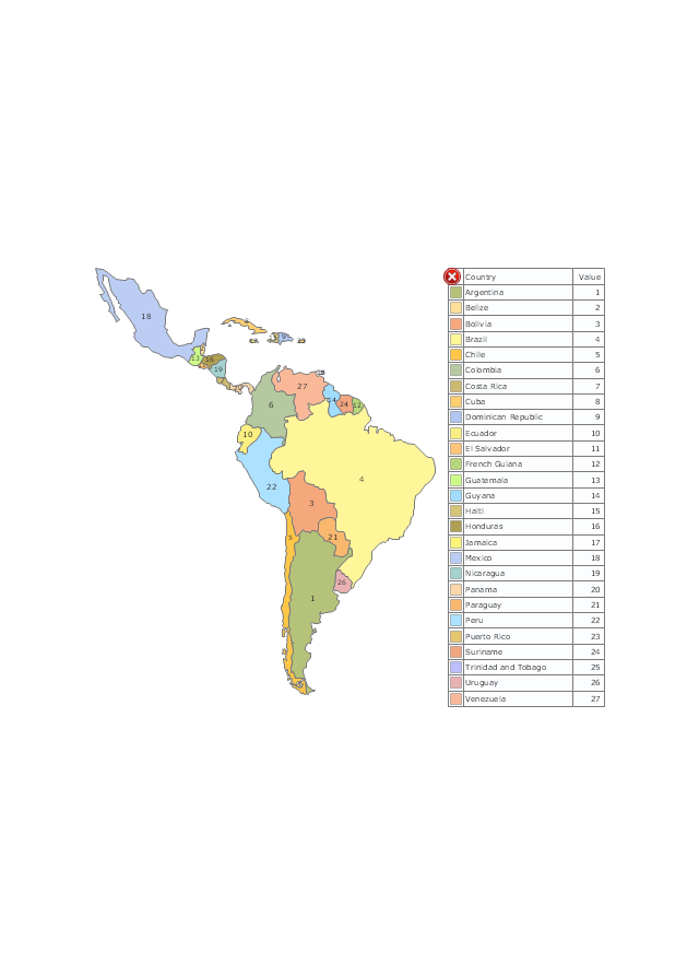
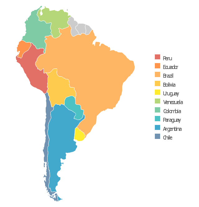
Use this template to design your South America political map, cartogram or thematic map, to visualize your spatial business information connected with geographic areas, locations or ways.
This South America map template for the ConceptDraw PRO diagramming and vector drawing software is included in the Continent Maps solution from the Maps area of ConceptDraw Solution Park.
This South America map template for the ConceptDraw PRO diagramming and vector drawing software is included in the Continent Maps solution from the Maps area of ConceptDraw Solution Park.
South America thematic map template
- Languages of South America - Thematic map | Geo Map - South ...
- Languages of South America - Thematic map
- Broadcast Area for Movie Central - Thematic map
- Benefit Corporation legislation - Thematic map
- Australia states time zones - Thematic map
- North America Thematic Map
- Europe thematic map - Template
- Visualization Spatial Data Using Thematic Maps Combined with ...
- Thematic maps - Vector stencils library
- Languages of South America - Thematic map | Geo Map - South ...
- Design elements - USA | Thematic Map Of West Virginia
- Design elements - Thematic maps | Name Three Primary Purposes ...
- Broadcast Area for Movie Central - Thematic map | Geo Map ...
- Design elements - Thematic maps | Design elements - Continental ...
- Benefit Corporation legislation - Thematic map | Continent Maps ...
- Australia states time zones - Thematic map | Design elements ...
- Australia map - Template
- Benefit Corporation legislation - Thematic map | USA Map | USA ...
- Languages of South America - Thematic map | North America map ...