How to draw Metro Map style infographics? Moscow, New York, Los Angeles, London

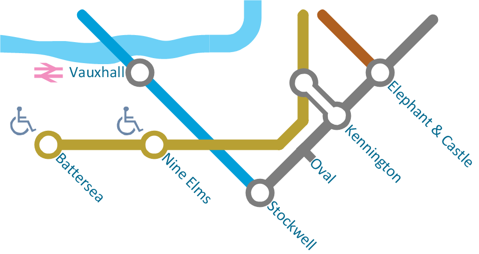
How to draw Metro Map style infographics? (London)
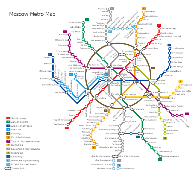
"The Moscow Metro is a rapid transit system serving Moscow, Russia and the neighbouring Moscow Oblast towns of Krasnogorsk and Reutov. Opened in 1935 with one 11-kilometre (6.8 mi) line and 13 stations, it was the first underground railway system in the Soviet Union. As of 2013, the Moscow Metro has 190 stations and its route length is 317.5 km (197.3 mi). The system is mostly underground, with the deepest section 74 metres (243 ft) at the Park Pobedy station. The Moscow Metro was the world's second most heavily used rapid transit system in 2012 after Seoul Metropolitan Subway." [Moscow Metro. Wikipedia]
The transit map example "Moscow metro map" was created using the ConceptDraw PRO diagramming and vector drawing software extended with the Metro Map solution from the Maps area of ConceptDraw Solution Park.
The transit map example "Moscow metro map" was created using the ConceptDraw PRO diagramming and vector drawing software extended with the Metro Map solution from the Maps area of ConceptDraw Solution Park.
 Metro Map
Metro Map solution extends ConceptDraw DIAGRAM software with templates, samples and library of vector stencils for drawing the metro maps, route maps, bus and other transport schemes, or design tube-style infographics.
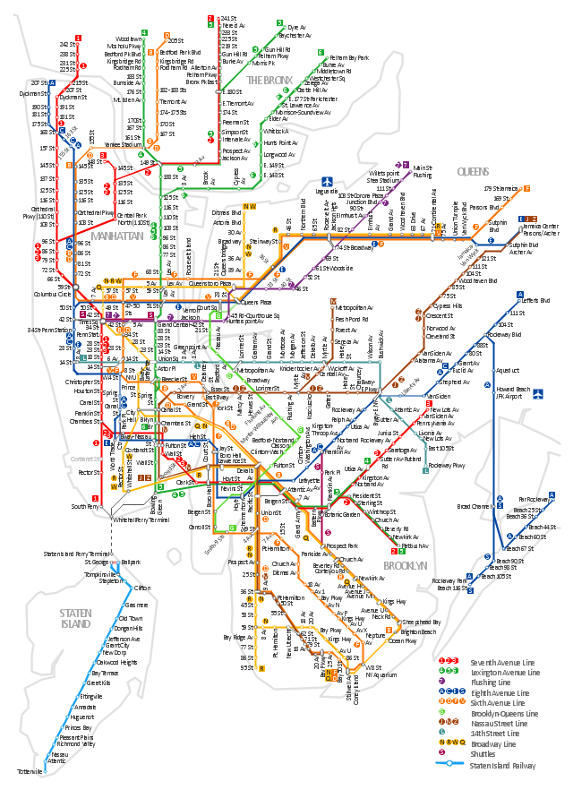
"The New York City Subway is a rapid transit system owned by the City of New York and leased to the New York City Transit Authority, a subsidiary agency of the Metropolitan Transportation Authority. It is the most extensive public transportation system in the world by number of stations, with 468 stations in operation (421, if stations connected by transfers are counted as single stations). The New York City Subway is also one of the world's oldest public transit systems. Overall, the system contains 209 mi (337 km) of routes, translating into 656 miles (1,056 km) of revenue track; and a total of 842 miles (1,355 km) including non-revenue trackage." [New York City Subway. Wikipedia]
The transit map example "New York City Subway map" was created using the ConceptDraw PRO diagramming and vector drawing software extended with the Metro Map solution from the Maps area of ConceptDraw Solution Park.
The transit map example "New York City Subway map" was created using the ConceptDraw PRO diagramming and vector drawing software extended with the Metro Map solution from the Maps area of ConceptDraw Solution Park.
New York City Subway
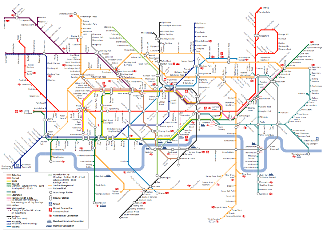
"The Tube map is a schematic transit map of the lines and stations of London's public rapid transit railway systems, namely the London Underground (commonly known as the Tube, hence the name), Docklands Light Railway, London Overground and Emirates Air Line, as well as being incorporated into Greater London connections maps.
As a schematic diagram, it shows not necessarily the geographic but rather the relative positions of stations along the lines, stations' connective relations with each other and fare zones. The basic design concepts have been widely adopted for other network maps around the world, especially that of mapping topologically rather than geographically." [Tube map. Wikipedia]
The transit map example "London tube map" was created using the ConceptDraw PRO diagramming and vector drawing software extended with the Metro Map solution from the Maps area of ConceptDraw Solution Park.
www.conceptdraw.com/ solution-park/ maps-metro-map
Explore the oldest underground in the world. Started in 1863, the London Tube today opens a new station inside ConceptDraw.
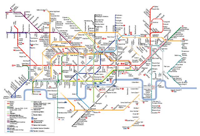
London tube map
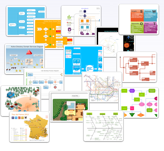
Excellent Examples of Infographic Maps
Spatial Infographics

 Mind Map Exchange
This solution extends ConceptDraw MINDMAP software with the ability to easily exchange mind maps with a large variety of other mind mapping applications.
Examples of Flowcharts, Org Charts and More
 Safety and Security
Safety and security solution extends ConceptDraw DIAGRAM software with illustration samples, templates and vector stencils libraries with clip art of fire safety, access and security equipment.
 Artwork
Artwork solution extends ConceptDraw DIAGRAM software with illustration samples, templates and libraries of vector clipart of architecture, food, music, funny animals, aquatic fauna and transport.
 eLearning for Skype
This solution extends ConceptDraw MINDMAP software with the ability to prepare and run remote learning sessions by using Skype
 Universal Diagramming Area
This area collects solutions for drawing diagrams, charts, graphs, matrices, geographic and road maps for education, science, engineering, business.
- Infographic design elements, software tools Subway and Metro style ...
- How to draw Metro Map style infographics? (New York) | Infographic ...
- How to draw Metro Map style infographics? (New York) | Metro Map ...
- Metro Map | How to draw Metro Map style infographics? Moscow ...
- How to draw Metro Map style infographics? Moscow, New York, Los
- How to draw Metro Map style infographics? (London) | Metro Map ...
- How to draw Metro Map style infographics? Moscow, New York, Los ...
- How to draw Metro Map style infographics? (New York) | How to ...
- How to draw Metro Map style infographics? (London) | How to draw ...
- How to draw Metro Map style infographics? Moscow, New York, Los ...
- How to draw Metro Map style infographics? Moscow, New York, Los ...
- How to draw Metro Map style infographics? (London) | London tube ...
- How to draw Metro Map style infographics? Moscow, New York, Los ...
- Value Stream Mapping | Metro Map | Mind Map Exchange |
- Value Stream Mapping | Fire Exit Plan | How to draw Metro Map ...
- Concept maps with ConceptDraw PRO | How to draw Metro Map ...
- Metro Map | Value Stream Mapping Symbols | Exercise your brain |
- Value Stream Mapping | How to draw Metro Map style infographics ...
- Metro Map | Maps | How to draw Metro Map style infographics ...
- How to draw Metro Map style infographics? (New York)