This flowchart example was created on the base of land sales process diagram from the Property management webpage of the VicRoads website.
[www.vicroads.vic.gov.au/ planning-and-projects/ property-services/ property-management]
"VicRoads or the Roads Corporation of Victoria is a statutory corporation which is the state road and traffic authority in the state of Victoria, Australia. It is responsible for maintenance and construction of the state arterial road network, as well as driver licensing and vehicle registration. VicRoads has broad responsibility for road safety policy and research. It is also responsible for regulating the accident towing industry in Victoria." [VicRoads. Wikipedia]
"Sales Process.
Once it has been established with the relevant VicRoads Regions/ Projects and other business areas that properties are identified as surplus to VicRoads’ operational needs, they are incorporated in the VicRoads annual sales program.
Following approval: relevant VicRoads Regional Manager and the VicRoads Chief Executive (and in some circumstances Minster for Public Transport and Roads) must approve all land deemed surplus and available for disposal.
The method of sale is then determined and consultant advice is sought:
(1) Planning.
(2) Valuer General Victoria (Valuer General’s office must provide a valuation for all sales).
(3) Government Land Monitor (Land Monitor approval is sought if the value exceeds $750,000).
(4) Environmental.
(5) Local Council." [www.vicroads.vic.gov.au/ planning-and-projects/ property-services/ property-management]
The example "Land sales process flowchart" was created using the ConceptDraw PRO diagramming and vector drawing software extended with the Sales Flowcharts solution from the Marketing area of ConceptDraw Solution Park.
Sales process chart

Local area network (LAN). Computer and Network Examples
 diagram")

Landscape Plan

Network Diagram Software. LAN Network Diagrams. Physical Office Network Diagrams

Geo Map - Asia - Japan

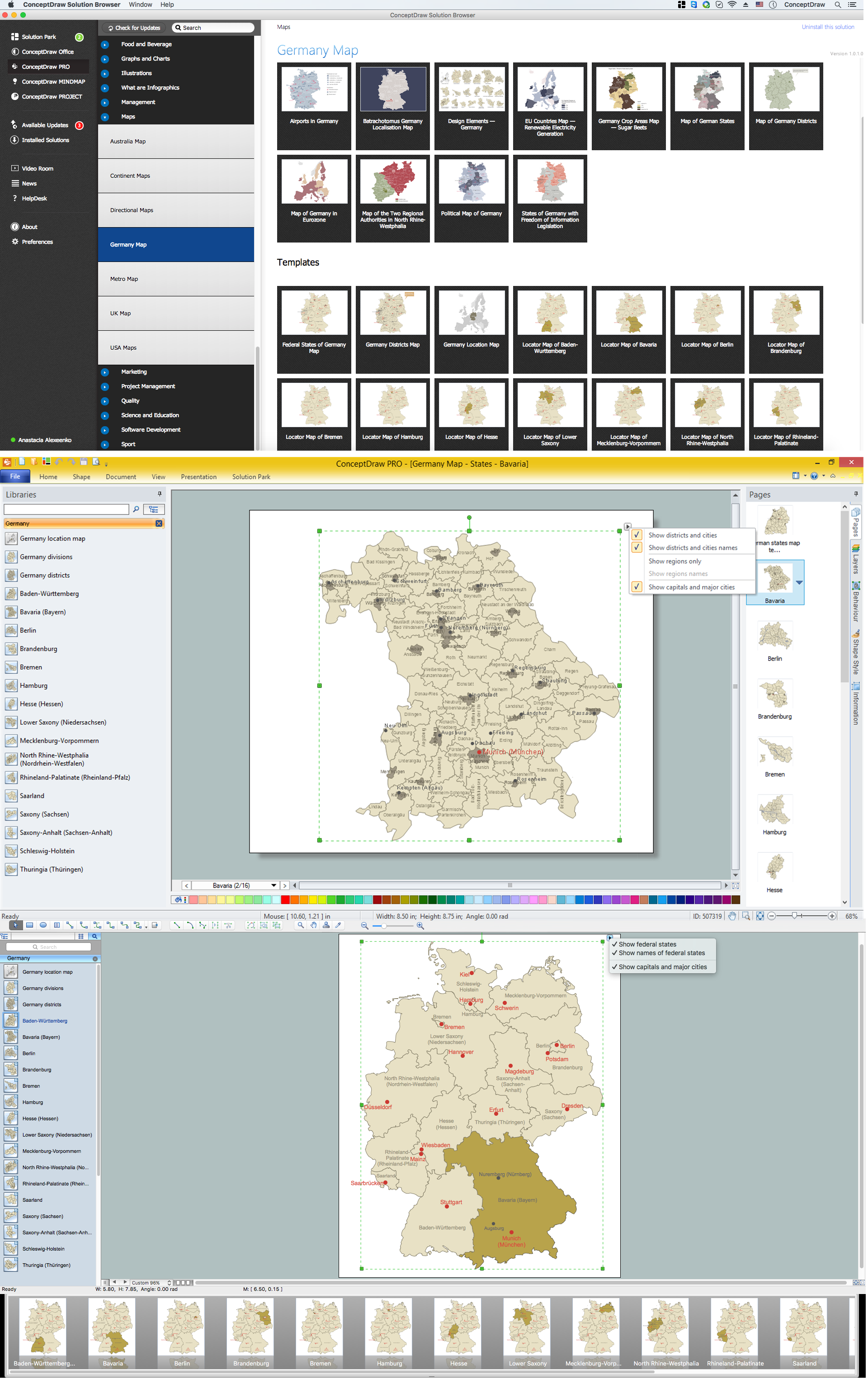
Map of Germany — Bavaria State
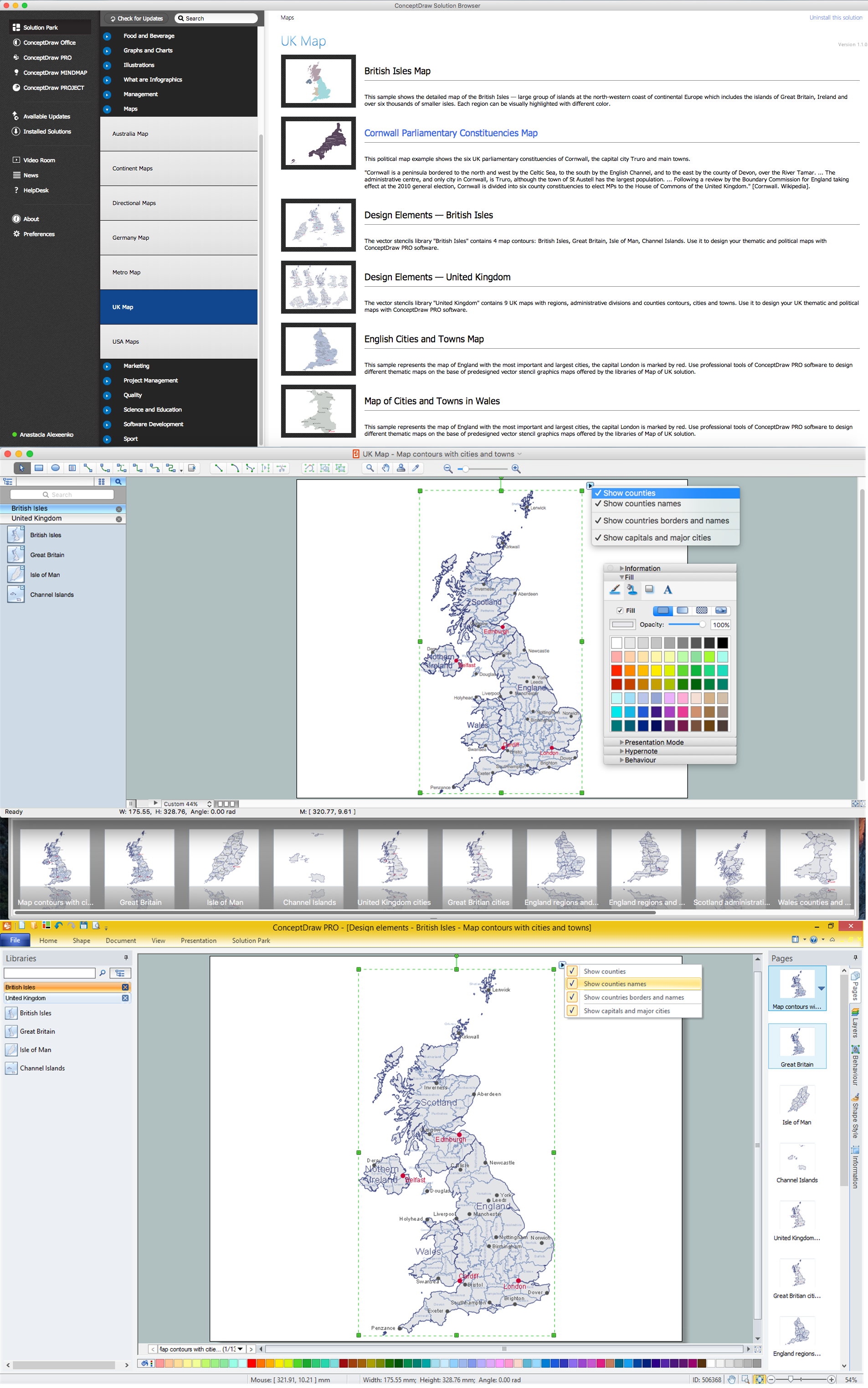
Contours Map of UK
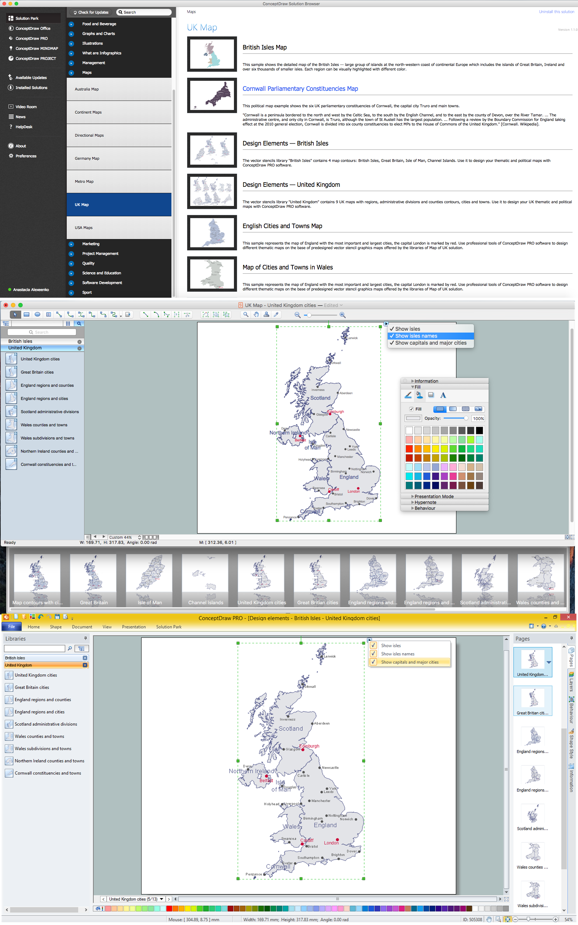
Map of UK

Geo Map - South America - Jamaica

Geo Map - Europe - United Kingdom

Geo Map - Africa - Niger

United Kingdom Cities
Geo Map - Africa - Namibia

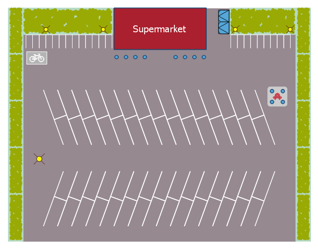
This landscape design sample depicts the supermarket parking site plan.
"Site planning in landscape architecture and architecture refers to the organizational stage of the landscape design process. It involves the organization of land use zoning, access, circulation, privacy, security, shelter, land drainage, and other factors. This is done by arranging the compositional elements of landform, planting, water, buildings and paving in site plans.
Site planning generally begins by assessing a potential site for development through site analysis. Information about slope, soils, hydrology, vegetation, parcel ownership, orientation, etc. are assessed and mapped. By determining areas that are poor for development (such as floodplain or steep slopes) and better for development, the planner or architect can assess optimal location and design a structure that works within this space." [Site planning. Wikipedia]
The site plan example "Supermarket parking" was created using the ConceptDraw PRO diagramming and vector drawing software extended with the Site Plans solution from the Building Plans area of ConceptDraw Solution Park.
Site plan
Geo Map - Europe - Russia

- Land sales process flowchart | How to Create a Timeline Diagram in ...
- Pyramid Diagram | Land sales process flowchart | Pyramid Diagram ...
- Network Topologies | Land sales process flowchart | Flow Cart ...
- Land sales process flowchart | Property Management Examples ...
- Land sales process flowchart | Spatial infographics Design Elements ...
- Flow Chart On Land Resources
- Aerospace and Transport | Land sales process flowchart | Spatial ...
- Land sales process flowchart
- Design elements - Rail transport | Land sales process flowchart ...
- Land sales process flowchart | Strategic planning cycle - Arrow loop ...
- Example of DFD for Online Store (Data Flow Diagram) DFD ...
- Land sales process flowchart | Sales Dashboard | Seven ...
- Types of Flowchart - Overview | Flowchart | UK Map | Land ...
- Land sales process flowchart | Road Transport - Design Elements ...
- Design elements - Rail transport | Land Transport Art Diagram
- Land sales process flowchart | HR Management Software | Work ...
- Simple Flow Chart | Land sales process flowchart | How to ...
- Land Transportation For Kids
- Sales Process Flowchart. Flowchart Examples | Land sales process ...
- Aerospace and Transport | Vehicular Networking | Land sales ...