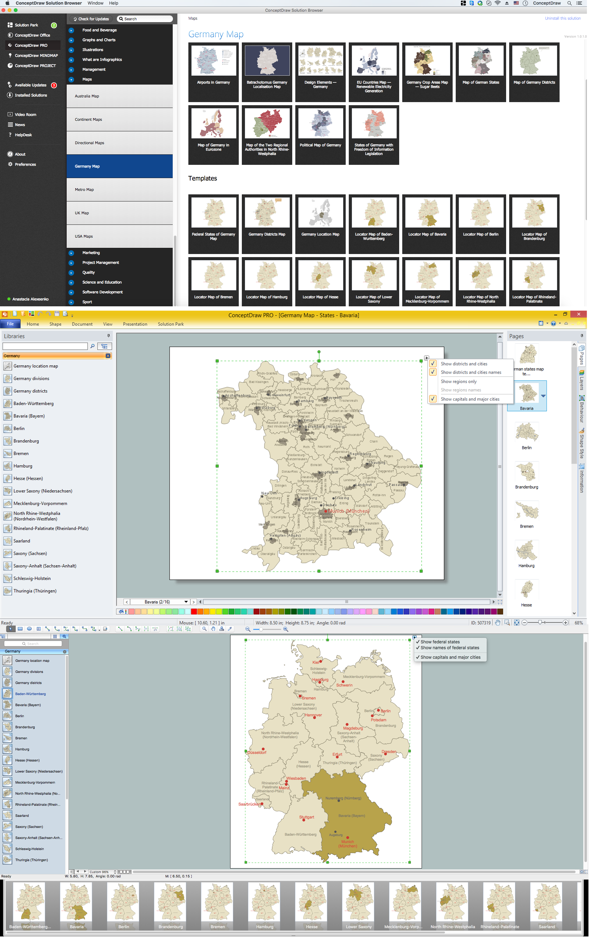
Map of Germany — Bavaria State
“Bavaria is a federal state of Germany. In the southeast of the country with an area of 70,548 square kilometres (27,200 sq mi), it is the largest state, making up almost a fifth of the total land area of Germany, and, with 12.6 million inhabitants, Germany's second most populous state. Munich, Bavaria's capital and largest city, is the third largest city in Germany. Capital - Munich.“
Landkreise
- Aichach-Friedberg
- Altötting
- Amberg-Sulzbach
- Ansbach
- Aschaffenburg
- Augsburg
- Bad Kissingen
- Bad Tölz-Wolfratshausen
- Bamberg
- Bayreuth
- Berchtesgadener Land
- Cham
- Coburg
- Dachau
- Deggendorf
- Dillingen
- Dingolfing-Landau
- Donau-Ries
- Ebersberg
- Eichstätt
- Erding
- Erlangen-Höchstadt
- Forchheim
- Freising
- Freyung-Grafenau
- Fürstenfeldbruck
- Fürth
- Garmisch-Partenkirchen
- Günzburg
- Hassberge
- Hof
- Kelheim
- Kitzingen
- Kronach
- Kulmbach
- Landsberg
- Landshut
- Lichtenfels
- Lindau
- Main-Spessart
- Miesbach
- Miltenberg
- Mühldorf
- München (Landkreis München)
- Neuburg-Schrobenhausen
- Neumarkt
- Neustadt (Aisch)-Bad Windsheim
- Neustadt (Waldnaab)
- Neu-Ulm
- Nürnberger Land
- Oberallgäu
- Ostallgäu
- Passau
- Pfaffenhofen
- Regen
- Regensburg
- Rhön-Grabfeld
- Rosenheim
- Roth
- Rottal-Inn
- Schwandorf
- Schweinfurt
- Starnberg
- Straubing-Bogen
- Tirschenreuth
- Traunstein
- Unterallgäu
- Weilheim-Schongau
- Weissenburg-Gunzenhausen
- Wunsiedel
- Würzburg
Cities
- Bayreuth
- Bamberg
- Schweinfurt
- Aschaffenburg
- Erlangen
- Kempten (Allgäu)
- Rosenheim
- Ingolstadt
- Regensburg
- Straubing
- Landshut
- Freising
- Dachau
- Augsburg
- Neu-Ulm
- Fürth
- Nuremberg (Nürnberg)
- Passau
- Munich (München)
- Würzburg