How to draw Metro Map style infographics? Moscow, New York, Los Angeles, London
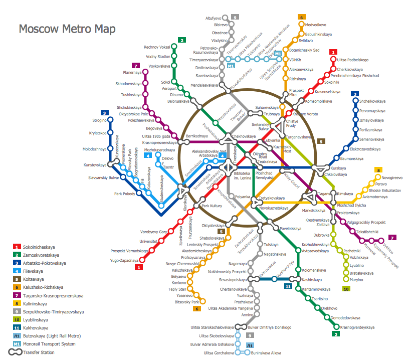
The solution handles designs of any complexity, and the comprehensive library covers all key aspects of a transportation system. To further enhance your map design, there is the option to embed links, that can display station images or other relevant, important information. We have also included a set of samples in the solution, that show the possible real-world application — complex tube systems including the London Tube and New York City Subway show the level of detail possible when using the Metro Map Solution.Subway infographic design elements - software tools
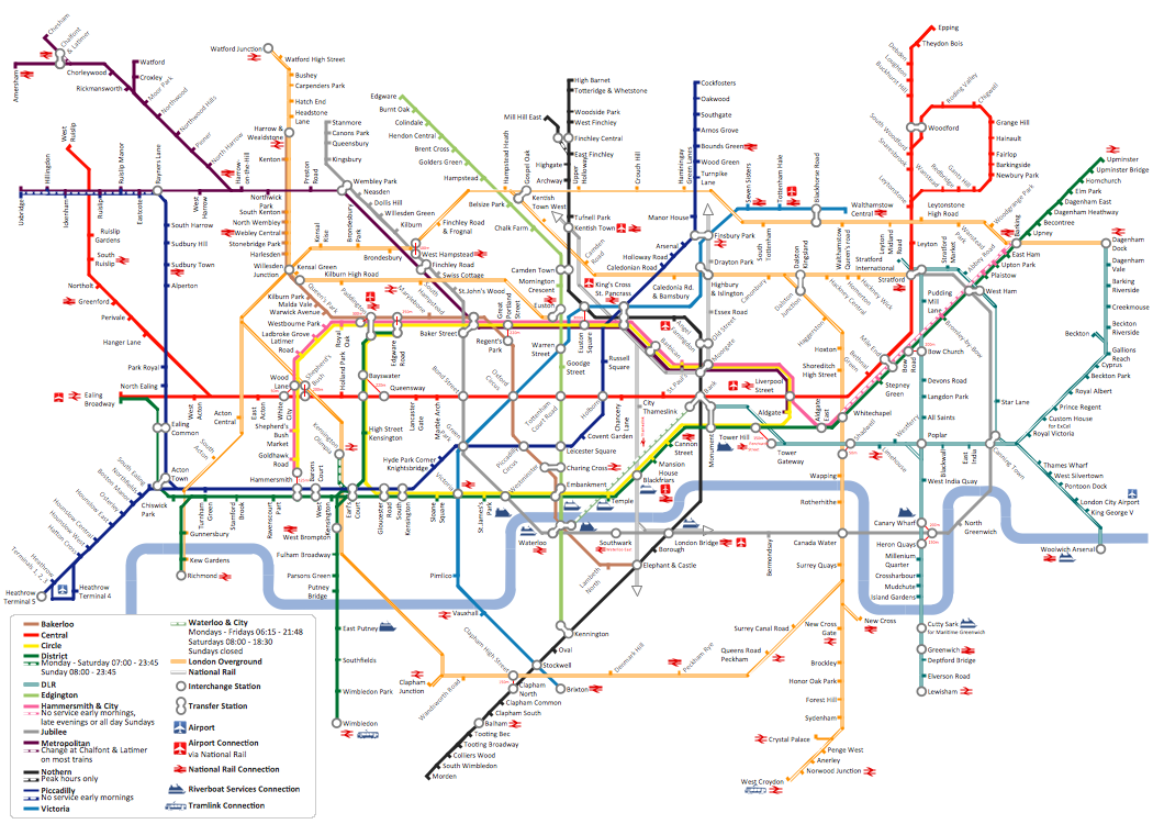
Subway infographic design elements of MetroMap and ConceptDraw software tools.How to draw Metro Map style infographics? (London)
Tool to draw Metro Map styled inforgraphics. London Tube map sample.Visio Files and ConceptDraw
Visio Files and ConceptDraw. ConceptDraw PRO is compatible with MS Visio .VDX formatted files.VDX is Visio’s open XML file format, and it can be easily imported and exported by ConceptDraw PRO.Subway Map
ConceptDraw PRO diagramming and vector drawing software is the best choice for making professional looking Subway Map. ConceptDraw PRO provides Metro Map Solution from the Maps Area of ConceptDraw Solution Park.Metro Maps
ConceptDraw PRO software enhanced with Metro Map Solution from the Maps Area of ConceptDraw Solution Park provides extensive drawing tools for fast and easy creating various metro maps, route maps, transport schemes, metro path maps, subway train maps, and many other types of maps.How to draw Metro Map style infographics? (New York)
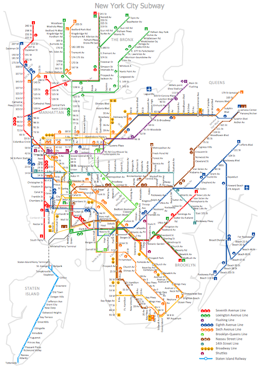
How to draw Metro Map style infographics of New York subway. New York Subway has a long history starting on October 27, 1904. Since the opening many agencies have provided schemes of the subway system. At present time are 34 lines in use. This page present New York City subway map construct with Metro Map Solution in Conceptdraw PRO software. This is a one-click tool to add stations to the map. It lets you control the direction in which you create new stations, change lengths, and add text labels and icons. It contains Lines, Stations, and Landmarks objectsMTA Subway Map
ConceptDraw PRO diagramming and vector drawing software offers the easiest and time-saving way of drawing the MTA Subway Map. Let's try to make sure this with Metro Map Solution from the Maps Area for ConceptDraw PRO Solution Park.
 Metro Map
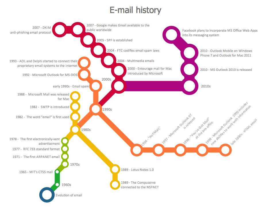
Metro Map solution extends ConceptDraw PRO software with templates, samples and library of vector stencils for drawing the metro maps, route maps, bus and other transport schemes, or design tube-style infographics.
Best Vector Drawing Application for Mac OS X
ConceptDraw PRO creates drawings, diagrams and charts with great visual appeal in Mac OS X.Value Stream Mapping Symbols
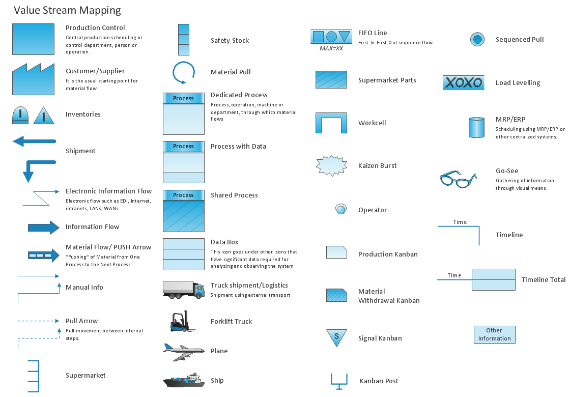
VSM symbols are the best for a production process designing. The entire Value Stream Mapping method uses a graphical representation of the manufacturing process, factors' pros and cons, that all stakeholders can easily understand. Value Stream Mapping is a graphical technique that provides possibilities to improve analysis of a manufacturing process, at the stage of the transferring information or materials that required to deliver a product or service to the customer.Directions Maps
It is convenient to represent various routes, directions, roads on the directional maps and navigation schemes. ConceptDraw PRO diagramming and vector drawing software supplied with Directional Maps Solution from the Maps Area of ConceptDraw Solution Park is effective for drawing Directions Maps.Subway Train Map
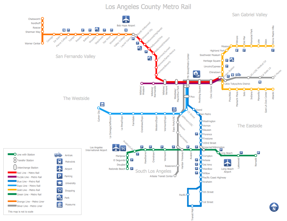
You want create a Subway Train Map fast and easy? Use the excellent tool - ConceptDraw PRO diagramming and vector drawing software. Extended with Metro Map Solution from the Maps Area, it is the best for drawing various types of metro maps.Geo Map - Asia - Philippines
The Philippines, officially known as the Republic of the Philippines, is a sovereign island country in Southeast Asia situated in the western Pacific Ocean. Use the Continent Maps solution and Philippines library to draw thematic maps, geospatial infographics and vector illustrations. This solution to help visualize the business and thematic information connected with geographic areas, locations or customs; for your business documents, presentations and websites.Directions Map
ConceptDraw PRO is a powerful diagramming and vector drawing software. Extended with Directional Maps Solution from the Maps Area of ConceptDraw Solution Park, it became the best software for quick and easy designing Directions Map of any complexity.- How to draw Metro Map style infographics? (New York) | Basic ...
- Aerospace and Transport | Metro Map | Entity-Relationship Diagram ...
- Process Flowchart | How to draw Metro Map style infographics ...
- Basic Flowchart Symbols and Meaning | How to draw Metro Map ...
- Spatial infographics Design Elements: Location Map | Process ...
- Aerospace and Transport | Metro Map | Entity-Relationship Diagram ...
- Metro Maps | Emergency Plan Template | Geo Mapping Software ...
- Basic Flowchart Symbols and Meaning | How to draw Metro Map ...
- How to draw Metro Map style infographics? (New York) | Metro Map ...
- Collaboration Diagram Of Smart City
- Entity-Relationship Diagram (ERD) | Computer Network Diagrams ...
- Data Flow Diagram For Metro
- Process Flowchart | How to draw Metro Map style infographics ...
- Entity-Relationship Diagram (ERD) | Computer Network Diagrams ...
- Excellent Examples of Infographic Maps | Process Flowchart | Map ...
- Metro Map | UML Composite Structure Diagram | How to draw Metro ...
- Process Flowchart | How to draw Metro Map style infographics ...
- Basic Flowchart Symbols and Meaning | Process Flowchart | How to ...
- Flow Chart For Metro Train
- Process Flowchart | Catabolism schematic - Biochemical diagram ...


