 Concept Maps
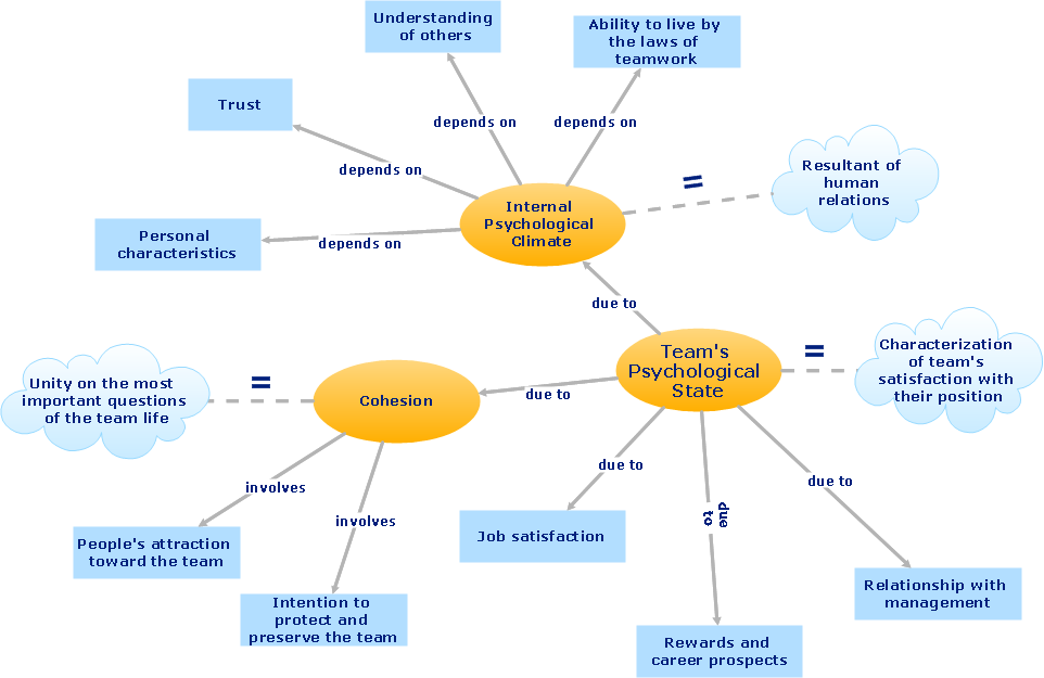
The technique of concept mapping was developed as a constructive way of representing knowledge in science and increasing the meaningfulness of learning. Now, the creation of a concept map is extremely helpful when used in education as learning and teaching techniques that assist memorization. Concept maps are also used for idea generation in brainstorming sessions, and for detailing the structure of complex ideas.
ConceptDraw Arrows10 Technology
How should diagramming software work? The answer is - Fast and easy. "Tree"- mode drawing works like that. Just select objects in your drawing and press Tree or Chain button to connect all of them just in one click. Your diagram looks professional and it took only a moment to draw."A thematic map is a type of map or chart especially designed to show a particular theme connected with a specific geographic area. ...
A thematic map is a map that focuses on a specific theme or subject area, whereas in a general map the variety of phenomena - geological, geographical, political - regularly appear together. ...
Thematic maps emphasize spatial variation of one or a small number of geographic distributions. These distributions may be physical phenomena such as climate or human characteristics such as population density and health issues. ...
Thematic map are sometimes referred to as graphic essays that portray spatial variations and interrelationships of geographical distributions. Location, of course, is important to provide a reference base of where selected phenomena are occurring. ...
Thematic maps serve three primary purposes.
First, they provide specific information about particular locations.
Second, they provide general information about spatial patterns.
Third, they can be used to compare patterns on two or more maps." [Thematic map. Wikipedia]
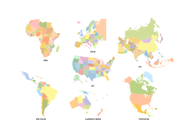
The vector stencils library "Thematic maps" contains 7 continent map contours for creating the thematic maps of geographic regions displaying the metric values by countries, states and territories marked by different colors.
Use the design elements library "Thematic maps" to create spatial dashboards using the ConceptDraw PRO diagramming and vector drawing software for your Spatial Intelligence and Location Intelligence business practice.
The example "Design elements - Thematic maps" is included in the Spatial Dashboard solution from the area "What is a Dashboard" of ConceptDraw Solution Park.
 Project Management Area
Project Management area provides Toolbox solutions to support solving issues related to planning, tracking, milestones, events, resource usage, and other typical project management functions.
- The Best Choice for Creating Diagram | Concept map - Team ...
- Concept Maps | Concept Maps | How to Create a Concept Map in ...
- Concept Maps | Value Stream Mapping | Concept maps with ...
- Concept maps with ConceptDraw PRO
- Concept Maps | Concept maps with ConceptDraw PRO | Concept ...
- Value Stream Mapping | Concept Maps | The Best Choice for ...
- Concept Maps
- Concept Maps | Value Stream Mapping | Concept maps with ...
- The Best Choice for Creating Diagram | The Best Mac Software for ...
- Concept Maps
- Communication Diagram UML2.0 / Collaboration UML1.x ...
- The Best Choice for Creating Diagram | The Best Mac Software for ...
- Fishbone Diagram | Metro Map | Basic Diagramming | What Is A ...
- Concept maps with ConceptDraw PRO | Simple Diagramming | The ...
- Spatial infographics Design Elements: Continental Map | Spatial ...
- Visualization Spatial Data Using Thematic Maps Combined with ...
- How to draw Metro Map style infographics? Moscow, New York, Los ...
- Geo Map - Oceania | Design elements - Thematic maps | Geo Map ...
- Swim Lane Diagrams | Cross-Functional Flowchart (Swim Lanes ...
- How to draw Metro Map style infographics? Moscow, New York, Los ...
- ERD | Entity Relationship Diagrams, ERD Software for Mac and Win
- Flowchart | Basic Flowchart Symbols and Meaning
- Flowchart | Flowchart Design - Symbols, Shapes, Stencils and Icons
- Flowchart | Flow Chart Symbols
- Electrical | Electrical Drawing - Wiring and Circuits Schematics
- Flowchart | Common Flowchart Symbols
- Flowchart | Common Flowchart Symbols

