USA Map

Geo Map — United States of America Map

USA Map States

 Maps Area
Solutions from the Maps Area of ConceptDraw Solution Park collect templates, samples and libraries of vector stencils for drawing geographical, directional and transport maps.
 ConceptDraw Solution Park
ConceptDraw Solution Park collects graphic extensions, examples and learning materials
 Germany Map
The Germany Map solution contains collection of samples, templates and scalable vector stencil graphic maps, representing map of Germany and all 16 states of Germany. Use the Germany Map solution from ConceptDraw Solution Park as the base for various them
 UK Map
The Map of UK solution contains collection of professionally designed samples and scalable vector stencil graphics maps, representing the United Kingdom counties, regions and cities. Use the Map of UK solution from ConceptDraw Solution Park as the base fo
Map Australia
HelpDesk
How to Create a Map Depicting the United Kingdom Counties and Regions

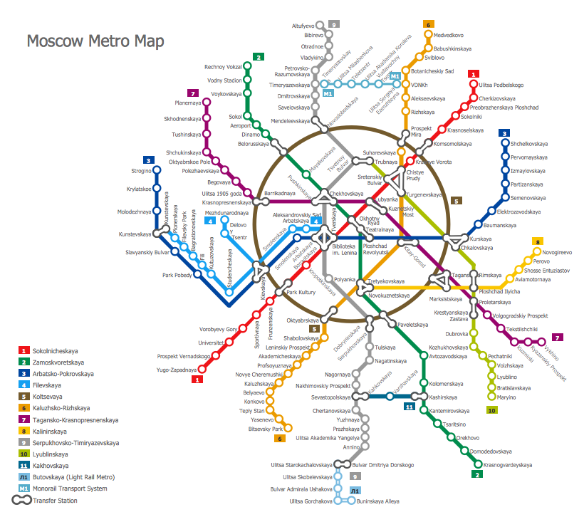
Subway Map
Map of Germany

Maps of Germany With Cities

Vector Map of Germany

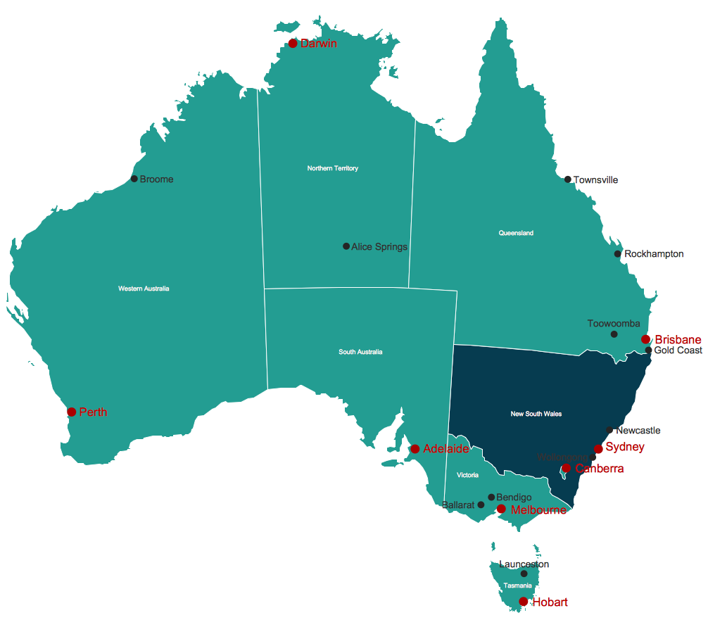
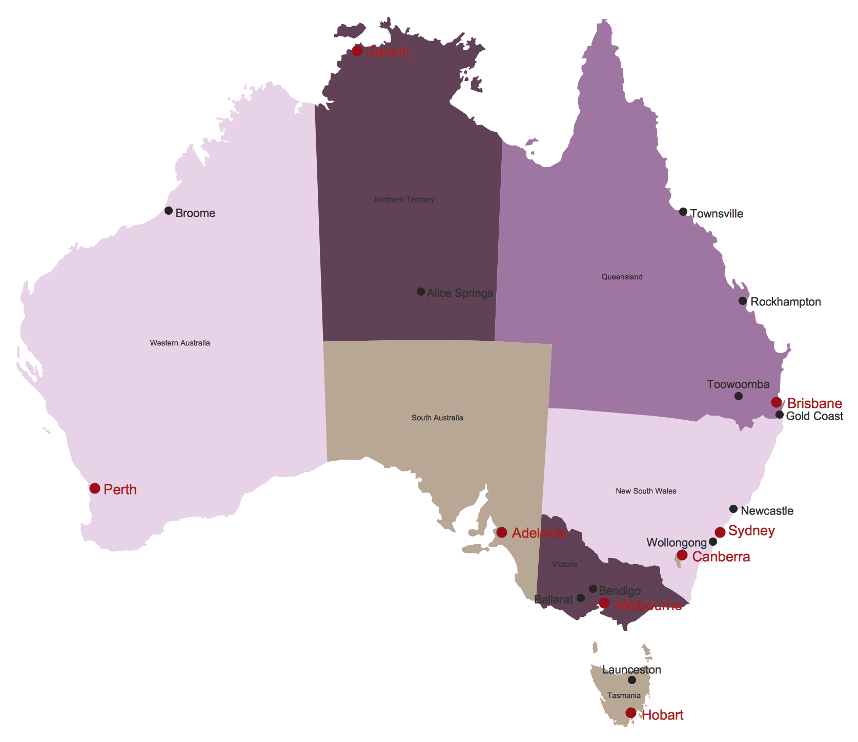
Map of Australia
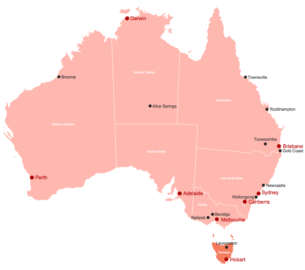
Australia Map
- Germany Detailed Map
- Map of Germany | 7 Continents Map | USA Map States | Large Map ...
- Map Of United States With State Names
- Geo Map - United States of America Map | How to Draw a Map of ...
- Geo Map - United States of America Map | Continent Maps | Map of ...
- Benefit Corporation legislation - Thematic map | Ranks US states by ...
- Geo Map - USA - New York | Draw Company Structure with ...
- Map of Continents | Map of USA | Australia Map | Germany ...
- Geo Map - USA - Ohio | Geo Map - South America - Mexico | Geo ...
- Metro Maps | Metro Map | Map of USA | Germany Map History
- How to Draw a Map of North America Using ConceptDraw PRO ...
- Germany District Map
- Map Of West Germany With Cities
- Germany Map | Maps of Germany With Cities | Map of Germany ...
- 7 Continents Map
- Geo Map - USA - New York
- Major Cities In Germany Map
- Maps of Germany With Cities
- How to Draw a Map of North America Using ConceptDraw PRO ...
- Map Of Germany With States And Capitals