Use this template to design your Africa political map, cartogram or thematic map, to visualize your spatial business information connected with geographic areas, locations or ways.
This Africa map template for the ConceptDraw PRO diagramming and vector drawing software is included in the Continent Maps solution from the Maps area of ConceptDraw Solution Park.
This Africa map template for the ConceptDraw PRO diagramming and vector drawing software is included in the Continent Maps solution from the Maps area of ConceptDraw Solution Park.
Africa thematic map template
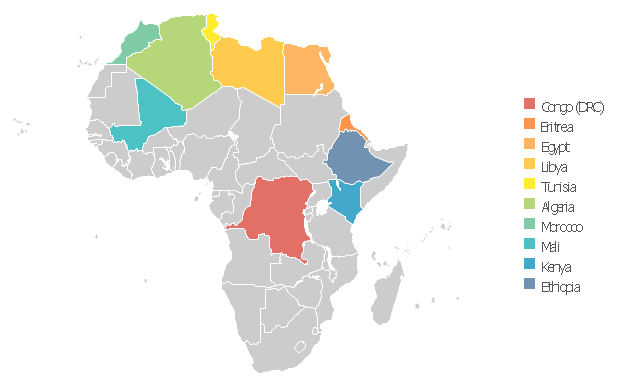
Use this Africa map template to design your political or thematic map.
This Africa map template for the ConceptDraw PRO diagramming and vector drawing software is included in the Continent Maps solution from the Maps area of ConceptDraw Solution Park.
This Africa map template for the ConceptDraw PRO diagramming and vector drawing software is included in the Continent Maps solution from the Maps area of ConceptDraw Solution Park.
Africa map

Continents Map

Spatial infographics Design Elements: Continental Map

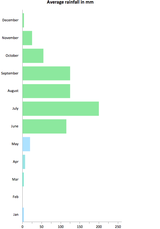
Rainfall Bar Chart
The Artwork template opens libraries of vector clipart: ABC, Africa flags, Architecture, Asia flags, Buidings and green spaces, Entertainment, Europe flags, Flags, Food, Funny animals, Funny aquatic fauna, Funny transport, Music, North and Central Americs flags, Oceania flags, Puzzles, South America flags.
The artwork template for the ConceptDraw PRO diagramming and vector drawing software is included in the Artwork solution from the Illustration area of ConceptDraw Solution Park.
The artwork template for the ConceptDraw PRO diagramming and vector drawing software is included in the Artwork solution from the Illustration area of ConceptDraw Solution Park.
Vector clip art

Spatial Data
Geo Map - World

Geospatial Data
Geo Map - Africa

- Africa map with countries, main cities and capitals - Template ...
- Africa map with countries, main cities and capitals - Template | Africa ...
- Africa map - Template
- Continents Map | Africa map - Template | Africa map with countries ...
- Africa map with countries, main cities and capitals - Template | Maps ...
- Africa map with countries, main cities and capitals - Template
- Africa Map
- Australia map with cities - Template | Australia map - Template ...
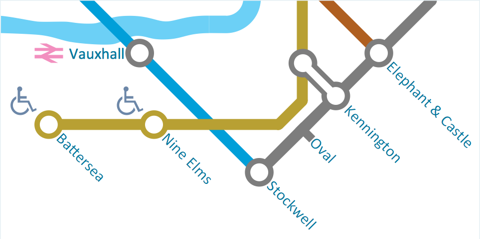
- Transport map - Template | Spatial infographics Design Elements ...
- Geo Map - Asia - Philippines | Asia map with capitals - Template ...