Winter Sports Vector Clipart. Medal Map. Spatial Infographics

Spatial infographics Design Elements: Transport Map

Sport pictograms. Olympic Games

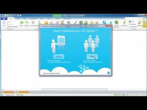
Mac Compatible Remote Presentation

 Aerospace and Transport
This solution extends ConceptDraw PRO software with templates, samples and library of vector clipart for drawing the Aerospace and Transport Illustrations. It contains clipart of aerospace objects and transportation vehicles, office buildings and anci
The vector stencils library "Asia" contains 47 country contours for drawing thematic maps of Asia.
Use it in your spatial infographics for visual representation of geospatial information, statistics and quantitative data in the ConceptDraw PRO diagramming and vector drawing software extended with the Spatial Infographics solution from the area "What is Infographics" of ConceptDraw Solution Park.
Use it in your spatial infographics for visual representation of geospatial information, statistics and quantitative data in the ConceptDraw PRO diagramming and vector drawing software extended with the Spatial Infographics solution from the area "What is Infographics" of ConceptDraw Solution Park.
Asia

Afghanistan

Armenia

Azerbaijan

Bahrain

Bangladesh

Bhutan

Brunei

Burma (Myanmar)
-asia---vector-stencils-library.png--diagram-flowchart-example.png)
Cambodia

China

Cyprus

Georgia

India

Indonesia

Iran

Iraq

Israel

Japan

Jordan

Kuwait

Kazakhstan

Kyrgyzstan

Laos

Lebanon

Malaysia

Mongolia

Nepal

North Korea

Oman

Pakistan

Papua New Guinea

Philippines

Qatar

Saudi Arabia

Singapore

South Korea

Sri Lanka

Syria

Tajikistan

Thailand

Turkey

Turkmenistan

United Arab Emirates

Uzbekistan

Vietnam

Yemen

The vector stencils library "North America" contains 70 contours for drawing thematic maps of North America in spatial infographics.
Use it for visual representation of geospatial information, statistics and quantitative data in the ConceptDraw PRO diagramming and vector drawing software extended with the Spatial Infographics solution from the area "What is Infographics" of ConceptDraw Solution Park.
Use it for visual representation of geospatial information, statistics and quantitative data in the ConceptDraw PRO diagramming and vector drawing software extended with the Spatial Infographics solution from the area "What is Infographics" of ConceptDraw Solution Park.
North America

Greenland (Denmark)
-north-america---vector-stencils-library.png--diagram-flowchart-example.png)
Canada

Canada (provinces and territories)
-north-america---vector-stencils-library.png--diagram-flowchart-example.png)
Alberta

British Columbia

Manitoba

New Brunswick

Newfoundland and Labrador

Northwest Territories

Nova Scotia

Nunavut

Ontario

Prince Edward Island

Quebec

Saskatchewan

Yukon

USA

US states

Alabama

Alaska

Arizona

Arkansas

California

Colorado

Connecticut

Delaware

Florida

Georgia

Hawaii

Idaho

Illinois

Indiana

Iowa

Kansas

Kentucky

Louisiana

Maine

Maryland

Massachusetts

Michigan

Minnesota

Mississippi

Missouri

Montana

Nebraska

Nevada

New Hampshire

New Jersey

New Mexico

New York

North Carolina

North Dakota

Ohio

Oklahoma

Oregon

Pennsylvania

Rhode Island

South Carolina

South Dakota

Tennessee

Texas

Utah

Vermont

Virginia

Washington

West Virginia

Wisconsin

Wyoming

Mexico

How to Make an Infographic

Make an Infographic

Education Information

 Audio, Video, Media
Use it to make professional-looking documents, impressive presentations, and efficient websites with colorful and vivid illustrations and schematics of digital audio, video and photo gadgets and devices, audio video connections and configurations, S Video connection, HD and 3D television systems, home entertainment systems, Closed-circuit television (CCTV) surveillance systems. All audio video schematics, drawings and illustrations designed in ConceptDraw PRO are professional looking, clear and understandable for all thanks to applying the most commonly used standards of designations, and are effective for demonstrating in front of a small audience and on the big screens.
 Picture Graphs
Typically, a Picture Graph has very broad usage. They many times used successfully in marketing, management, and manufacturing. The Picture Graphs Solution extends the capabilities of ConceptDraw PRO v10 with templates, samples, and a library of professionally developed vector stencils for designing Picture Graphs.
Education Infographics

Educational Technology Tools

- Winter Sports Vector Clipart . Medal Map. Spatial Infographics ...
- Winter Olympics - Figure skating | Winter Sports Vector Clipart ...
- Winter Sports | Winter Sports. Illustrations and Visualize Statistics ...
- Winter Sports Vector Clipart . Medal Map. Spatial Infographics ...
- Winter Sports | Winter Sports Vector Clipart . Medal Map. Spatial ...
- Winter Sports Vector Clipart . Medal Map. Spatial Infographics | Mind ...
- Presentation Clipart | Business People Clipart | Winter Sports Vector ...
- Winter Sports. Illustrations and Visualize Statistics | Winter Sports ...
- Winter Sports. Illustrations and Visualize Statistics | Winter Sports ...
- Winter Sports Vector Clipart . Medal Map. Spatial Infographics ...
- Winter Sports. Olympic Games Infographics. Medal Table | Winter ...
- Arrows - Vector clipart library | Winter Sports Vector Clipart . Medal ...
- Winter Sports | Sport pictograms. Olympic Games | Winter Sports ...
- Interior Design Sport Fields - Design Elements | Sport pictograms ...
- How to Create PowerPoint Presentation from Data Driven ...
- Snowboarding Clip Art
- Winter Sports. Olympic Games Infographics. Medal Table | Sport ...
- How to Draw Pictorial Chart. How to Use Infograms | Design Pictorial ...
- Winter Sports | Winter Sports. Olympic Games Illustrations. Medal ...
- Winter Sports | Design elements - Winter sports pictograms | Winter ...