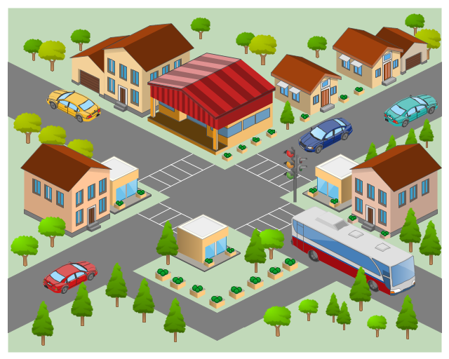
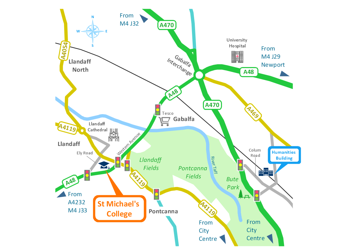
The 3D pictorial street maps are used as road maps, route maps, locator maps, transit maps, directional maps, tourist maps with points of interest (POI).
"A point of interest, or POI, is a specific point location that someone may find useful or interesting. ...
Most consumers use the term when referring to hotels, campsites, fuel stations or any other categories used in modern (automotive) navigation systems. ...
The term is widely used in cartography, especially in electronic variants including GIS, and GPS navigation software. In this context the synonym waypoint is common.
A GPS point of interest specifies, at minimum, the latitude and longitude of the POI, assuming a certain map datum. A name or description for the POI is usually included, and other information such as altitude or a telephone number may also be attached. GPS applications typically use icons to represent different categories of POI on a map graphically." [Point of interest. Wikipedia]
The example "3D pictorial street map" was created using the ConceptDraw PRO diagramming and vector drawing software extended with the Directional Maps solution from the Maps area of ConceptDraw Solution Park.
How tо Represent Information Graphically
ConceptDraw Infographics is a great visual tool for communicating the large amounts of data and graphic visualization and representations of data and information.
 Directional Maps
Directional Maps solution extends ConceptDraw PRO software with templates, samples and libraries of vector stencils for drawing the directional, location, site, transit, road and route maps, plans and schemes.
Tools to Create Your Own Infographics
Over the past few centuries, data visualization has evolved so much that we use it every day in all areas of our lives. Many believe that infographic is an effective tool of storytelling, as well as analytics, and that it is able to overcome most of the language and educational barriers. Understanding the mechanisms of human perception will help you to understand how abstract forms and colors used in data visualization can transmit information more efficient than long paragraphs of text.Best Tool for Infographic Construction
ConceptDraw is a best data visualization tool that will allow everyone to create rich infographics and visualizations quickly and easily.Transportation Infographics
ConceptDraw is a visualization Software for making transportation infographics. Infographics design vector elements and vector graphics which will surely help you in your design process.Travel Infographics
Creating Travel infographics is super-easy with ConceptDraw.
 Sport Field Plans
Construction of sport complex, playgrounds, sport school, sport grounds and fields assumes creation clear plans, layouts, or sketches. In many cases you need represent on the plan multitude of details, including dimensions, placement of bleachers, lighting, considering important sport aspects and other special things.
- Road Maps
- Directional Maps | How to Create a Directional Map Using ...
- Directions Maps | 3D pictorial street map | Design elements ...
- Design elements - 3D directional maps | 3D pictorial street map ...
- Directional Maps | Maps and Directions | Directions Maps | 3d ...
- 3D pictorial road map | 2D Directional map - Template | 3D pictorial ...
- Design elements - 3D directional maps | Maps | 3D pictorial street ...
- Maps Driving Directions | Directional Maps | 3D pictorial street map ...
- 3D pictorial street map
- Directional Maps | Design elements - 3D directional maps | 3D ...
- Design elements - 3D directional maps | Directions Map | Map ...
- 3D pictorial street map | Design elements - 3D directional maps ...
- Directional Map Road Signs
- Directional Maps | Map Directions | Directions Map | Example ...
- Directional Map Software Examples
- 3D Directional map - Template | 3D pictorial street map | Road signs ...
- Design elements - 3D directional maps | Directional Maps | Maps ...
- Directional Maps | Map Directions | Directions Map | Example Of ...
- Drawing Simple Road Map Software
- 3D pictorial street map | Design elements - 3D directional maps | 3D ...
