The vector clipart library Geography contains 14 images of geographical features: ocean, forest, river, lake, waterfall, mountains, ravine, volcano, desert, hills, iceberg, trees.
Use the design elements library Geography to draw illustrations with landform images using the ConceptDraw PRO diagramming and vector drawing software.
"A landform in the earth sciences comprises a geomorphological unit, and is largely defined by its surface form and location in the landscape. As part of the terrain a landform is an element of topography. Landform elements also include land such as hills, mountains, plateaus,canyons,valleys, seascape and oceanic waterbody interface features such as bays, peninsulas, seas and so forth, including sub-aqueous terrain features such as mid-ocean ridges, volcanoes,and the great ocean basins." [Landform. Wikipedia]
This landscape illustration example is included in the Nature solution from the Illustration area of ConceptDraw Solution Park.
Vector illustration

The vector stencils library "Geography" contains 14 clipart images of natural landscapes and water features for drawing illustrations.
"A natural landscape is a landscape that is unaffected by human activity. A natural landscape is intact when all living and nonliving elements are free to move and change. The nonliving elements distinguish a natural landscape from a wilderness. A wilderness includes areas within which natural processes operate without human interference, but a wilderness must contain life. As implied, a natural landscape may contain either the living or nonliving or both." [Natural landscape. Wikipedia]
The clip art example "Geography - Vector stencils library" was created using the ConceptDraw PRO diagramming and vector drawing software extended with the Nature solution from the Illustration area of ConceptDraw Solution Park.
www.conceptdraw.com/ solution-park/ illustrations-nature
Ocean

Forest

River

Lake

Waterfall

Mountains

Mountain

Ravine

Volcano

Desert

Hills

Iceberg

Conifer tree

Tree

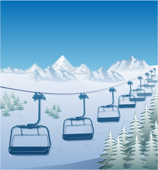
"The term ski lift generally refers to any cable transport device that carries skiers up a hill. A ski lift may fall into one of the following three main classes:
Aerial lifts, including:
Aerial tramways,
Chairlifts,
Detachable chairlifts,
Funifors,
Funitels,
Gondola lifts,
Telemix.
Surface lifts, including:
J-bars,
T-bars,
Magic carpets,
Platter / Button / Poma lifts,
Rope tows & handle tows.
Cable railways, including:
Funiculars." [Ski lift. Wikipedia]
The winter sport illustration example "Ski lift in the snow capped mountains" was created using the ConceptDraw PRO diagramming and vector drawing software extended with the Winter Sports solution from the Sport area of ConceptDraw Solution Park.
Winter sport illustration
The vector stencils library "Geography" contains 14 clipart images of natural landscapes and water features for drawing illustrations.
"A natural landscape is a landscape that is unaffected by human activity. A natural landscape is intact when all living and nonliving elements are free to move and change. The nonliving elements distinguish a natural landscape from a wilderness. A wilderness includes areas within which natural processes operate without human interference, but a wilderness must contain life. As implied, a natural landscape may contain either the living or nonliving or both." [Natural landscape. Wikipedia]
The clip art example "Geography - Vector stencils library" was created using the ConceptDraw PRO diagramming and vector drawing software extended with the Nature solution from the Illustration area of ConceptDraw Solution Park.
www.conceptdraw.com/ solution-park/ illustrations-nature
"A natural landscape is a landscape that is unaffected by human activity. A natural landscape is intact when all living and nonliving elements are free to move and change. The nonliving elements distinguish a natural landscape from a wilderness. A wilderness includes areas within which natural processes operate without human interference, but a wilderness must contain life. As implied, a natural landscape may contain either the living or nonliving or both." [Natural landscape. Wikipedia]
The clip art example "Geography - Vector stencils library" was created using the ConceptDraw PRO diagramming and vector drawing software extended with the Nature solution from the Illustration area of ConceptDraw Solution Park.
www.conceptdraw.com/ solution-park/ illustrations-nature
Ocean
Forest
River
Lake
Waterfall
Mountains
Mountain
Ravine
Volcano
Desert
Hills
Iceberg
Conifer tree
Tree
Geo Map - USA - Montana

Geo Map - South America - Colombia

Geo Map of Americas

Geo Map - South America - Costa Rica

Geo Map - South America - Chile

Nature Drawings - How to Draw

Geo Map - Europe - Russia

Geo Map - South America - Peru

Geo Map - South America - Argentina

Geo Map - South America - Nicaragua

Geo Map - Europe - Greece

- Mountain To River Illustration
- Elements Of Nature River Ocean Mountain Hill Forest Volcano
- Photos Of River Flowing From Mountain To Ocean
- Mountains Hills Forest Deserts
- Ski lift in the snow capped mountains | Geography - Vector stencils ...
- Mountains Hills River Sea
- Design Elements Geography To Draw Illustrations
- Drawing Of Mountains Rivers Forests Seas
- Mountain Vector Illustration
- Mountain Illustration Png
- River From Mountain Clip Art
- Mountain Illustration Vector Png
- Mountain Range Illustrations
- Draw A Mountain Valley River Lake
- Mountain Riaver Lake Sea
- Mountain And River Vector
- Drawings Of Mountains And Sea
- Design elements - Geography | Drawing Of Mountain Hills Plateau ...
- Iceberg Png
- River Originated From Mountain Drawing