Use this Germany locator map template to design Germany in the European Union political and thematic maps with ConceptDraw PRO software.
The template "Germany location map" is included in the Map of Germany solution from the Maps area of ConceptDraw Solution Park.
The template "Germany location map" is included in the Map of Germany solution from the Maps area of ConceptDraw Solution Park.
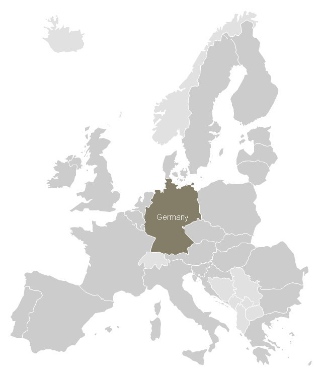
Locator map of Germany
Spatial infographics Design Elements: Location Map

Spatial infographics Design Elements: Continental Map

Geospatial Data

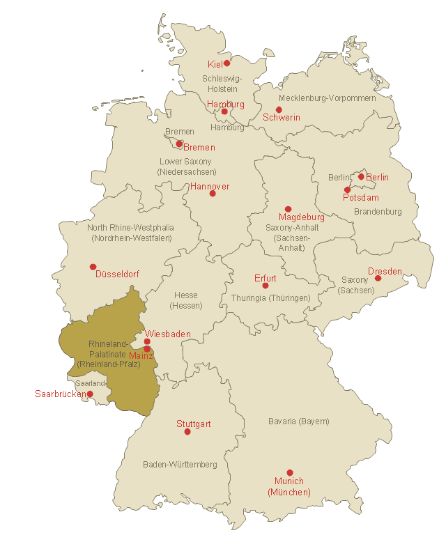
This template shows Rhineland-Palatinate location on the Germany federal states map with major cities.
Use it to design Germany political and thematic maps with ConceptDraw PRO software.
You can show or hide federal state borders and names, or capitals and major cities by map selecting and Action menu commands.
The template "Locator map of Rhineland-Palatinate" is included in the Map of Germany solution from the Maps area of ConceptDraw Solution Park.
Rhineland-Palatinate location on the Germany map
Brilliant Examples of Infographics Map, Transport, Road

Spatial infographics Design Elements: Transport Map

"A thematic map is a map that focuses on a specific theme or subject area, whereas in a general map the variety of phenomena - geological, geographical, political - regularly appear together. The contrast between them lies in the fact that thematic maps use the base data, such as coastlines, boundaries and places, only as points of reference for the phenomenon being mapped. General maps portray the base data, such as landforms, lines of transportation, settlements, and political boundaries, for their own sake." [Thematic map. Wikipedia]
The template "Europe thematic map" for the ConceptDraw PRO diagramming and vector drawing software is included in the Spatial Infographics solution from the area "What is Infographics" of ConceptDraw Solution Park.
The template "Europe thematic map" for the ConceptDraw PRO diagramming and vector drawing software is included in the Spatial Infographics solution from the area "What is Infographics" of ConceptDraw Solution Park.
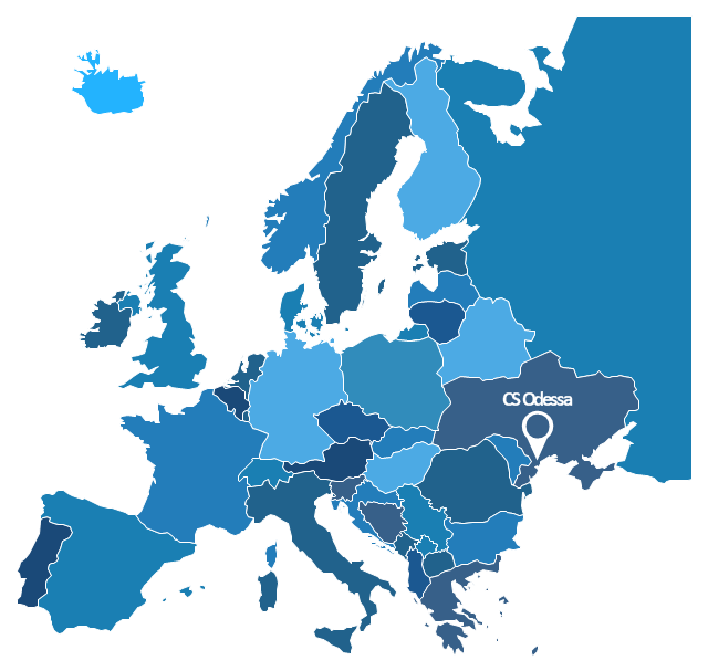
Europe contour map
Map Infographic Design

Directions Maps

Excellent Examples of Infographic Maps

How tо Represent Information Graphically

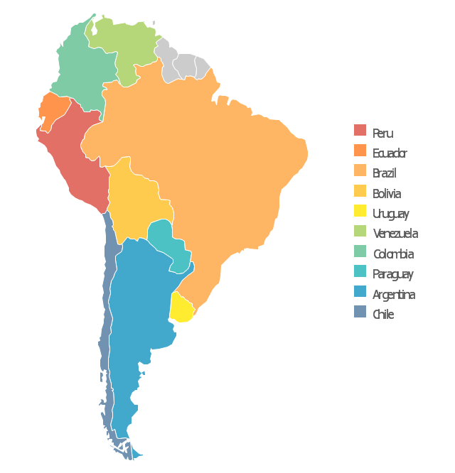
Use this template to design your South America political map, cartogram or thematic map, to visualize your spatial business information connected with geographic areas, locations or ways.
This South America map template for the ConceptDraw PRO diagramming and vector drawing software is included in the Continent Maps solution from the Maps area of ConceptDraw Solution Park.
This South America map template for the ConceptDraw PRO diagramming and vector drawing software is included in the Continent Maps solution from the Maps area of ConceptDraw Solution Park.
South America thematic map template
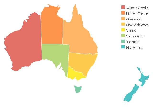
Use this template to design your Australia political map, cartogram or thematic map, to visualize your spatial business information connected with geographic areas, locations or ways.
This Australia map template for the ConceptDraw PRO diagramming and vector drawing software is included in the Continent Maps solution from the Maps area of ConceptDraw Solution Park.
This Australia map template for the ConceptDraw PRO diagramming and vector drawing software is included in the Continent Maps solution from the Maps area of ConceptDraw Solution Park.
Australia thematic map template
 Spatial Infographics
Spatial infographics solution extends ConceptDraw PRO software with infographic samples, map templates and vector stencils libraries with design elements for drawing spatial information graphics.
- Conference centre location map | Directional Maps | 2D Directional ...
- 2D Directional map - Template | How To use House Electrical Plan ...
- Spatial infographics Design Elements: Location Map | Brilliant ...
- 2D Directional map - Template | Landmarks - Vector stencils library ...
- Location of the Migration Health Assessment Center (MHAC) | 2D ...
- Site Map Template
- Transit map template | Transport map - Template | Metro Map ...
- Directional Map Drawing Software
- Direction Map Templates
- Website Site Map Template
- North America map - Template | Geo Map - South America Continent ...
- 3D pictorial road map | 2D Directional map - Template | Maps | Road ...
- Spatial infographics Design Elements: Location Map | Design ...
- Locator map - Template | Hotel locator map | Maps | Locator Map
- Directional Maps | Maps | Map Directions | Road Maps
- Map Templates From House
- Map Directions | Directions Map | 2D Directional map - Template ...
- 2D Directional map - Template | Directional Maps | Map Directions ...
- Directional Maps | How to Create a Directional Map Using ...