Continents Map

Map of Continents

Geo Map — South America Continent

Map Software

7 Continents Map

World Continents Map

Geo Map - Asia - Mongolia

Continents and Oceans Map

Geo Map — Europe

Continent Map
 Continent Maps
Continent Maps solution extends ConceptDraw DIAGRAM software with templates, samples and libraries of vector stencils for drawing the thematic maps of continents, state maps of USA and Australia.
Geo Map - Africa

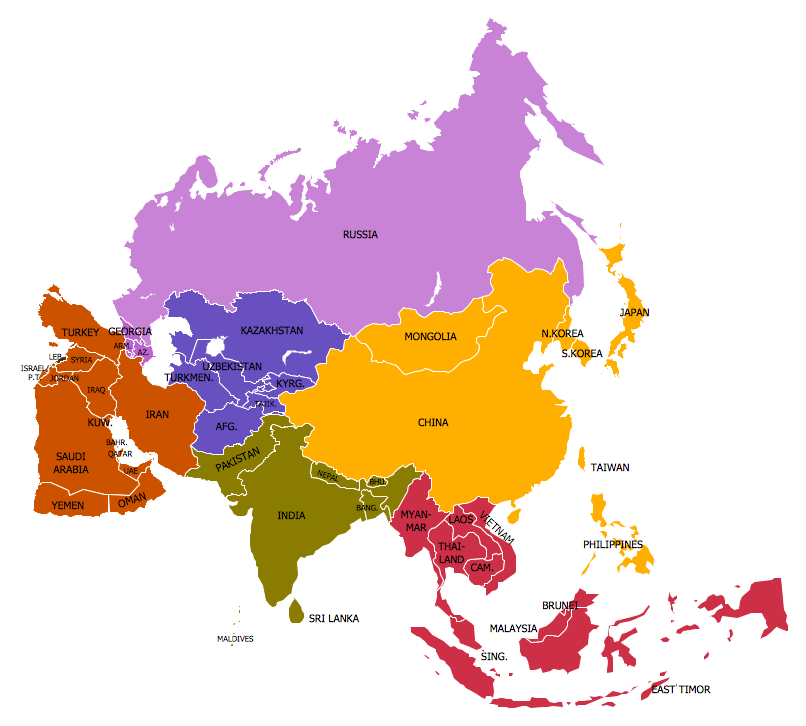
Geo Map — Asia

 Maps Area
Solutions from the Maps Area of ConceptDraw Solution Park collect templates, samples and libraries of vector stencils for drawing geographical, directional and transport maps.
Geo Map — United States of America Map

- Flags Of Asia Continent
- Flags Continents
- Geo Map - Africa | Continents Map | Flags - Stencils library | African ...
- Continent Of South America An Flags
- Continents Map | Design elements - Europe flags | Geo Map ...
- All Country Flags Asia
- Continent Maps
- Design elements - Africa flags | Geo Map - Africa | Geo Map - South ...
- Asia Continent Flag
- Geo Map - South America Continent | Design elements - South ...
- Geo Map - South America Continent | South America flags - Stencils ...
- Flag Of Continents
- Continent Maps | Geo Map of Americas | North and Central America ...
- South America flags - Stencils library | Geo Map - South America ...
- Design elements - Asia flags | Continent Maps | Flag Of Asian Contries
- Geo Map - South America Continent | South America flags - Stencils ...
- Design elements - Africa flags | Geo Map - Africa - South Africa | Geo ...
- South America flags - Stencils library | Geo Map - South America ...
- Geo Map - South America Continent
- North and Central America flags - Stencils library | Geo Map - South ...