This site uses cookies. By continuing to browse the ConceptDraw site you are agreeing to our Use of Site Cookies.
HelpDesk

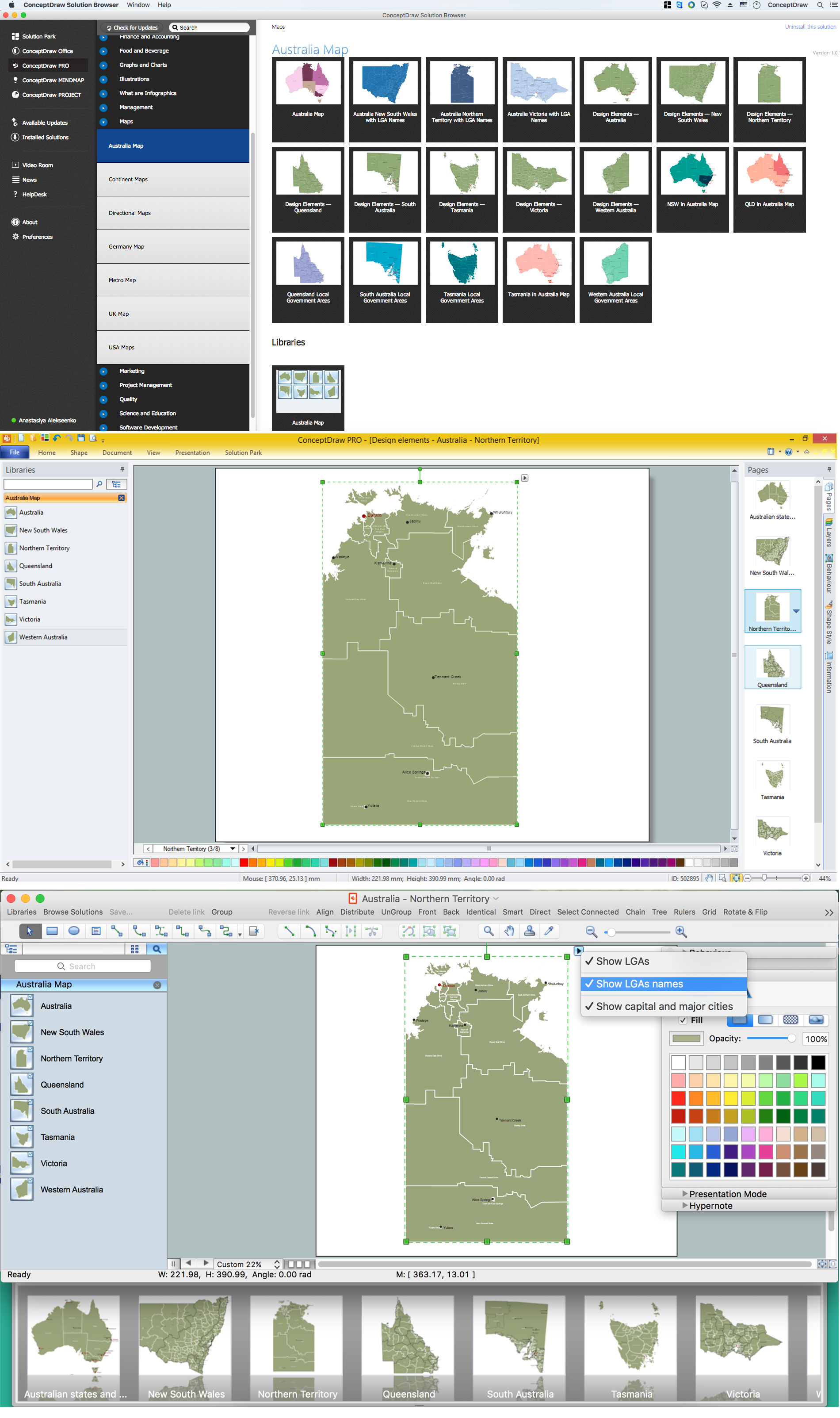
How to Draw Maps of Australia

Australia is the sixth largest country in the world. Australia consists from the mainland which is surrounded by many thousands of small fringing islands and numerous larger ones. The vast territories, aligned with interesting historic features across a wide expanse, make the thematic map an ideal way of depicting geographical, geological and political information related to Australia. The Australia Map solution for ConceptDraw DIAGRAM will help you to make the steps of the creativeness easy and intuitive. The Australia Map solution provides templates and samples along with vector stencils to get you started. Used together with other ConceptDraw DIAGRAM solutions it will allow you to create comprehensive geography-related infographics.

Geo Map - Australia - Victoria

Victoria (abbreviated as Vic.) is a state in the south-east of Australia. Victoria is Australia's most densely populated state and its second-most populous state overall.

Geo Map — Australia — New Zealand
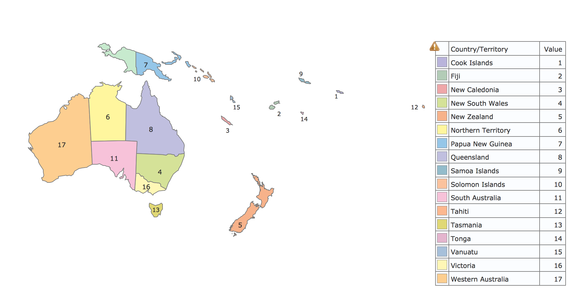
The vector stencils library Australia contains contours of New Zealand and Australian states and mainland territories for ConceptDraw DIAGRAM diagramming and vector drawing software.

Geo Map - Oceania

The vector stencils library Oceania contains contours for ConceptDraw DIAGRAM diagramming and vector drawing software.

Geo Map - Asia - Papua New Guinea

Papua New Guinea, officially named the Independent State of Papua New Guinea, is a country in Oceania that occupies the eastern half of the island of New Guinea (the western portion of the island is a part of the Indonesian provinces of Papua and West Papua) and numerous offshore islands.
The vector stencils library Papua New Guinea contains contours for ConceptDraw DIAGRAM diagramming and vector drawing software. This library is contained in the Continent Maps solution from Maps area of ConceptDraw Solution Park.

Australia Map — Northern Territory

The Northern Territory (abbreviated as NT) is a federal Australian territory in the centre and central northern regions.
Maps surround us everywhere in our life, study, work, traveling, they are widely used in geography, history, politics, economics, and many other fields of science and life activity. But designing of maps is usually complex and labor-intensive process. Now we have the possibility to make easier this process - ConceptDraw DIAGRAM diagramming and vector drawing software extended with Australia Map Solution from the Maps Area of ConceptDraw Solution Park will help us in easy drawing detailed Australia map.

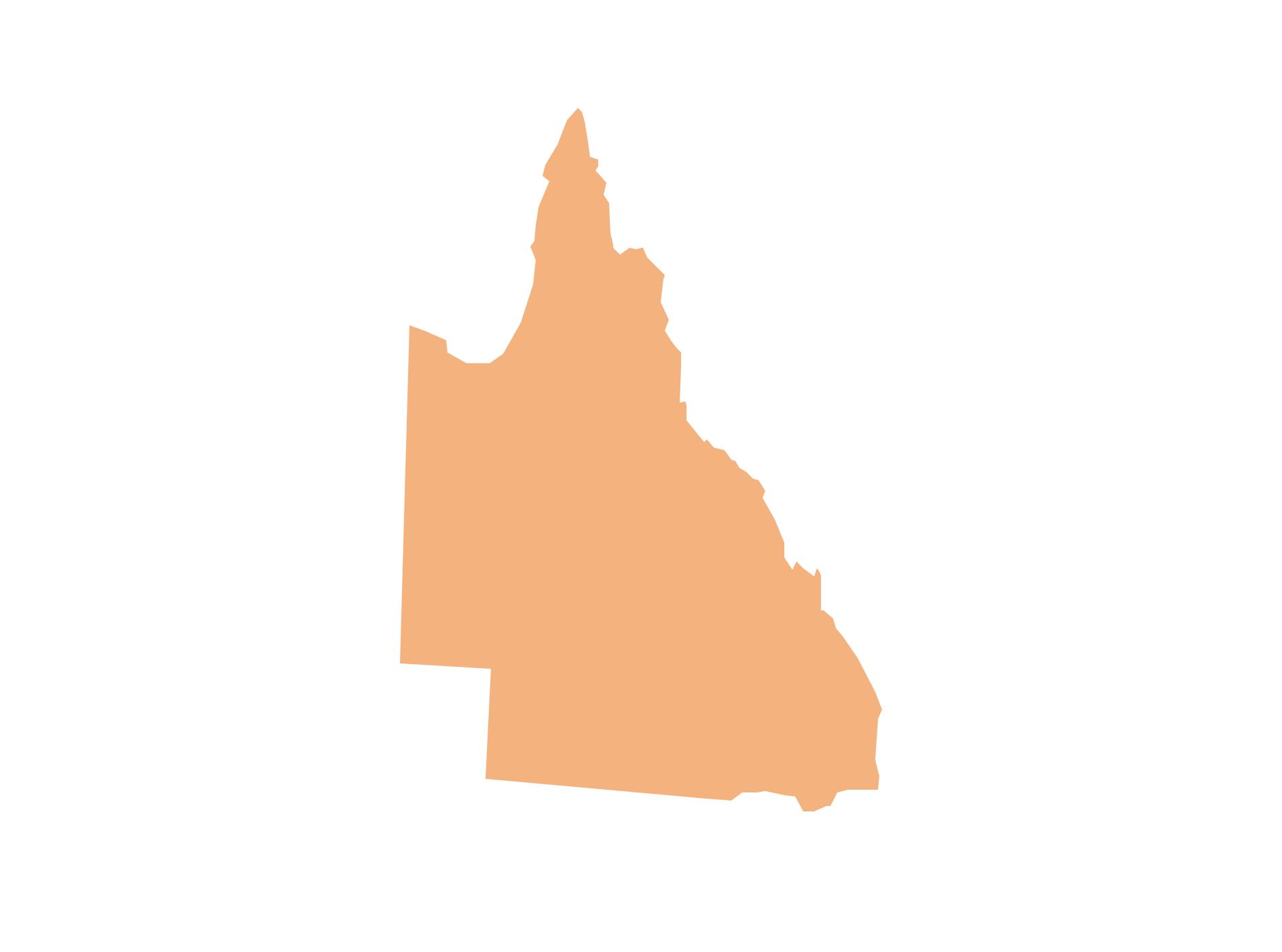
Geo Map - Australia - Queensland

Queensland (abbreviated as QLD) is the second-largest and third-most populous state in Australia.

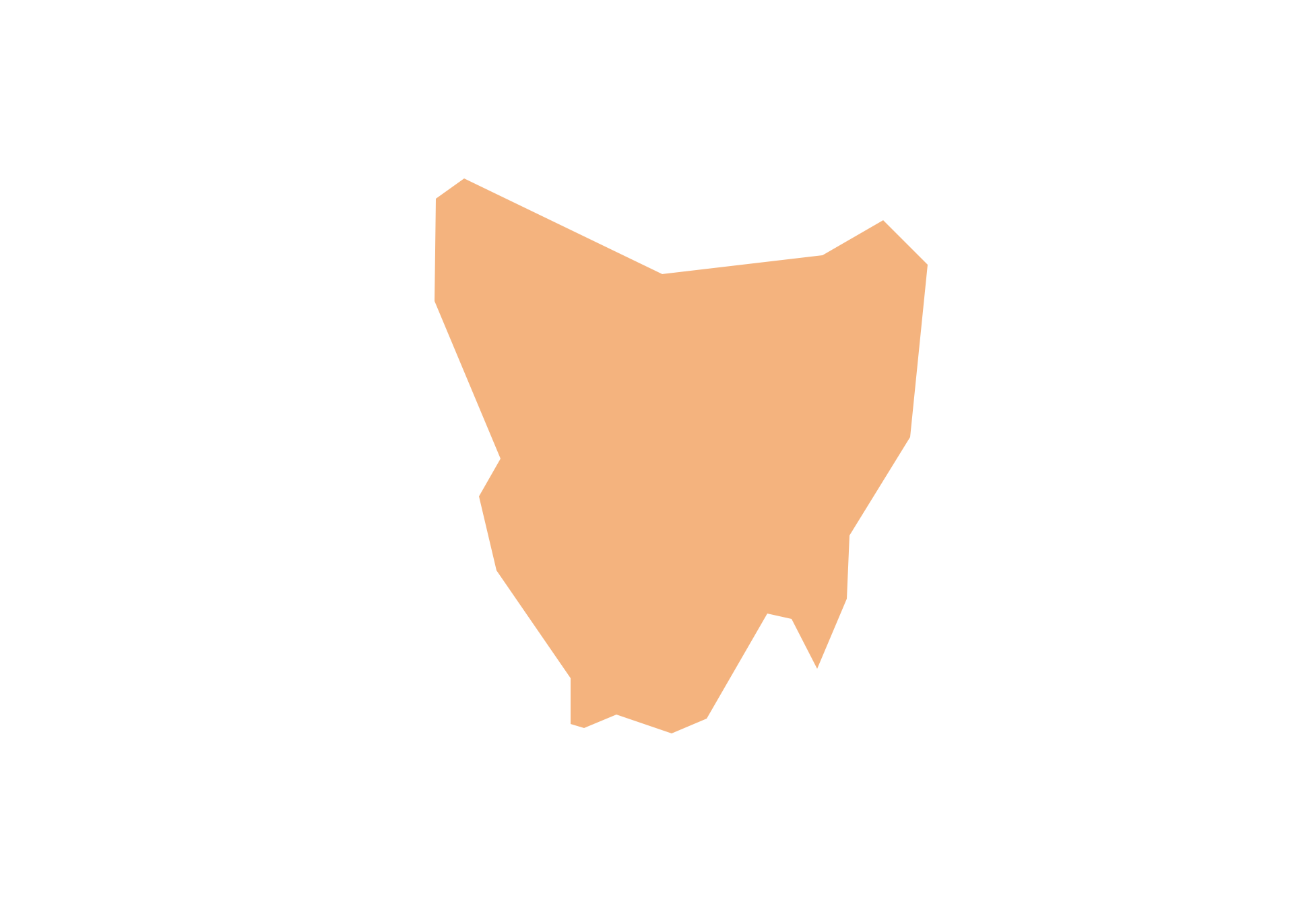
Geo Map - Australia - Tasmania

Tasmania (abbreviated as Tas and known colloquially as "Tassie") is an island state, part of the Commonwealth of Australia.

Geo Map - Australia

The vector stencils library Australia contains contours of New Zealand and Australian states and mainland territories for ConceptDraw DIAGRAM diagramming and vector drawing software.

Geo Map - Australia - Western Australia

Western Australia (abbreviated as WA) is a state occupying the entire western third of Australia.