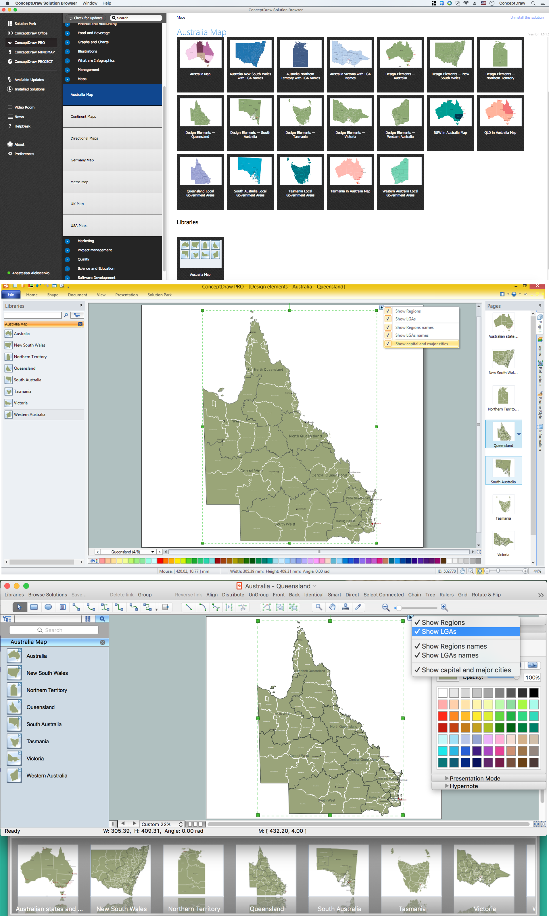
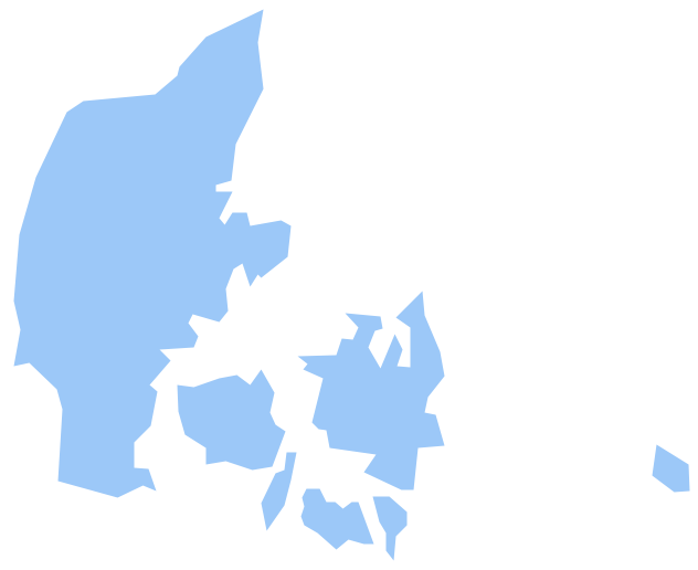
Geo Map - Australia - Victoria
Australia map contours - Victoria
"Victoria (abbreviated as Vic.) is a state in the south-east of Australia. Victoria is Australia's most densely populated state and its second-most populous state overall. Most of its population is concentrated in the area surrounding Port Phillip Bay, which includes the metropolitan area of its capital and largest city, Melbourne, which is Australia's second-largest city. Geographically the smallest state on the Australian mainland, Victoria is bordered by Bass Strait and Tasmania to the south, New South Wales to the north, the Tasman Sea to the east, and South Australia to the west."
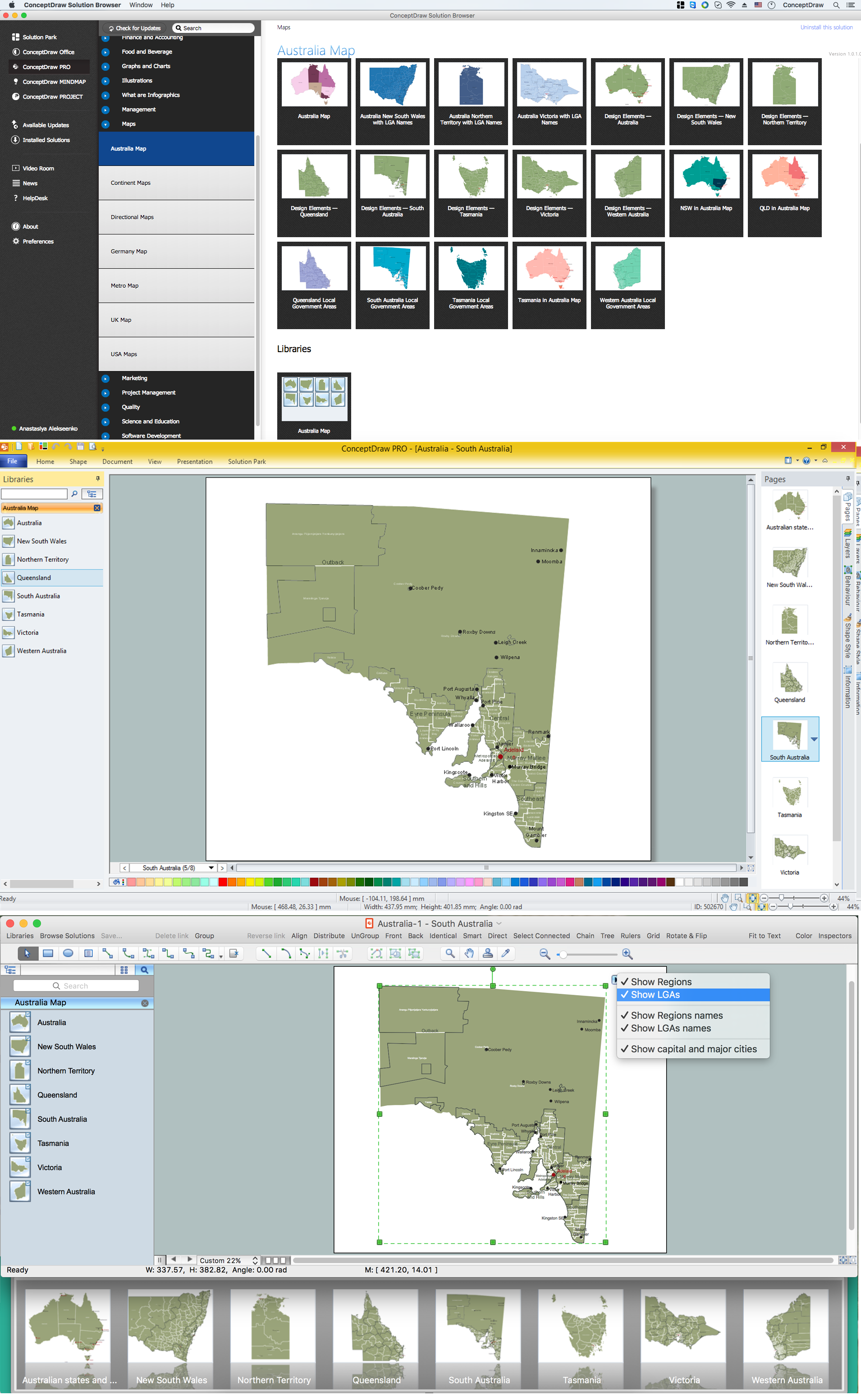
The vector stencils library Australia contains contours of the Australian states and mainland territories for ConceptDraw DIAGRAM diagramming and vector drawing software. This library is contained in the Continent Maps solution from Maps area of ConceptDraw Solution Park.

Pic. 1. Continent Maps Solution
Use the Australia library to draw thematic maps, geospatial infographics and vector illustrations for your business documents, presentations and websites.
Geo Map - Australia - Victoria
Victoria has a population of over 40.3 million and an area 237,639 km²(91,753 sq mi).

Pic. 2. Victoria
Geo Map - Australia - Victoria Contour
Capital city - Melbourne
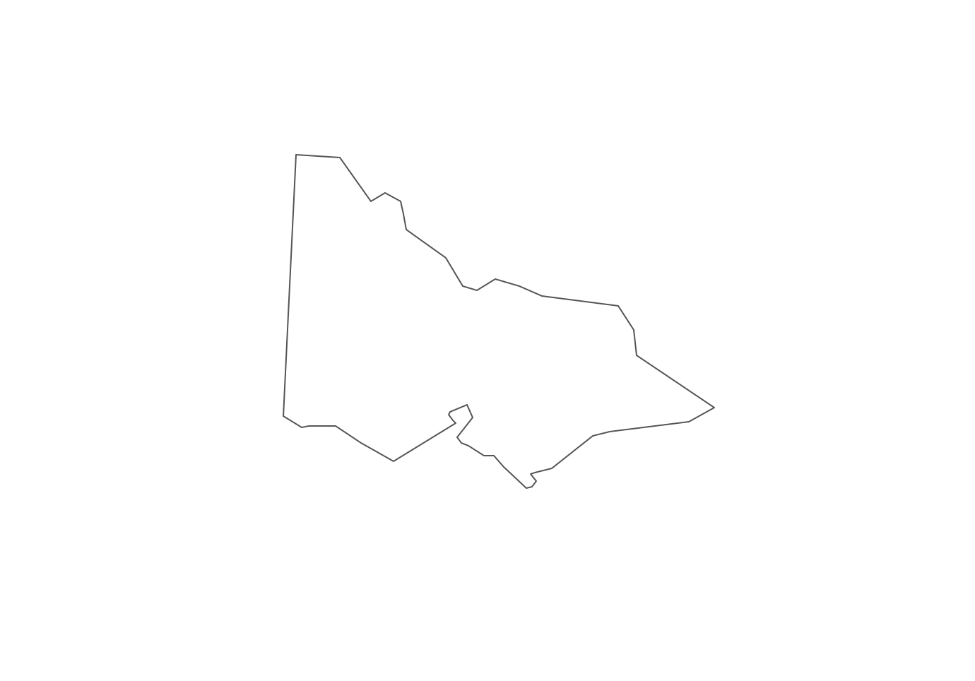
Pic. 3. Victoria Contour
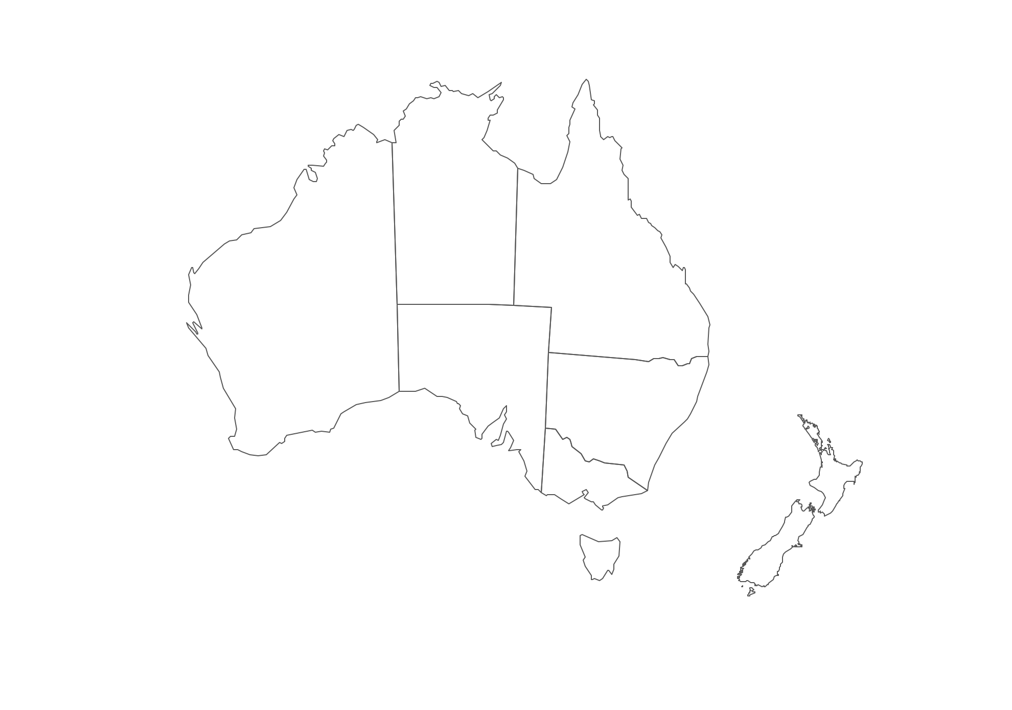
Geo Map - Australia and New Zealand
Australia has six states — New South Wales, Queensland, South Australia, Tasmania, Victoria, Western Australia and two major mainland territories — the Australian Capital Territory and the Northern Territory.
Australia has a population of over 24 million and an area 7,692,024 km2(2,969,907 sq mi).

Pic. 4. Australia and New Zealand map
Geo Map - Australia and New Zealand Contour
A contour map is a map illustrated with contour lines.
Pic. 5. Australia and New Zealand Contour
Geo Map - contours of Australian states and mainland territories and New Zealand
Use the map contours library "Australia" to design thematic maps using the ConceptDraw DIAGRAM diagramming and vector drawing software.
The vector stencils library "Australia" contains 10 map contours: Australia political map, map contours of states.
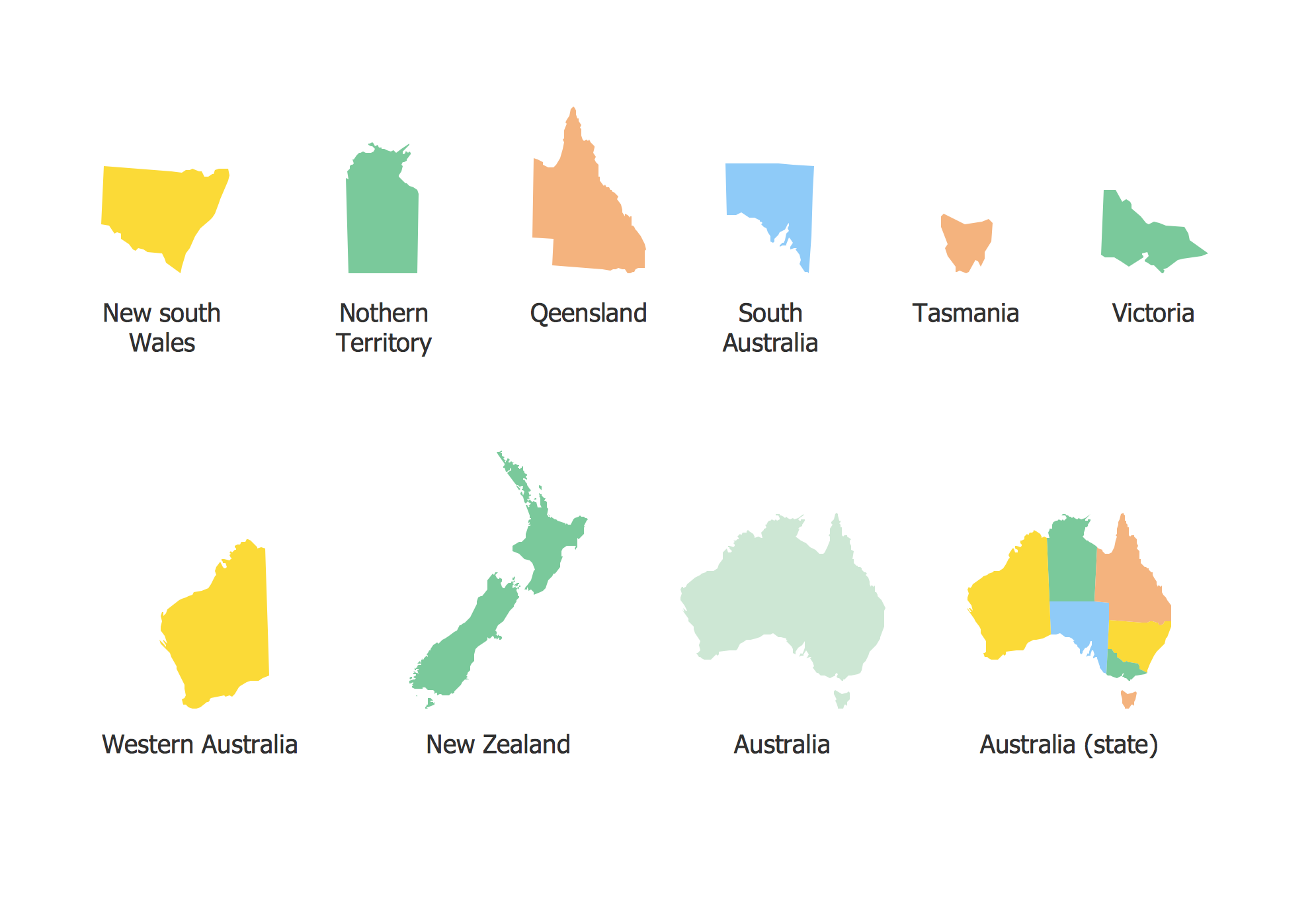
Pic. 6. Contours of Australian states and mainland territories and New Zealand
All ConceptDraw DIAGRAM documents are vector graphic files and are available for reviewing, modifying, and converting to a variety of formats: image, HTML, PDF file, MS PowerPoint Presentation, Adobe Flash, MS Visio (.VDX, .VSDX).