The vector stencils library "Landmarks" contains 34 signs and pictograms for drawing road and transit maps.
The vector stencils library "Map symbols" contains 10 signs and pictograms for drawing road and transit maps.
"A landmark is a recognizable natural or man-made feature used for navigation, a feature that stands out from its near environment and is often visible from long distances.
In modern use, the term can also be applied to smaller structures or features, that have become local or national symbols." [Landmark. Wikipedia]
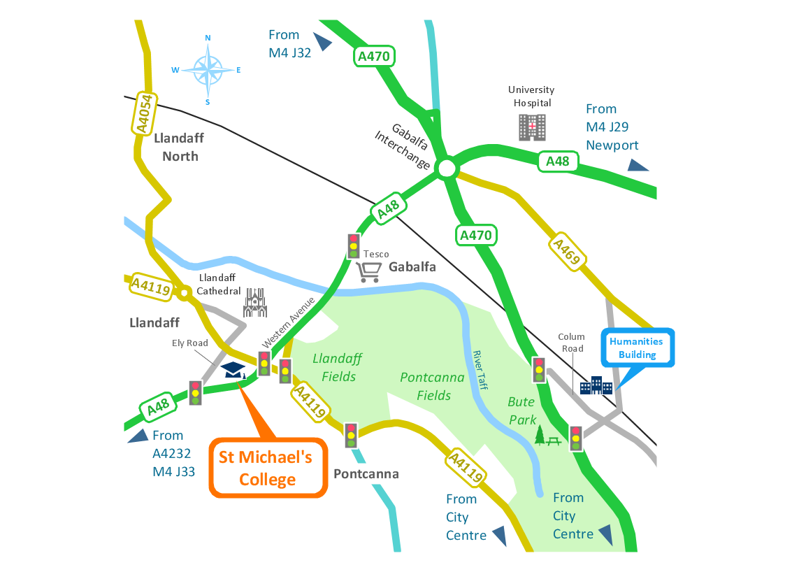
The pictograms example "Design elements - Location map" was created using the ConceptDraw PRO diagramming and vector drawing software extended with the Spatial Infographics solution from the Maps area of ConceptDraw Solution Park.
Spatial infographics Design Elements: Location Map
Infographic Design Elements for visually present various geographically distributed information.HelpDesk
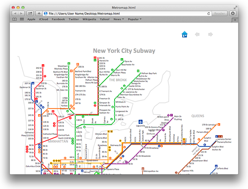
How to Make a Web Page from Your Metro Map
Using ConceptDraw PRO, you can create metro maps, route maps and various transport schemes. It is easy for anyone to build a map, one does not needed to be a cartographer to make good use of the ConceptDraw mapping solutions. Elaborate maps can be quickly assembled and then used on the web, printed, or made into signage. Graphical power and ease of use are built into the ConceptDraw mapping solutions. You can save your drawing as a Web pages. ConceptDraw PRO adds the HTML tags that are needed to display your diagrams in a Web browser, so all you have to do is design their appearance.
How tо Represent Information Graphically
ConceptDraw Infographics is a great visual tool for communicating the large amounts of data and graphic visualization and representations of data and information.Spatial infographics Design Elements: Transport Map
Do you like infographics and data visualization? Creating infographics is super-easy with ConceptDraw.Map Infographic Design
ConceptDraw collection of vector elements for infographics design.HelpDesk
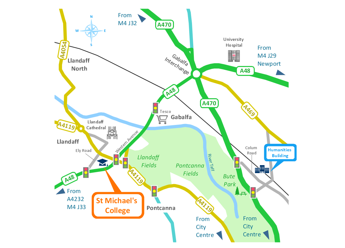
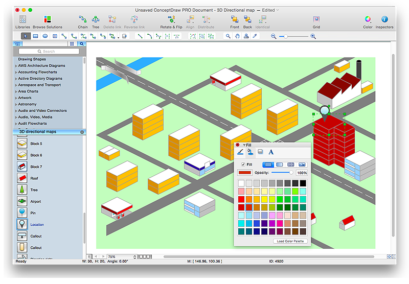
How to Create a Directional Map Using ConceptDraw PRO
Travelers often use directional maps to find directions for certain places. These maps are guide millions of tourists to explore towns and cities worldwide. Searching addresses on a map, view nearby businesses, get driving directions - this is only a little of what directional maps is needed. ConceptDraw PRO allows you to create various kinds of directional maps. You can easily visualize city maps or destinations with driving directions and traveler information using special vector stencils libraries.- Directional Map Drawing Software
- Building Drawing Software for Design Site Plan | Directions Maps ...
- How To Draw Building Plans | Design elements - Location map ...
- Draw Simple Location Map
- Spatial infographics Design Elements: Location Map | Map ...
- Conceptdraw.com: Mind Map Software, Drawing Tools | Project ...
- Location Map Template
- Software Drawing Directional Map
- Spatial infographics Design Elements: Location Map | Conference ...
- Building Drawing Software for Design Site Plan | Map Directions ...
- Drawing Simple Road Map Software
- Directions Maps | Maps and Directions | Directions Map | Drawing ...
- Directional Maps | How to Create a Directional Map Using ...
- Design elements - Location map | Design elements - Landmarks ...
- Building Drawing Software for Design Site Plan | Road Transport ...
- Spatial infographics Design Elements: Location Map | Process ...
- Location Symbol Drawing
- Design elements - Location map | Road signs - Vector stencils ...
- Location Direction Map
- Site Plans | Building Drawing Software for Design Site Plan | Road ...
- ERD | Entity Relationship Diagrams, ERD Software for Mac and Win
- Flowchart | Basic Flowchart Symbols and Meaning
- Flowchart | Flowchart Design - Symbols, Shapes, Stencils and Icons
- Flowchart | Flow Chart Symbols
- Electrical | Electrical Drawing - Wiring and Circuits Schematics
- Flowchart | Common Flowchart Symbols
- Flowchart | Common Flowchart Symbols


