 Germany Map
The Germany Map solution contains collection of samples, templates and scalable vector stencil graphic maps, representing map of Germany and all 16 states of Germany. Use the Germany Map solution from ConceptDraw Solution Park as the base for various them
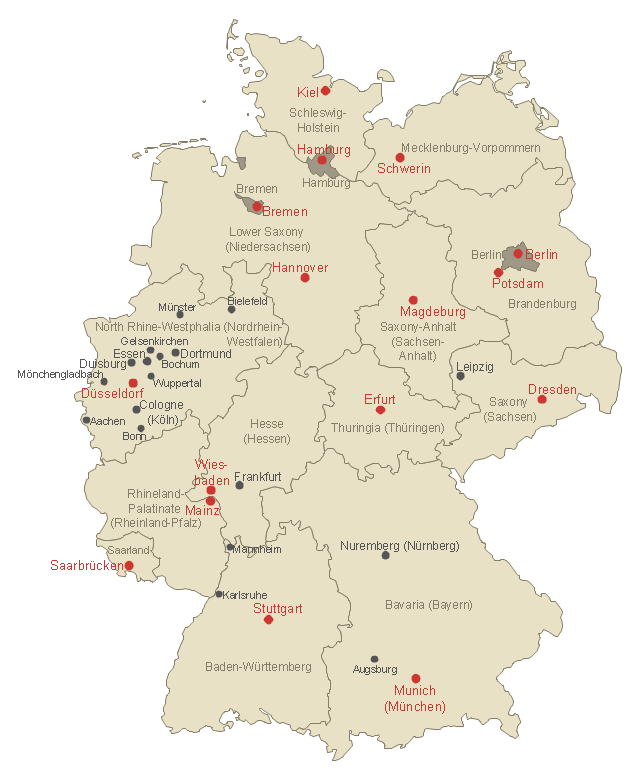
Maps of Germany With Cities

Map of Germany — Saarland State

Use this German states map template to design Germany political or thematic maps with ConceptDraw PRO software.
You can show or hide federal state borders or names, or main cities by the map selecting and Action menu commands.
The template "Federal States of Germany map" is included in the Map of Germany solution from the Maps area of ConceptDraw Solution Park.
You can show or hide federal state borders or names, or main cities by the map selecting and Action menu commands.
The template "Federal States of Germany map" is included in the Map of Germany solution from the Maps area of ConceptDraw Solution Park.
German states map template
Maps of Germany

Vector Map of Germany

This Germany thematic map example was created on the base of Wikimedia Commons file: Deutschland Bundesländer mit Informationsfreiheitsgesetzgebung.svg. [commons.wikimedia.org/ wiki/ File:Deutschland_ Bundesl%C3%A4nder_ mit_ Informationsfreiheitsgesetzgebung.svg]
This file is licensed under the Creative Commons Attribution-Share Alike 2.0 license. [creativecommons.org/ licenses/ by-sa/ 2.0]
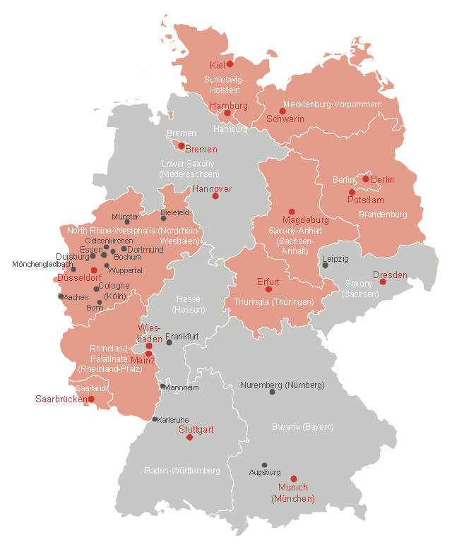
"In Germany, the federal government passed a freedom of information law on September 5, 2005; it was last updated on August 7, 2013. The law grants each person an unconditional right to access official federal information. No legal, commercial, or any other kind of justification is necessary.
Nine of the sixteen Bundesländer—Berlin, Brandenburg, Nordrhein-Westfalen, Schleswig-Holstein, Hamburg, Bremen, Mecklenburg-Vorpommern, Saarland and Thüringen—have approved individual "Informationsfreiheitsgesetze" (Freedom of Information laws)." [Germany. Freedom of information laws by country. Wikipedia]
The thematic map example "Map - States of Germany with Freedom of Information Legislation" was designed using the ConceptDraw PRO software extended with the Map of Germany solution from the Maps area of ConceptDraw Solution Park.
This file is licensed under the Creative Commons Attribution-Share Alike 2.0 license. [creativecommons.org/ licenses/ by-sa/ 2.0]
"In Germany, the federal government passed a freedom of information law on September 5, 2005; it was last updated on August 7, 2013. The law grants each person an unconditional right to access official federal information. No legal, commercial, or any other kind of justification is necessary.
Nine of the sixteen Bundesländer—Berlin, Brandenburg, Nordrhein-Westfalen, Schleswig-Holstein, Hamburg, Bremen, Mecklenburg-Vorpommern, Saarland and Thüringen—have approved individual "Informationsfreiheitsgesetze" (Freedom of Information laws)." [Germany. Freedom of information laws by country. Wikipedia]
The thematic map example "Map - States of Germany with Freedom of Information Legislation" was designed using the ConceptDraw PRO software extended with the Map of Germany solution from the Maps area of ConceptDraw Solution Park.
Germany thematic map example
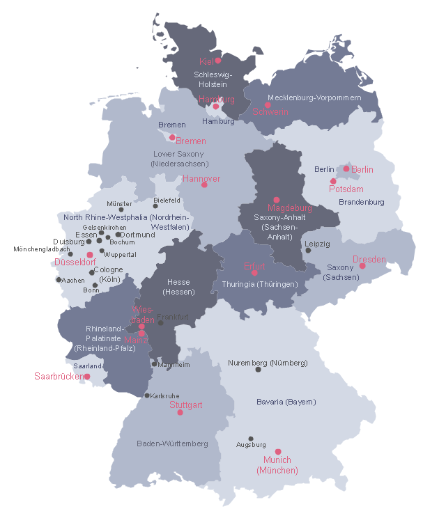
This Germany political map example was created on the base of Wikimedia Commons file: Deutschland politisch bunt.png. [commons.wikimedia.org/ wiki/ File:Deutschland_ politisch_ bunt.png]
This file is licensed under the Creative Commons Attribution-Share Alike 2.5 Generic license. [creativecommons.org/ licenses/ by-sa/ 2.5/ deed.en]
"Germany (German: Deutschland), officially the Federal Republic of Germany (German: Bundesrepublik Deutschland), is a federal parliamentary republic in West-Central Europe. It includes 16 constituent states and covers an area of 357,021 square kilometres (137,847 sq mi) with a largely temperate seasonal climate. Its capital and largest city is Berlin. With about 81.5 million inhabitants, Germany is the most populous member state in the European Union. After the United States, it is the second most popular migration destination in the world." [Germany. Wikipedia]
The example "Political map of Germany" was designed using the ConceptDraw PRO software extended with the Map of Germany solution from the Maps area of ConceptDraw Solution Park.
States and cities map example
Map of Germany — Saxony State

Map of Germany — Brandenburg State

- Map of Germany — Hesse State | Map of Germany — Saxony State ...
- Federal States of Germany map - Template
- Germany Map | Maps of Germany With Cities | Map of Germany ...
- Map - States of Germany with Freedom of Information Legislation
- Vector Map of Germany | Geo Map - United States of America Map ...
- Federal States of Germany map - Template | UML state machine ...
- Australia Map | Continent Maps | Map of Germany — Brandenburg ...
- Germany Map | Map of Germany — Saarland State | Map of ...
- Map of Germany — Lower Saxony State | Map of German states ...
- Geo Map - United States of America Map | Vector Map of Germany ...