Map of Germany — Lower Saxony State

This Germany political map example was created on the base of Wikimedia Commons file: Map Germany Länder-en.svg. [commons.wikimedia.org/ wiki/ File:Map_ Germany_ Länder-en.svg]
This file is licensed under the Creative Commons Attribution-Share Alike 3.0 Unported license. [creativecommons.org/ licenses/ by-sa/ 3.0/ deed.en]
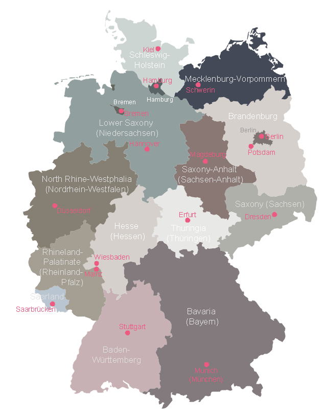
"Germany is a federal republic consisting of sixteen federal states (German: Bundesland, or Land). Since today's Germany was formed from an earlier collection of several states, it has a federal constitution, and the constituent states retain a measure of sovereignty. With an emphasis on geographical conditions, Berlin and Hamburg are frequently called Stadtstaaten (city-states), as is the Free Hanseatic City of Bremen, which in fact includes the cities of Bremen and Bremerhaven. The remaining 13 states are called Flächenländer (literally: area states)." [States of Germany. Wikipedia]
The political map example "Map of German states" was designed using the ConceptDraw PRO software extended with the Map of Germany solution from the Maps area of ConceptDraw Solution Park.
This file is licensed under the Creative Commons Attribution-Share Alike 3.0 Unported license. [creativecommons.org/ licenses/ by-sa/ 3.0/ deed.en]
"Germany is a federal republic consisting of sixteen federal states (German: Bundesland, or Land). Since today's Germany was formed from an earlier collection of several states, it has a federal constitution, and the constituent states retain a measure of sovereignty. With an emphasis on geographical conditions, Berlin and Hamburg are frequently called Stadtstaaten (city-states), as is the Free Hanseatic City of Bremen, which in fact includes the cities of Bremen and Bremerhaven. The remaining 13 states are called Flächenländer (literally: area states)." [States of Germany. Wikipedia]
The political map example "Map of German states" was designed using the ConceptDraw PRO software extended with the Map of Germany solution from the Maps area of ConceptDraw Solution Park.
Germany federal states map example
Map of Germany — Schleswig-Holstein State

- Map of Germany — Lower Saxony State | Germany crop areas map ...
- Map of Germany — Saarland State | Germany Map | Map of ...
- Vector Map of Germany | Maps of Germany With Cities | Map of ...
- Germany Map | Map of Germany — Saarland State | Map of ...
- Map of Germany — Schleswig-Holstein State | Germany Map | Map ...
- Australia Map | Continent Maps | Map of Germany — Brandenburg ...
- Fault Tree Analysis Diagrams | Cisco Multimedia, Voice, Phone ...
- Maps of Germany With Cities | Map of Germany — Saarland State ...
- Excellent Examples of Infographic Maps | Sample Pictorial Chart ...
- The Map Of States