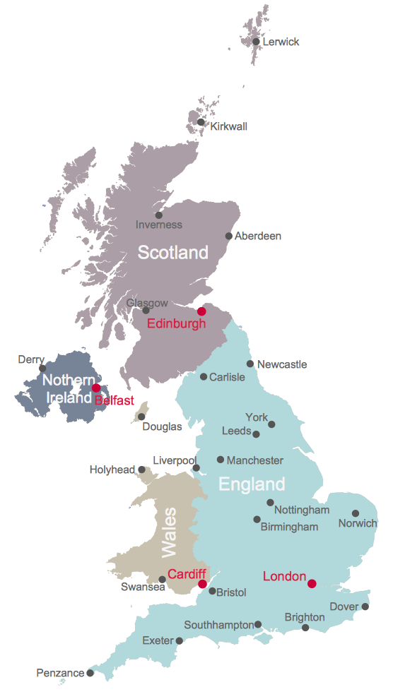
UK Map

Map of Germany

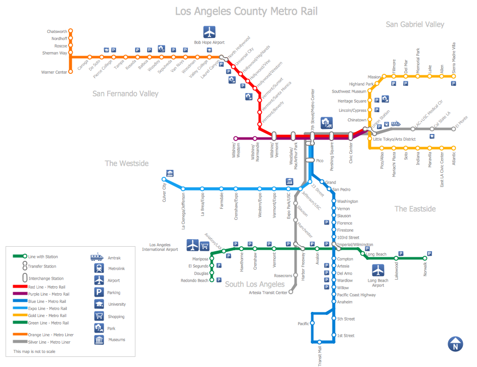
Subway Train Map
HelpDesk
How to Plan Projects Effectively Using Solutions

United Kingdom Map
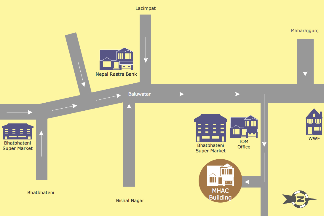
Map Directions
Map of England

Directions Maps

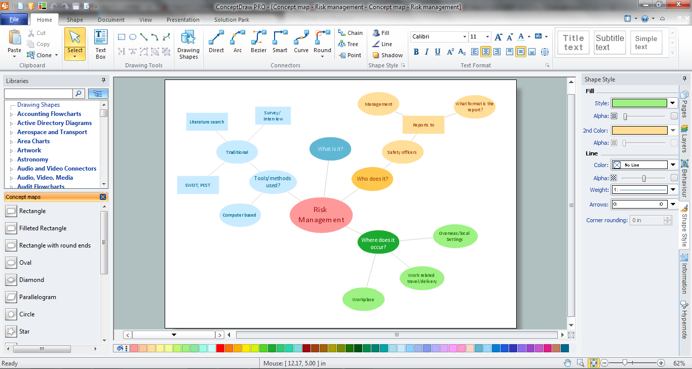
How To Make a Concept Map
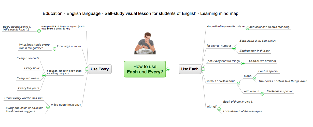
eLearning - Easy English on Skype
- How To Draw Nigerian Map Easily
- Easy Drawing Map Of Greece
- Easy To Draw Map Of Europe
- Continent Maps | Easy To Draw Asian Continent Map
- Route Map Easy Drawing
- Easy To Draw Map Of Indonesia
- Tools to Create Your Own Infographics | Philippine Map Easy ...
- Geo Map - Asia - Philippines | Continents Map | Tools to Create Your ...
- Easy Steps To Draw North America Outline Map
- Easy To Draw Mexico Map