This site uses cookies. By continuing to browse the ConceptDraw site you are agreeing to our Use of Site Cookies.

Spatial infographics Design Elements: Transport Map

Do you like infographics and data visualization? Creating infographics is super-easy with ConceptDraw.

How to draw Metro Map style infographics? Moscow, New York, Los Angeles, London

The solution handles designs of any complexity, and the comprehensive library covers all key aspects of a transportation system. To further enhance your map design, there is the option to embed links, that can display station images or other relevant, important information. We have also included a set of samples in the solution, that show the possible real-world application — complex tube systems including the London Tube and New York City Subway show the level of detail possible when using the Metro Map Solution.

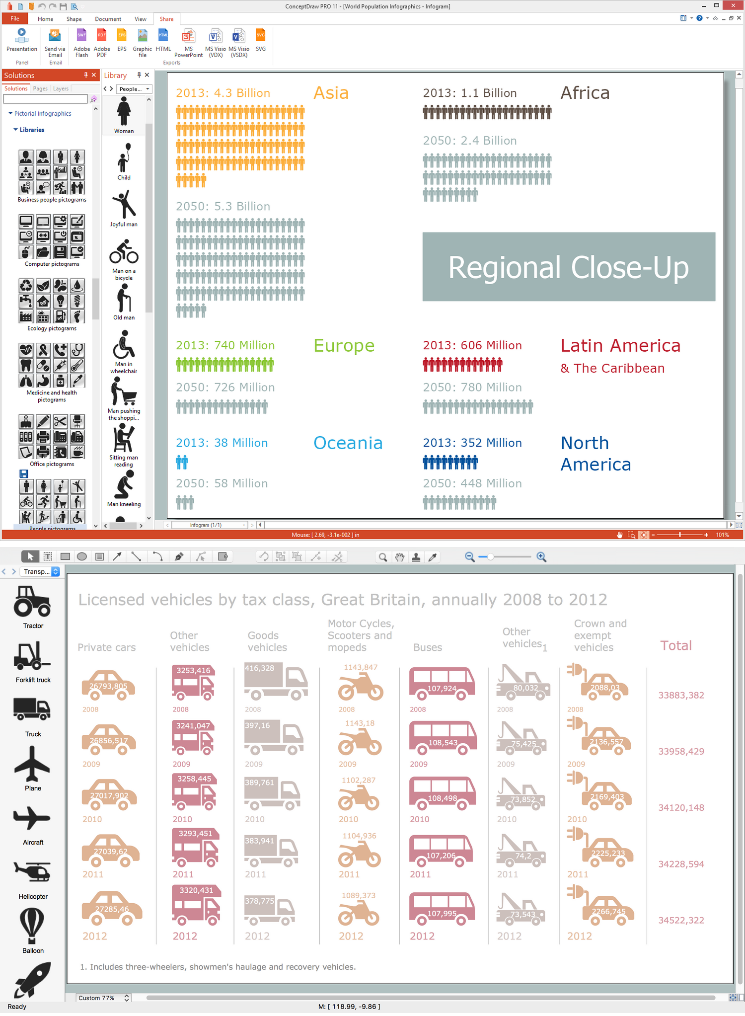
Map Infographic Maker

Take inspiration with ConceptDraw to visualise your maps and make eye-catching infographics.

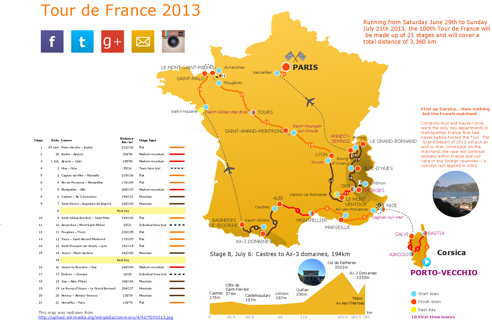
Brilliant Examples of Infographics Map, Transport, Road

ConceptDraw DIAGRAM contains spatial infographics samples, map templates to be filled in, and libraries of vector stencils for main design elements of spatial infographics.

metro maps, subway map, mta subway map, metro train map, metro path map, subway train map Metro Map

metro maps, subway map, mta subway map, metro train map, metro path map, subway train map
Metro Map solution extends ConceptDraw DIAGRAM software with templates, samples and library of vector stencils for drawing the metro maps, route maps, bus and other transport schemes, or design tube-style infographics.

Transportation Infographics

ConceptDraw is a visualization Software for making transportation infographics. Infographics design vector elements and vector graphics which will surely help you in your design process.

Rail transport - Design elements

The vector stencils library Rail transport contains clipart of railway transport for ConceptDraw DIAGRAM diagramming and vector drawing software.
Use it to draw illustrations of trains and transportation of passengers and goods by railroads.

Map Infographic Design

ConceptDraw collection of vector elements for infographics design.

Visualization Spatial Data Using Thematic Maps Combined with Infographics

Now anyone can build an infographics from their data using ConceptDraw.
Nice and simple, but the features it have are power-packed!

Infographic Software

ConceptDraw DIAGRAM extended with Pictorial Infographics Solution from the “Infographics” Area is a powerful Infographic Software. Make sure in it right now!