Geo Map - Canada - Quebec

Geo Map - Canada - Prince Edward Island

Geo Map - Canada - Ontario

Geo Map - Canada - British Columbia

Geo Map - Canada - Yukon

Geo Map - Canada - Saskatchewan

Geo Map - Canada

Geo Map - Canada - Newfoundland and Labrador

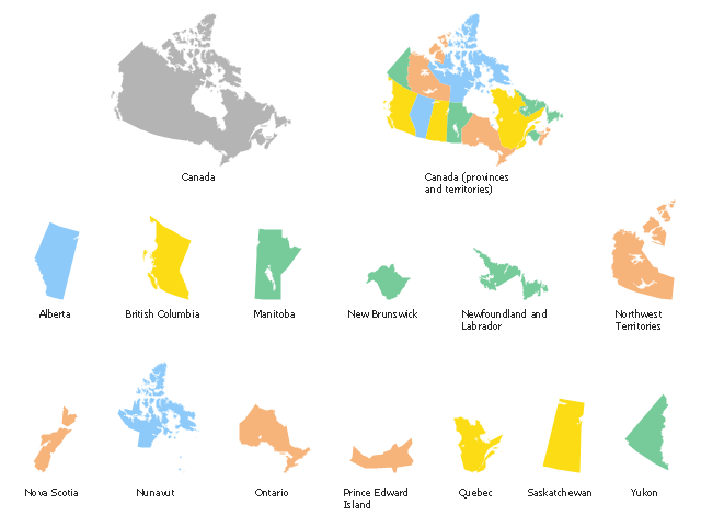
Use the map contours library "Canada" to design thematic maps using the ConceptDraw PRO diagramming and vector drawing software.
The vector stencils library "Canada" contains 15 map contours: Canada political map and map contours of Canada provinces and territories: Alberta, British Columbia, Manitoba, New Brunswick, Newfoundland and Labrador, Northwest Territories, Nova Scotia, Nunavut, Ontario, Prince Edward Island, Quebec, Saskatchewan, Yukon.
The map contours example "Design elements - Canada" is included in the Continent Maps solution from the Maps area of ConceptDraw Solution Park.
Canada map contours
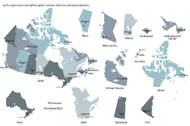
This sample displays state map contours with capitals and major cities of Canada provinces and territories. Use it to design your management infographics.
"The provinces and territories of Canada combine to make up the world's second-largest country by area. ... The ten provinces are Alberta, British Columbia, Manitoba, New Brunswick, Newfoundland and Labrador, Nova Scotia, Ontario, Prince Edward Island, Quebec, and Saskatchewan. The three territories are Northwest Territories, Nunavut, and Yukon." [Canada. Wikipedia]
The infogram shapes example "Design elements - Management map Canada" was created using the ConceptDraw PRO diagramming and vector drawing software extended with the Management Infographics solition from the area "Business Infographics" in ConceptDraw Solution Park.
Canada state map contours
Geo Map - Canada - Nova Scotia

Geo Map - USA - New Hampshire

Geo Map - USA - Maine

Geo Map - Canada - Alberta

Geo Map - USA - New York

- Geo Map - Canada - Quebec | Geo Map - USA - Maine | Canada ...
- Canada Provinces And Territories Map Contour
- Clipart Province Of Quebec Black And White
- Geo Map - Canada - Quebec
- Geo Map - Canada
- Geo Map - Canada - Quebec | Geo Map - Canada - Ontario | Geo ...
- Map Of Ontario Quebec Newfoundland And Nova Scotia
- Canada Map Ontario Quebec
- Geo Map - Canada - Ontario
- Line Drawing Of Each Canadian Province
- Canada Language Map
- Geo Map - Canada - Northwest Territories
- Geo Map - Canada - Newfoundland and Labrador | Management ...
- How To Draw The Map Of Prince Edward Island
- Geo Map - Canada - Nova Scotia
- Geo Map Software | USA Maps | Geo Map - Canada - Quebec ...
- Geo Map - Canada - Prince Edward Island | Design elements ...
- Canada - Vector stencils library | Geo Map - Canada - Prince ...
- Geo Map - Canada - Nova Scotia | Canada - Vector stencils library ...