The vector stencils library "CRM maps" contains 8 thematic maps: World maps, continent maps (Africa map, Asia map, Europe map, North America map, South America map), and Oceania map.
Use it to represent geospatial data on your CRM center dashboards with ConceptDraw PRO software.
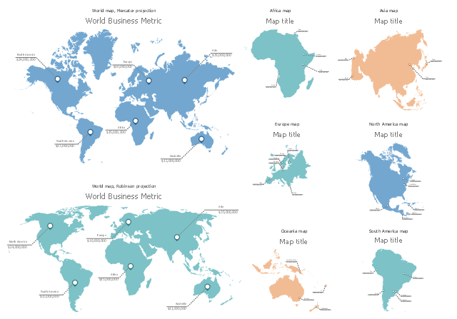
The thematic maps example "Design elements - CRM maps" is included in CRM Dashboard solution from Management area of ConceptDraw Solution Park.
Use it to represent geospatial data on your CRM center dashboards with ConceptDraw PRO software.
The thematic maps example "Design elements - CRM maps" is included in CRM Dashboard solution from Management area of ConceptDraw Solution Park.
Dashboard stencils
Types of Map - Overview

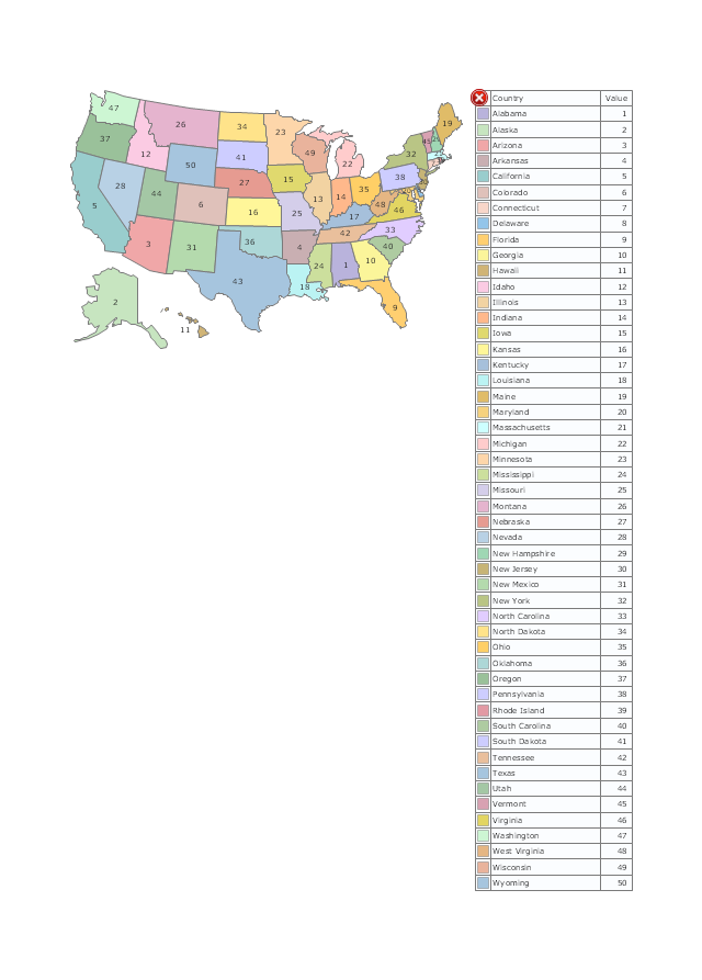
Geo Mapping Software Examples - World Map Outline

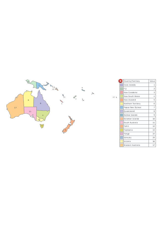
Geo Map - Oceania

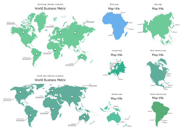
The vector stencils library "HR maps" contains 8 thematic maps: 2 World maps, Africa map, Asia map, Europe map, North America map, Oceania map, South America map.
Use it to represent geospatial data in your human resources dashboards with ConceptDraw PRO software.
The thematic maps example "Design elements - HR maps" is included in HR Dashboard solution from Management area of ConceptDraw Solution Park.
Use it to represent geospatial data in your human resources dashboards with ConceptDraw PRO software.
The thematic maps example "Design elements - HR maps" is included in HR Dashboard solution from Management area of ConceptDraw Solution Park.
Geo Map — United States of America Map

Geo Map of Americas

Map of Continents

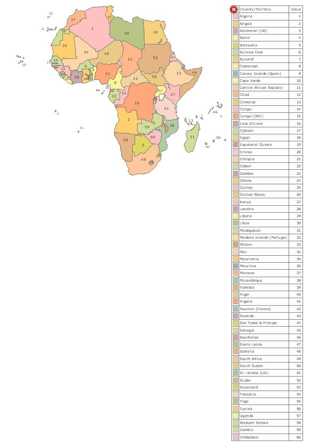
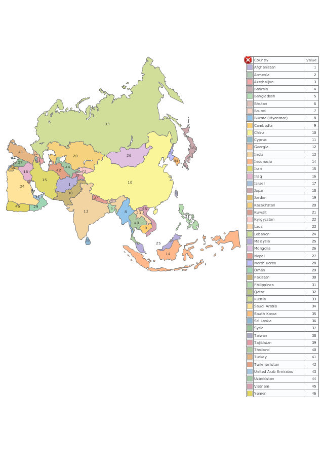
The vector stencils library "Thematic maps" contains 7 continent map contours.
Use it for drawing thematic maps of geographic regions displaying the metric values by countries, states and territories marked by different colors in the ConceptDraw PRO diagramming and vector drawing software extended with the Spatial Dashboard solution from the area "What is a Dashboard" of ConceptDraw Solution Park.
Use it for drawing thematic maps of geographic regions displaying the metric values by countries, states and territories marked by different colors in the ConceptDraw PRO diagramming and vector drawing software extended with the Spatial Dashboard solution from the area "What is a Dashboard" of ConceptDraw Solution Park.
Africa
Asia
Australia and Oceania
Europe
Latin America
North America
USA
Geo Map — USA — Wisconsin

- Geo Map - Oceania | Map Software | Geo Map - South America ...
- Geo Map - Oceania | Design elements - CRM maps | Types of Map ...
- Geo Map - South America - Chile | Geo Map - South America ...
- Geo Map - Oceania | Map Software | Geo Map - Asia - Papua New ...
- Geo Map - USA - Hawaii | Management map US - Vector stencils ...
- Oceania Country Map Flag S
- Geo Map - Oceania | Geo Mapping Software Examples - World Map ...
- Geo Map - Oceania | Flags - Stencils library | Flags - Stencils library ...
- Design elements - Oceania flags | Geo Map - Oceania | Map ...
- Oceania flags - Vector stencils library | Design elements - Oceania ...