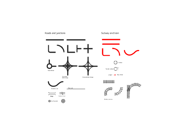
The vector stencils library "Roads and junctions" contains 38 symbols for creating the road and route maps, transit and directional maps, street and locator maps using the ConceptDraw PRO diagramming and vector drawing software.
The vector stencils library "Subway and train" contains 22 shapes for creating the transit maps of tube (metro) and railway.
"Road maps are perhaps the most widely used maps today, and form a subset of navigational maps, which also include aeronautical and nautical charts, railroad network maps, and hiking and bicycling maps." [Map. Wikipedia]
The example "Design elements - Roads and junctions, subway and train" is included in the Directional Maps solution from the Maps area of ConceptDraw Solution Park.
Road map stencils
The vector stencils library "3D directional maps" contains 40 symbols for creating pictorial maps, street maps, locator maps, transit maps, tourist maps with points of interest (POI), road maps and route maps using the ConceptDraw PRO diagramming and vector drawing software.
"Pictorial maps are a category of maps that are also loosely called illustrated maps, panoramic maps, perspective maps, bird’s-eye view maps and Geopictorial maps amongst others. In contrast to the regular road map, Atlas or topographic cartography, pictorial maps depict a given territory with a more artistic rather than technical style. The cartography can be a sophisticated 3-D perspective landscape or a simple map graphic enlivened with illustrations of buildings, people and animals. They can feature all sorts of varied topics like historical events, legendary figures or local agricultural products and cover anything from an entire continent to a college campus. ...
Pictorial maps usually show an area as if viewed from above at an oblique angle. They are not generally drawn to scale in order to show street patterns, individual buildings, and major landscape features in perspective. While regular maps focus on the accurate rendition of distances, pictorial maps enhance landmarks and often incorporate a complex interplay of different scales into one image in order to give the viewer a more familiar sense of recognition." [Pictorial maps. Wikipedia]
The design elements library "3D directional maps" is included in the Directional Maps solution from the Maps area of ConceptDraw Solution Park.
3D pictorial map symbols

Spatial infographics Design Elements: Continental Map

Map Infographic Design

Spatial infographics Design Elements: Location Map

Spatial infographics Design Elements: Transport Map

The vector stencils library "Road signs" contains 58 symbols of traffic signs for labeling the road and route maps, street and locator maps, transit and directional maps using the ConceptDraw PRO diagramming and vector drawing software.
"Traffic signs or road signs are signs erected at the side of or above roads to give instructions or provide information to road users. ...
With traffic volumes increasing since the 1930s, many countries have adopted pictorial signs or otherwise simplified and standardized their signs to overcome language barriers, and enhance traffic safety. Such pictorial signs use symbols (often silhouettes) in place of words and are usually based on international protocols. Such signs were first developed in Europe, and have been adopted by most countries to varying degrees." [Traffic sign. Wikipedia]
The vector stencils library "Road signs" is included in the Directional Maps solution from the Maps area of ConceptDraw Solution Park.
Road signs

Brilliant Examples of Infographics Map, Transport, Road

The vector stencils library "Landmarks" contains 34 signs and pictograms for drawing road and transit maps.
The vector stencils library "Map symbols" contains 10 signs and pictograms for drawing road and transit maps.
"A landmark is a recognizable natural or man-made feature used for navigation, a feature that stands out from its near environment and is often visible from long distances.
In modern use, the term can also be applied to smaller structures or features, that have become local or national symbols." [Landmark. Wikipedia]
The pictograms example "Design elements - Location map" was created using the ConceptDraw PRO diagramming and vector drawing software extended with the Spatial Infographics solution from the Maps area of ConceptDraw Solution Park.
Landmarks and Map symbols

- Design elements - 3D directional maps | Maps and Directions | Map ...
- Design elements - 3D directional maps | Directions Map | Map ...
- Brilliant Examples of Infographics Map , Transport, Road | Map ...
- Directions Map | Map Directions | 2D Directional map - Template ...
- 3D pictorial street map | Design elements - 3D directional maps ...
- 3D pictorial road map | Site Plans | Design elements - 3D directional ...
- Map Infographic Design | Map Directions | Brilliant Examples of ...
- Directional Maps | How to Create a Directional Map Using ...
- Design elements - Transport map | Subway Map | Subway Train ...
- Road signs - Vector stencils library | Directional Maps | Design ...
- 3D pictorial street map | 3D pictorial road map | Design elements ...
- Road Transport - Design Elements | Design elements - Road signs ...
- Building Drawing Software for Design Site Plan | Directions Maps ...
- Brilliant Examples of Infographics Map , Transport, Road | Design ...
- Design elements - Metro maps
- Geospatial Data | Spatial infographics Design Elements: Location ...
- Design elements - Transport map | Transport map - Template | What ...
- Maps | Map Directions | 2D Directional map - Template | Road Maps
- Design elements - Road signs | Design elements - Location map ...
- Subway Train Map | Metro Train Map | Design elements - Roads and ...