HelpDesk
How to Create a Directional Map

Map of Germany — Saarland State

 Mind Map Exchange
This solution extends ConceptDraw MINDMAP software with the ability to easily exchange mind maps with a large variety of other mind mapping applications.
Pyramid Diagram

The vector stencils library Map symbols contains 19 icons for labeling the maps using the ConceptDraw PRO diagramming and vector drawing software.
The vector stencils library Subway map contains 41 shapes for creating the subway (tube, metro) maps using the ConceptDraw PRO.
"The various features shown on a map are represented by conventional signs or symbols. For example, colors can be used to indicate a classification of roads. Those signs are usually explained in the margin of the map, or on a separately published characteristic sheet.
Some cartographers prefer to make the map cover practically the entire screen or sheet of paper, leaving no room "outside" the map for information about the map as a whole. These cartographers typically place such information in an otherwise "blank" region "inside" the map -- cartouche, map legend, title, compass rose, bar scale, etc. In particular, some maps contain smaller "sub-maps" in otherwise blank regions—often one at a much smaller scale showing the whole globe and where the whole map fits on that globe, and a few showing "regions of interest" at a larger scale in order to show details that wouldn't otherwise fit." [Map. Wikipedia]
The example "Design elements - Subway map, Map symbols" is included in the Directional Maps solution from the Maps area of ConceptDraw Solution Park.
Map symbols

The vector stencils library "Map symbols" contains 19 symbols for labeling the maps.
The pictograms example "Map symbols - Vector stencils library" was created using the ConceptDraw PRO diagramming and vector drawing software extended with the Directional Maps solution from the Maps area of ConceptDraw Solution Park.
The pictograms example "Map symbols - Vector stencils library" was created using the ConceptDraw PRO diagramming and vector drawing software extended with the Directional Maps solution from the Maps area of ConceptDraw Solution Park.
Compass

North

North arrow 1
North arrow 2
North arrow 3
North arrow 4
North arrow 5
Scale

Scale symbol 1

Scale symbol 2

Horizontal

Vertical

Callout

Church

Cathedral

Viewpoint

Castle

Ruins

Curiosity

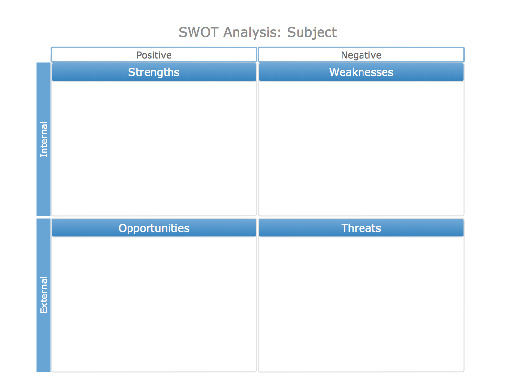
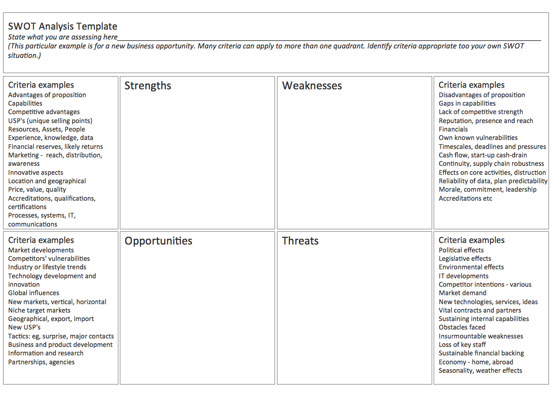
SWOT analysis matrix diagram templates
The vector stencils library "Map symbols" contains 19 symbols for labeling the maps.
The pictograms example "Map symbols - Vector stencils library" was created using the ConceptDraw PRO diagramming and vector drawing software extended with the Directional Maps solution from the Maps area of ConceptDraw Solution Park.
The pictograms example "Map symbols - Vector stencils library" was created using the ConceptDraw PRO diagramming and vector drawing software extended with the Directional Maps solution from the Maps area of ConceptDraw Solution Park.
Compass
North
North arrow 1
North arrow 2
North arrow 3
North arrow 4
North arrow 5
Scale
Scale symbol 1
Scale symbol 2
Horizontal
Vertical
Callout
Church
Cathedral
Viewpoint
Castle
Ruins
Curiosity
The vector stencils library "3D directional maps" contains 40 symbols for creating pictorial maps, street maps, locator maps, transit maps, tourist maps with points of interest (POI), road maps and route maps using the ConceptDraw PRO diagramming and vector drawing software.
"Pictorial maps are a category of maps that are also loosely called illustrated maps, panoramic maps, perspective maps, bird’s-eye view maps and Geopictorial maps amongst others. In contrast to the regular road map, Atlas or topographic cartography, pictorial maps depict a given territory with a more artistic rather than technical style. The cartography can be a sophisticated 3-D perspective landscape or a simple map graphic enlivened with illustrations of buildings, people and animals. They can feature all sorts of varied topics like historical events, legendary figures or local agricultural products and cover anything from an entire continent to a college campus. ...
Pictorial maps usually show an area as if viewed from above at an oblique angle. They are not generally drawn to scale in order to show street patterns, individual buildings, and major landscape features in perspective. While regular maps focus on the accurate rendition of distances, pictorial maps enhance landmarks and often incorporate a complex interplay of different scales into one image in order to give the viewer a more familiar sense of recognition." [Pictorial maps. Wikipedia]
The design elements library "3D directional maps" is included in the Directional Maps solution from the Maps area of ConceptDraw Solution Park.
3D pictorial map symbols

 Australia Map
For graphic artists creating accurate maps of Australia. The Australia Map solution - allows designers to map Australia for their needs, offers a collection of scalable graphics representing the political geography of Australia, split into distinct state
SWOT Matrix Template
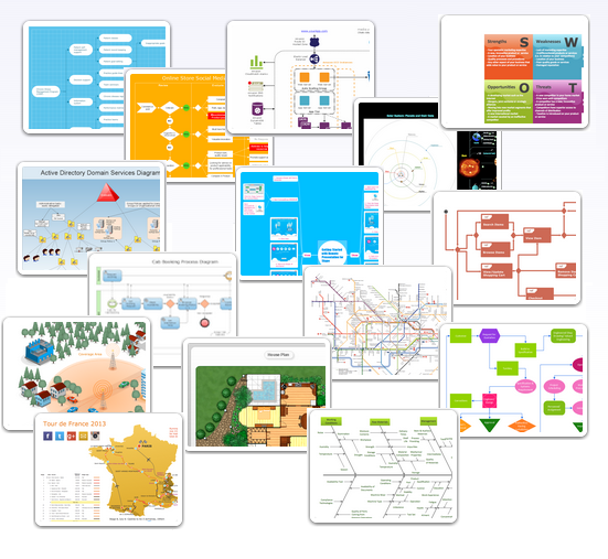
Examples of Flowcharts, Org Charts and More
HelpDesk
How to Create a Floor Plan
- Map Scale Bar Km Png
- Scale Map Png
- North Symbol Architecture Png
- North Point Symbol Png
- Map symbols - Vector stencils library | Design elements - Title blocks ...
- North Sign On Map Png
- Saturn Big Scale Icon Png Vector
- Map Scale
- North Arrow Architecture Png
- Design elements - Subway map , Map symbols | Map symbols ...
- Map Locator Png
- Scale Bar Png
- North Direction Png For Architecture
- Map symbols - Vector stencils library | Education pictograms - Vector ...
- Map Scale Bar
- North Sign Architecture Vector Png
- Map Symbols Scale Bar
- Map symbols - Vector stencils library | How to Draw a Map of North ...
- Scale Icon Png
- How to draw Metro Map style infographics? Moscow, New York, Los ...